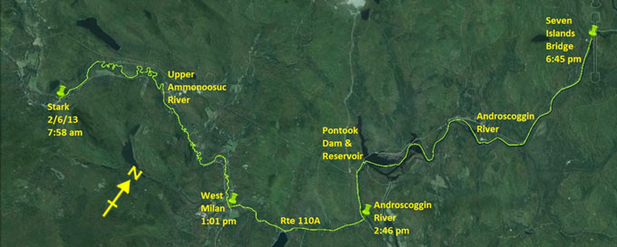
Day 15 route on Google Earth imagery
|
|
We have a relaxed start to the day, and, after a good breakfast, arrive back at Stark Bridge at about 8:00 am. I sign the register, not
having felt like doing that on Friday, send a SPOT to announce my presence on the Trail again, and launch into phase two of this trip.
|
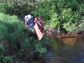
I love a light boat! [photo: R&H Danforth]
|
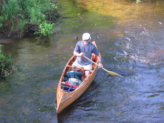
Already focussed [photo: R&H Danforth]
|
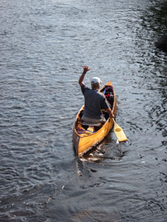
So long! [photo: R&H Danforth]
|
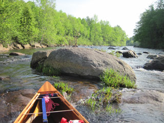
Where there's a will, there's a way through
|
|
It's a beautiful sunny day as I paddle a little way upstream. Soon the shallows and current dictate that I must take to the poles.
Meanwhile Hildy wields the camera. Still in sight of the bridge a pole gets wedged between two rocks and I have to let go; it's
embarrassing, but the drier option.
The bridge is soon out of sight, so I focus on the patient process of progressing upstream while conserving as much energy as possible.
I'm determined to remain on or in the water for the rest of the Upper Ammonoosuc, having missed several miles of it on Friday through
carrying.
|
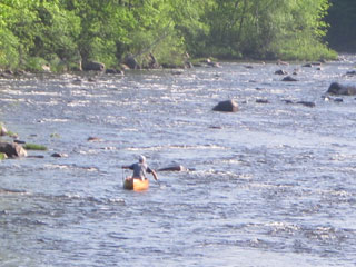
Double poling in action [photo: R&H Danforth]
|
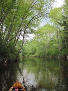
Calmer water on the Upper Ammonoosuc
|
|
Initially I make good progress, but it becomes frustrating. Avoiding the main current leads me to the insides of bends, but there lie
sand bars, no depth in which to paddle and nothing solid against which to pole.
There are some rapid changes between paddle and poles as I push through riffles. At one point I reach for the poles, only to find that
I have just one. My heart sinks: there's no option but to paddle back downstream to find it. A single pole is no good for double poling.
A few minutes downstream I find it, floating in an eddy, and then have to retrace my route upstream. Having to repeat an upstream
section is a bit soul-destroying. I still have no idea of how I lost the pole. Maybe on stowing them rapidly I missed the canoe with
the tip of one. But I'm surprised that I didn't see it go.
I can imagine that the Upper Ammonoosuc is a beautiful river to paddle down. The frustrations of going upstream do not allow me to
appreciate it at its best. After about five hours of fairly hard work I reach West Milan. On signing the register, I'm perplexed to see
a note from Team Moxie (through-paddle 2011) for today's date. I drop into Gord's Country Store for a drink, to be met by Janet who
seems to know all about me. It never ceases to amaze me that there is a whole network out there following my movements, and I know so
little about it. Apparently Team Moxie had come by earlier in the day, visiting old haunts, and had advised her that I was due to pass
through soon. It's a shame that our arrival times didn't coincide.
|
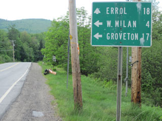
I just carried from West Milan
|
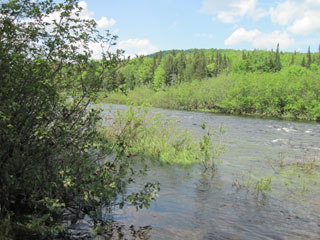
Androscoggin River
|
|
The carry to the Androscoggin takes just 1.25 hours – I time the longer carries so that I can gauge my progress: 20 minutes to the mile
on good terrain with full load. About 200 yards up Route 16 I find the put-in and launch into the Androscoggin. It is flowing well, but
I can hug the banks and work the eddies in time-honoured tradition by now. My progress is good until the Pontook rapids steepen. At this
point I take out and carry along the road to Pontook Dam. The sky is darkening, dropping occasional rain.
As I pump water above Pontook Dam, it is clear that a storm is gathering. A family considering launching for a fishing outing thinks
better of it. Just as I'm about to set out again, I'm confused to see Ray walking towards me; it's not time to stop yet – I'm aiming for
Seven Islands Bridge, and he knows it. My mistake – I set a SPOT at the start of the carry and also at the end, totally forgetting that
we had agreed that a second SPOT would act as a one-hour warning, meaning to come and find me one hour hence. Ray has suspected that
this was a mistake and is equipped with books to occupy him, and encourages me to go for today's goal. I feel guilty about wasting his
time, but set off anyway.
Violent thunderstorms pass to the north and south and a strong squall pushes me across the top of Pontook Dam, but nothing strikes
directly overhead, other than the rain which now becomes my companion once more. Ray has told me of a cut-through to the river which
will help to avoid some of the current, but I enter the wrong section of the reservoir and lose confidence that I can find it. A short
bushwhack carry takes me to the main river. I later see where the cut-through emerges.
The river here is deep enough to use my long paddle. We have agreed on 7:00 pm as the rendez-vous time at Seven Islands Bridge, and I
stretch out in order to guarantee making this. For a while I judge that I'm making about 4 mph upstream in the eddies. A rested,
well-fed body is capable of so much more than a jaded, under-nourished one! Rapids slow my ascent, but I'm able to make progress with a
combination of paddling and poling. On reaching the top I experience a powerful sense of elation. Not once have I had to get out and
wade or carry. This is what upstream travel should be like.
There follows more deep water paddling in which I make good time in the eddies, and pull into the take-out at Seven Islands Bridge 15
minutes ahead of schedule. Ray turns up within minutes, having been trying to spot me farther downstream. I was tucked under the near
bank, which probably explains why he couldn't find me.
We drive back home through the rain which has been nearly continuous since Pontook, and have dinner by candle-light. The storm has
knocked out power to large areas, and Hildy, ever practical, has taken to using the camping stove. We retire as the light fades. Today
has been a day with immense paddling satisfaction. Despite the frustrations of the Upper Ammonoosuc, it's a beautiful river, and
upstream on the Androscoggin has surpassed all my expectations.
|
|

