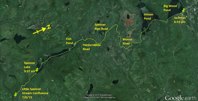
Day 20 route on Google Earth imagery
|
|
It rained most of the night and I eventually fell asleep sometime after 4:00 am. I have little more than an hour's sleep, not the
restful night I wished for before the tough day ahead. The wood that I put under cover last night is still dry, so I use the wood-stove
to cook breakfast, and then pack sequentially, keeping everything as dry as possible. The wet tarp is the last to be packed. At 6:30 am
I'm on the water.
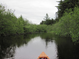
Little Spencer Stream proves to be anything other than what I expected. It is thoroughly beautiful, and, with the rain that has fallen
recently, I'm lucky that there is enough water to float most of the way.
|
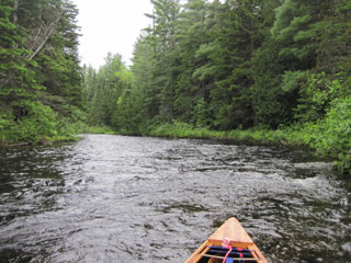
Little Spencer Stream
|
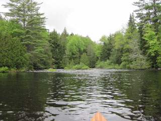
Relief from rapids ... temporarily
|
|
It's hard work against the current, upstream against class I and II rapids, but entirely within the realms of possibility. Parts of it
are deep enough to paddle, eddy-hopping, but most of it I pole or wade. The rocks are slippery, but my ski pole acts as a walking stick
and keeps me upright. It's an exercise in patience and, insects aside, I'm proud of my control. It's great to reach the deadwaters,
although the rapids in between them prove to be some of the most challenging. Is that because I think I'm nearly there, and so lose
perspective? I don't know. Maybe they really are tougher.
|
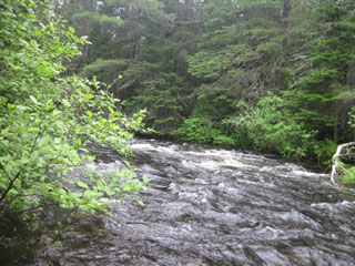
Tougher going
|
|
I cover the 4.5 miles to Spencer Dam in just three hours, an achievement that I'm proud of. It's been tough work, but mostly enjoyable
and satisfying. Negotiating Spencer Dam proves to be a challenge all of its own. I'm faced with a steep rock face, no recognisable
take-out, and the knowledge from other sources that this is a tough scramble. I perch precariously on a small ledge while tying the
canoe to a small tree that has taken root in a crevice, and then carry my pack to the top of the rock. This is the first carry that I
have doubled. It should be the only one. What faces me is a steep drop to a pool above the dam but then another similar lump of rock to
climb over in order to reach the lake itself. A boom separates this pool from the lake. A quick scout doesn't yield any easier route,
and I'm worried about straying too far when negotiations are underway to establish a formal portage trail. Annoying the landowner would
not help this process.
|
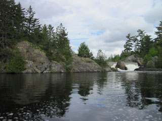
Spencer Dam approach
|
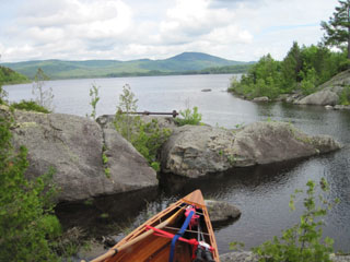
Spencer Dam carry - a challenge
|
|
Returning to the canoe, I'm now faced with the difficulty of hauling it up a very steep rock face which has limited footholds. Again,
the curse of the solo paddler strikes. Fortunately there is a thick growth of lichen on parts of the rocks, so I haul the canoe up,
sliding it along lichen until it can remain in place, and then move myself farther up in order to repeat the process. If the canoe
sustains any scratches, they are minimal. There is far less lichen on the other lump of rock. This does not look good. Quickly sizing up
the situation, I lower the bow into the pool above the dam, and climb down the rock face carrying the stern. Once the boat is afloat, I
ensure that it is secured and climb back once more to retrieve my patiently waiting pack. Having descended for the last time, I load the
pack in the canoe, climb in and paddle to the boom. The chain is hanging low enough to paddle over with minimal scraping, and I emerge
into Spencer Lake.
The rain has let up and I even see a little sun as I paddle this very beautiful lake. There are a few camps around the shoreline, but
mostly it is wild. Sandy beaches invite me for a swim, but the weather forecast tells me to keep going for Jackman. With some help from
the south-east wind I make good time up Spencer Lake, and pass through into Fish Pond. At the north end of this pond I see a young
moose. Initially I identify it as a deer, but curiosity leads me out of my way to take a closer look. This is my first confirmed moose
sighting.
|
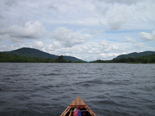
Spencer Lake
|
Little Spencer Stream
|
|
Again, even though I know that I'm still heading up Little Spencer Stream, something in my head has been telling me that reaching
Spencer Lake was the end of the upstream paddling. Indeed, on reaching Spencer Lake I allowed myself a few moments of celebration and
self-congratulation. I'm taken aback, therefore, by the current that greets me as I leave Fish Pond and thread my way up the alder-lined
continuation of Little Spencer Stream. It takes me longer than expected to reach Hardscrabble Road. I've been toying with the idea of
taking the original course of the Trail up to Whipple Pond, especially as I have high water levels, but the idea of pushing against this
current for a few more miles dictates otherwise. The 5.5 or more miles of carry from here to Spencer Rips on the Moose River seem more
appealing.
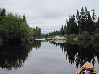
I change my shoes and start carrying, again in 20-minute sessions. I'm not confident of finding the turning on to Spencer Rips road,
and certainly there are no road signs here to label the roads, so I wish to keep track of my position. My estimate of distance to the
turning is 2.25 miles. Just over 5 minutes into the third bout of carrying I lift the bow and see a very obvious junction. There would
have been no mistaking it, but I'm pleased that the regularity of my carrying speed has proved so reliable. I turn north for three more
bouts of carrying, in the rain now, and, at the end of the third, can see the destination, so continue to Spencer Rips. The mosquitoes
here are appalling, so I sign the register quickly, change my shoes while feeding the mosquitoes, and paddle off down the Moose River,
complete with retinue of vampirish hexapods
|
Spencer Rips - Moose River
|
Attean Falls
|
|
I see another moose crashing away through the undergrowth (so that's now high water in Highwater, Canada geese in Canada, and a moose by
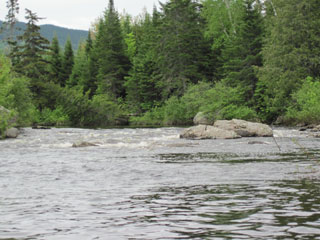
the Moose River). At Attean Falls, I recall from a Moose River Bow trip with Ray and Hildy a few years ago that these rapids were bony.
Now there is good flow over them, so I adopt white-water protocol and run them, a few waves splashing over the bow. It's now heavily
overcast as I emerge into Attean Pond, and rain is sprinkling. I paddle hard across the pond, past the landing and into the Moose River
once more, leading to Big Wood Pond.
Where the map suggests there is a boat launch there is nothing. Where it suggests Pomerleau Park lies, I find a boat launch. Not knowing
if this is Pomerleau Park, I take out and carry through a residential district to a main road. Asking a local about the possibility of a
motel, she assures me there is none, but points to the hotel down the road a little way. “Hotel” to me sounds expensive, but it's now
raining steadily and this is my last chance to be indoors for another week. As I'm carrying to the hotel, my eyes wander down the road
to a large sign proclaiming “Motel”. I rejoice internally, continue past the hotel and cross back over to the motel.
The room costs $40 (it has to be cash because the card reader seems not to work) and has an adjustable thermostat. By now I'm wet and
cold - again. It's been another long day and my body appears to have run out of reserves to generate heat. I crank up the thermostat,
take a hot shower, including washing out some clothing, and then set clothes and shoes on the radiator to dry, as well as spreading out
anything else that's damp. The humidity rises noticeably. I then creatively use the microwave and a mug to cook a dried dinner. It's a
tedious process, but sort of works. A long simmer proves difficult, but a rapid boil followed by standing and repeating makes it
edible.
For some reason my left shoulder and chest region have been painful today while carrying. Maybe I've tweaked something while poling? I
also have sore toes – they take a battering whenever I wade on slippery cobbles, and then are further abused by being asked to walk
several miles with an unreasonable load. I venture out into the rain, definitely continuous now, to a store down the road to find some
comfort food – chocolate and beef jerky. Calories and protein seem to be what I have been missing most. Maybe it's down to the weather,
but so far I have had no craving for fresh salad.
|
|

