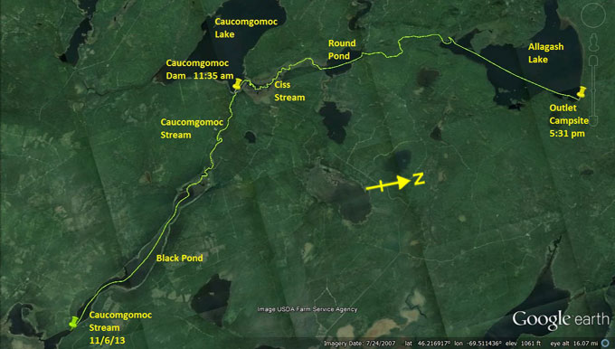
Day 24 route on Google Earth imagery
|
|
The night was disrupted by small rodents running around, but otherwise fine. Up at 6:00 am, I use some of my wood supply to cook a
double portion of oatmeal. As I'm completing packing the rain starts. It's 7:00 am. I head up Caucomgomoc stream, having left a supply
of wood and a charcoal note for my neighbours. A couple of moose swim across the stream half a mile ahead. They move surprisingly fast,
and are long gone by the time I reach their crossing point. Although it's raining, I warm up on the pull to Black Pond, but there's a
chill in the north-east wind that does not bode well.
As the stream narrows, the current becomes more noticeable. I reflect on the celebration that I allowed myself on reaching Spencer Lake,
the “end” of the upstream. I was wrong then, even before altering the route to include yet more upstream. Before long I am double poling
up class I rapids. The cobbles are large and frequently trap my poles, requiring either a quick snatch to release them or letting go for
subsequent retrieval. As the class I rapids give way to class II, poling becomes ever more difficult. I attempt to carry out to my left
to find the road to the dam ahead, but the vegetation proves impenetrable, the bushwhack of all bushwhacks, so I return to the water.
Even wading up class II rapids on very slippery cobbles is preferable to trying to carry. A little later I try another carry, but with
the same result.
|
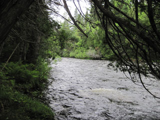
Poling and wading up ...
|
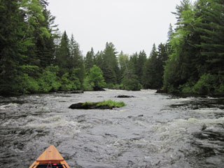
... Caucomgomoc Stream
|
|
Even though these rapids are no more difficult than on Little Spencer Stream, they seem it. Maybe it's because I'm not mentally prepared
for them. After another hour and a half of difficult wading, sometimes thigh-deep, upstream against class II rapids in the cold wind and
rain, which bruises my feet, tests my patience and, I'm sad to say, exercises a very limited portion of my vocabulary, I reach the ledge
a little way below the dam and locate the take-out. Here the vegetation has been cleared and the path to the road is passable. It's a
relief to be able to move freely on the carry to Caucomgomoc Dam. Caucomgomoc Lake looks dismal in the flat, grey wetness that is today.
I put in, have a brief lunch of trail-mix, set a SPOT, and then head out to the entrance to Ciss Stream. There are several downed trees
in this region, and a couple of bald eagles, having nothing tall to perch on, use these. Another moose wanders away in the middle
distance, and I have to wonder if they ever get depressed in these surroundings. Eeyore's gloomy place springs to mind (an AA Milne
reference for the uninitiated!)
|
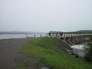
Caucomgomoc Dam & Lake
|
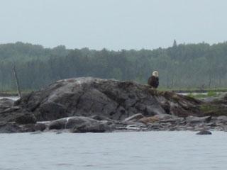
Low perch for a bald eagle
|
|
Ciss Stream is flooded, making it hard to follow the deep channel. I continually find myself paddling across shallows with a muddy bed,
having departed from the main channel, and sometimes backtrack to find it again, and sometimes am lucky enough to hit upon it once more,
maybe having cut a corner. It's frustrating, getting colder, and still raining, harder now. Eventually Ciss Stream opens into Round
Pond. I push across into the wind and find the camp-site which marks the start of the carry to Allagash Lake. Some fishermen there offer
me a ride for the first two miles to a gate, beyond which there is no vehicular access. Once more I have to dig deep to decline their
generous offer.
|
|
As the rain falls ever more heavily, I hoist the canoe on to my shoulders and head north. The carry is easy to follow. Two miles in I
pass around the gate; only a mile or so to go now. The last part of the carry proves to be extremely rough and muddy. I wondered about
taking the route to the Ranger Station, but decided to follow the signed trail. Now I'm regretting it. Allagash Lake, which I suspect
may be very beautiful, comes into view, and before long I'm paddling again as the canoe once more collects rainwater. I head around the
point to the Ranger Station to sign in.
|
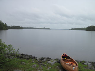
Allagash Lake - looking north
|
|
Ranger Jay seems happy to have someone to talk to, so I stay for an hour and a half, waiting in vain for the rain to ease off. No chance
– it gets ever heavier. In the end, Jay not having responded positively to my mention of the outside chance of my sleeping on his couch
(maybe there are rules about this), I head out into the cold and rain to aim for the north-east corner of the lake. I'm feeling cold to
the core now; even time spent indoors has not warmed me up. I recognise the early stages of hypothermia once more, and know that time is
of the essence.
|
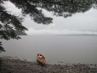
Allagash Lake - cold, wet & grey
|
I cover the 4.5 miles to Outlet camp-site in an hour and a quarter, despite the headwind. The hard work staves off some of the cold,
but, as soon as I land, it bites once more. Shaking ever more violently I put up the tarp, pile everything underneath, grab my clothes
bag and run to the outhouse. There, in a space about 3 feet square and which, let's be frank, smells fairly foul, I strip off all wet
clothing and replace it with dry. The wet clothes I drape around the outhouse. There's no chance that they'll dry, but at least they
won't get any wetter.
|
|
To minimise how wet my dry clothes get I sprint back to the tarp and now set about putting some of the dry wood I collected to good use.
The wood-stove is soon burning well, so I cook up a double portion of food and brew plenty of tea. The combination of dry clothing,
being out of the rain, and the intake of hot food and drink gradually ease the symptoms of hypothermia. My mood however is somewhere
near rock bottom.
A strong north wind is forecast for tomorrow, and my pack up is likely to be slow if this rain persists, so whether I make it to Lock
Dam remains to be seen. Maybe I'll go straight to the Tramway and see very little of Chamberlain Lake. This will depend on what the
morning brings. It's still raining hard as I go to bed. Since 7:00 am it has not stopped. So much for “a 30% chance of showers after
1:00 pm”.
|
|

