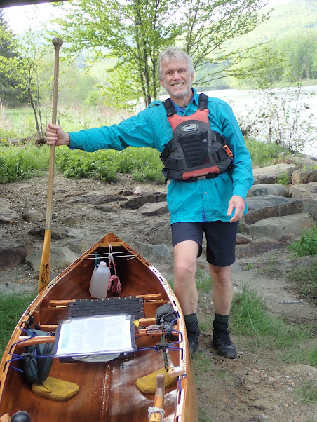
Having stayed the night with my ever trusty New Hampshire-based support crew, Ray & Hildy, I was up at 6:30 am, with Viveka rising about an hour later. Breakfast consisted of eggs, ham, muffins and grapes, with, of course, copious quantities of tea.
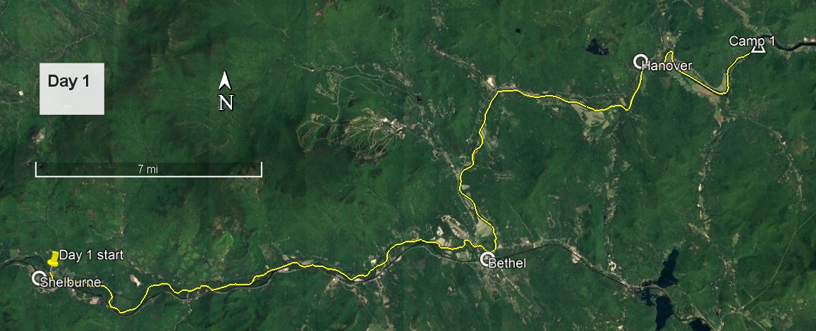
I was already packed, so we then drove the half mile to the Meadow Road bridge over the Androscoggin River. The flow looked good; the wind was from the northwest; and the sun was bright in a blue sky. We took all of the preliminary photos, after which I launched the canoe, packed and attached everything: pack in the bow, map over the top attached to bungees on the gunwales, and directions similarly attached just in front of the thwart. My compass was attached to the port end of the thwart, and my watch strapped to the starboard end (well, it started on port, but soon moved for symmetry). My camera hung from the port gunwale and my 'bow' bag, with small items such as hat and sunglasses, hung from the starboard gunwale.
All dressed up and somewhere to go (Photo: R&H Danforth)
Everything but the pack
Following farewell hugs, remembered this time, I climbed aboard, swung the bow left to break into the current, and headed downstream, helped by current and, for now, wind. Within half an hour I had passed some ledge rocks which would make a good lunch spot - it was far too early to stop - and one hour into the journey I reached the Gilead bridge, where Ray was stationed at the boat launch for chat and photos, and Hildy kept vigil on the bridge.
The team (Photo: R&H Danforth)
Departure (Video: R&H Danforth)
Approaching Gilead bridge (Photo: H Danforth)
Leaving Gilead bridge (Photo: H Danforth)
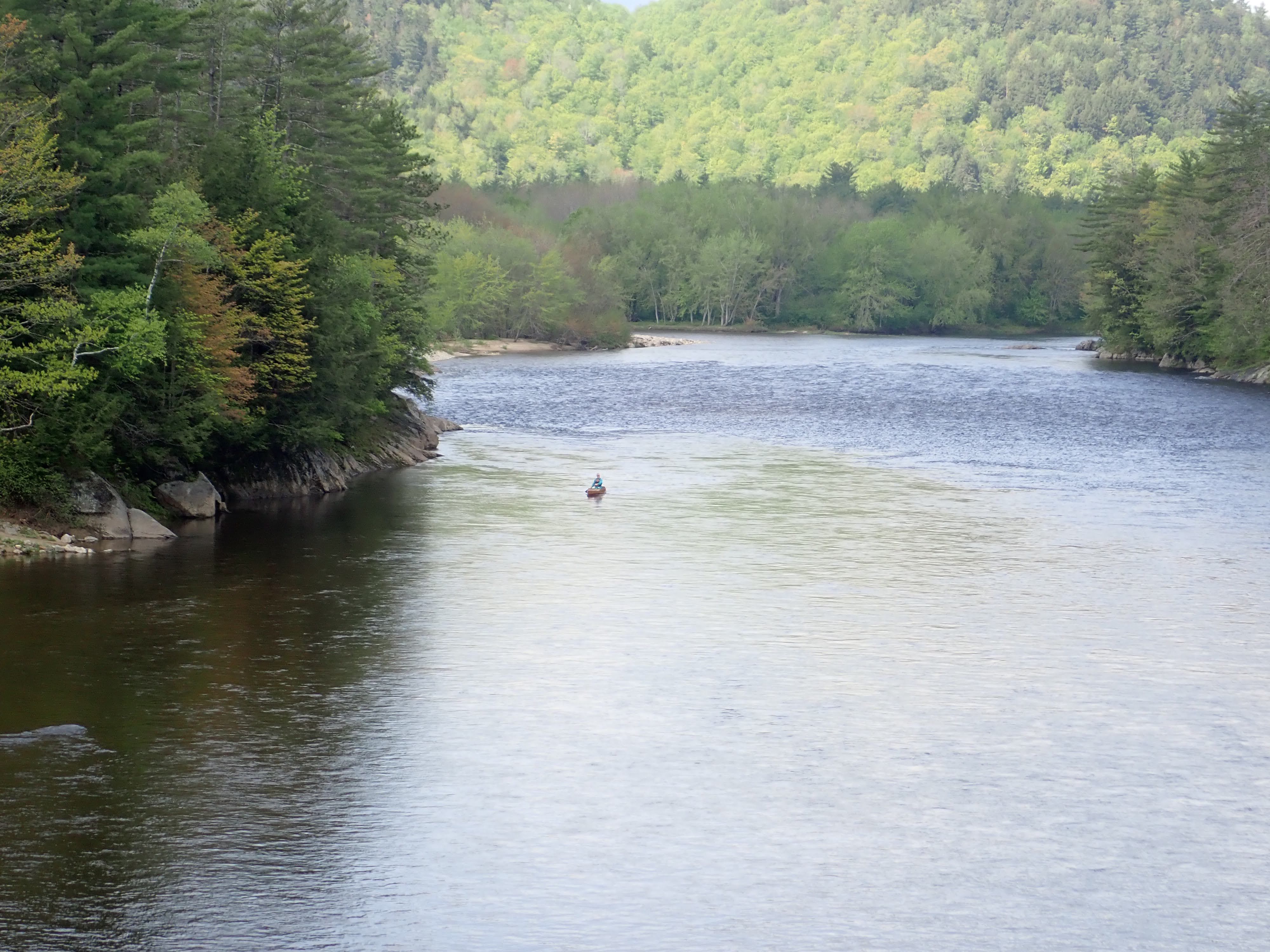
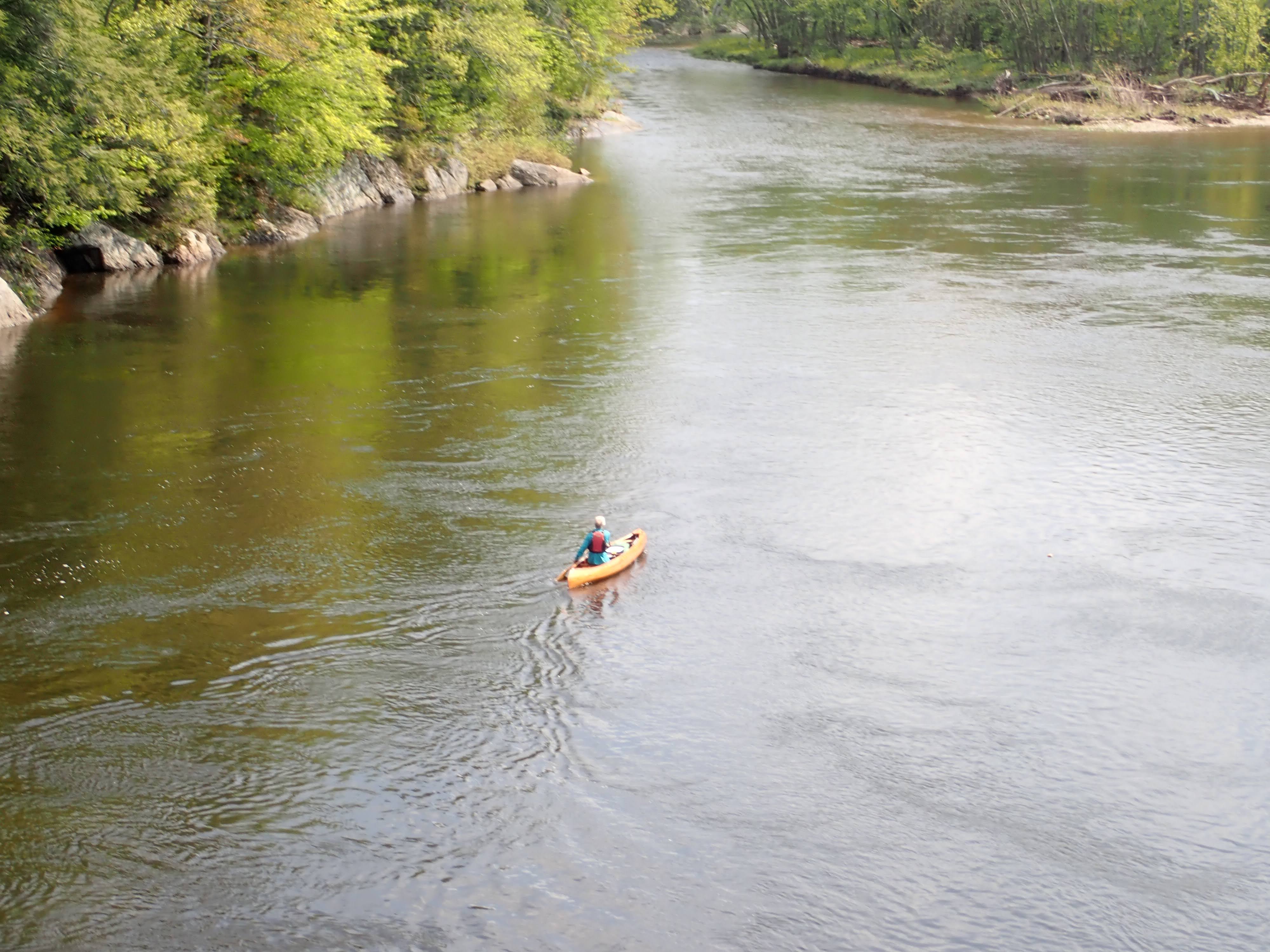
And then I was past. Ray and Hildy were heading west to visit family, so I was now on my own, although had a couple of phone numbers that I could call if necessary. Last night's 0.8 inch of rain had added to the flow, and, despite a few shallow shoals which could be avoided, the flow was good, as were some gentle riffles. I attached the camera to a device that I had recently fashioned to sit on the gunwale, and took low-level video of some of these riffles. Eagles abounded overhead; rarely was there not at least one in sight. One particular eagle kept pace with me downriver for a couple of miles, being mobbed by a succession of crows, none of whom wished that particular eagle, or maybe any, to remain on its turf.
Androscoggin valley
Androscoggin riffles
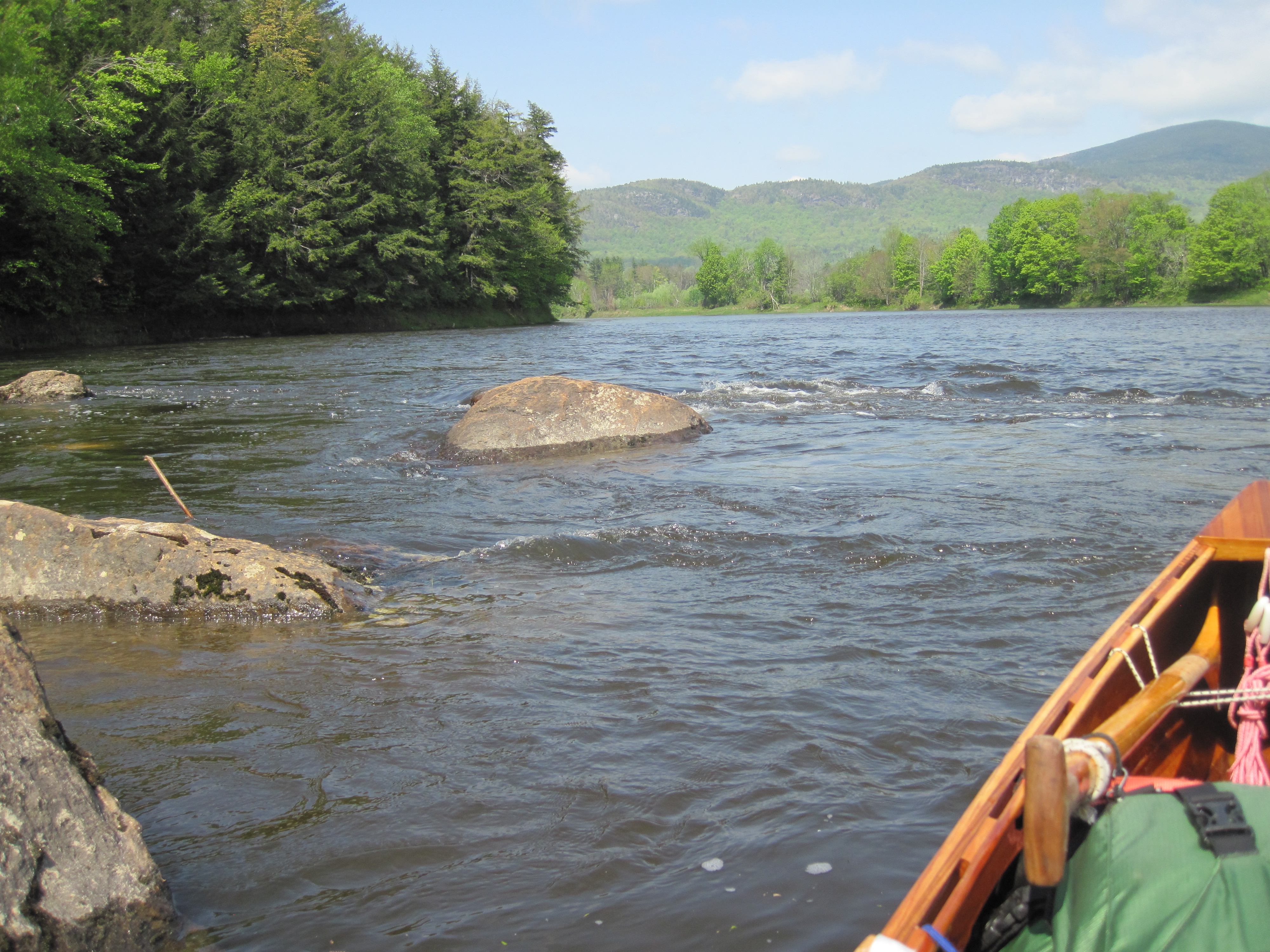
In Bethel, about 16 miles into the day, I stopped briefly at Bethel Outdoor Adventure, chatting to Mike, who worked there, as well as the owner. I was determined that this trip should be more relaxed than my previous trips, and that I would take time out, such as for meeting more people. Setting off again, I took the long way around an island, and then the river headed north for a while, throwing the wind in my face. The wind opposing the current generated noticeable waves in mid-stream. I tucked under the west bank for as much shelter as possible.
Rounding the bend in Newry where the Bear River joins from the left, the wind was once more behind me, and I took a leisurely lunch break on an island, with maybe 23 miles behind me. It was good to uncurl the legs - my knees were not yet used to this length of time of kneeling. More riffles came and went, and a bit more headwind met me as I turned north towards Hanover. Soon after 3:00 pm I was at the mouth of the Ellis River, the place I had notionally intended to camp. It was too early to stop, so, after sending some texts to confirm my movements, I continued downstream. Now I was scanning the banks, trying to get used to spotting possible camping places, developing a search image for appropriately spaced trees together with minimal under-brush and a convenient take-out.
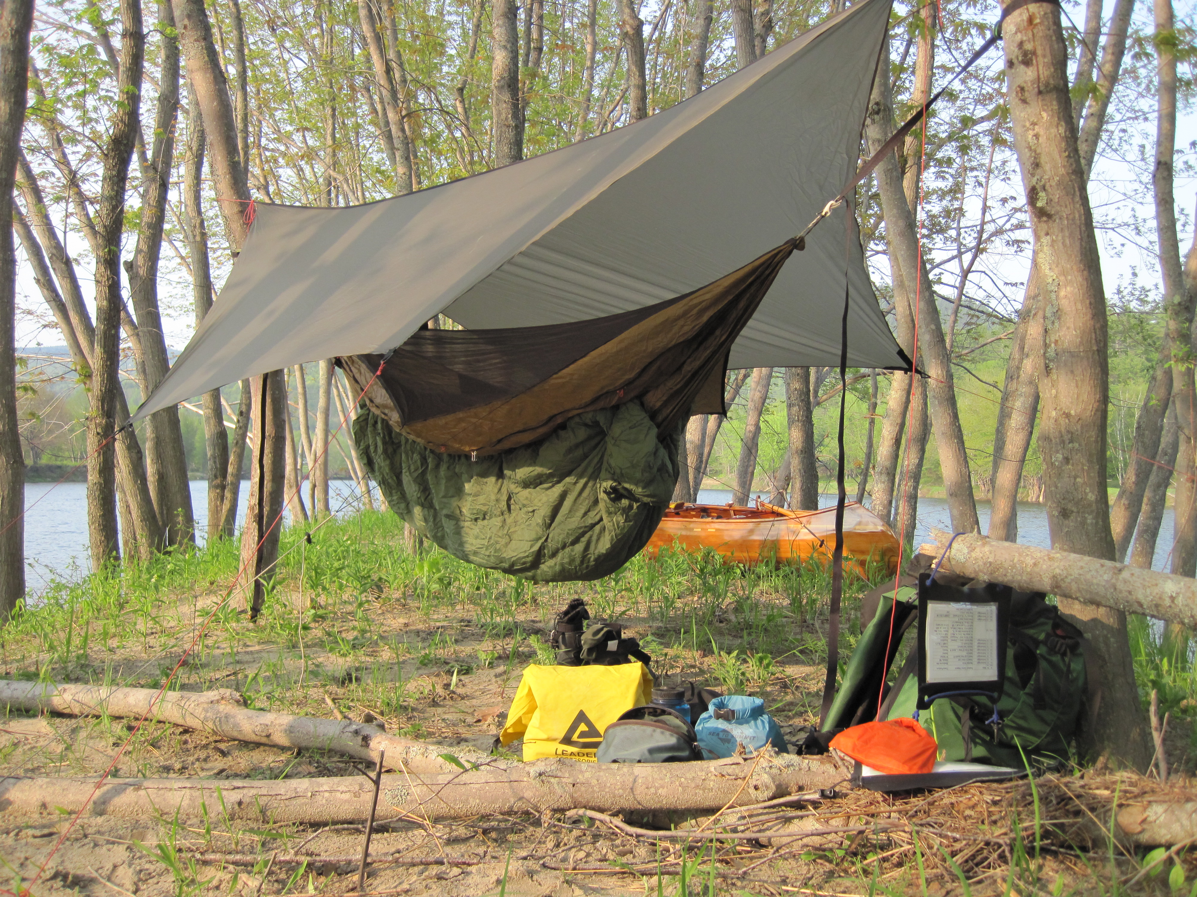
Initially I was faced with private property, or agricultural land, or places too near to the main road, Route 2, but approaching Rumford I came across a small, elongated, sandy island in mid-stream, crowned with a beautiful set of silver maples, some of which would inevitably have perfect spacing to hang a hammock. The road noise from one side and engine noise and loud music from the other were less than ideal, but the privacy and the trees were sufficient to make the decision. This would be camp number 1. It was only 4:20 pm, far earlier than I am used to stopping for the day, but I had already travelled farther than planned, and was determined to keep this trip more relaxed. I took out, hauled everything up to the top of the island, and dropped a waypoint. This time I was using Gaia GPS, and had deliberately changed my cell phone plan to include data to make this possible. Viveka, Ray & Hildy had access to my account, so they would be able to see exactly where I was stationed each night. A few texts flew back and forth as we worked out kinks in the technical aspects, all while I was putting up my hammock.
Almost perfection
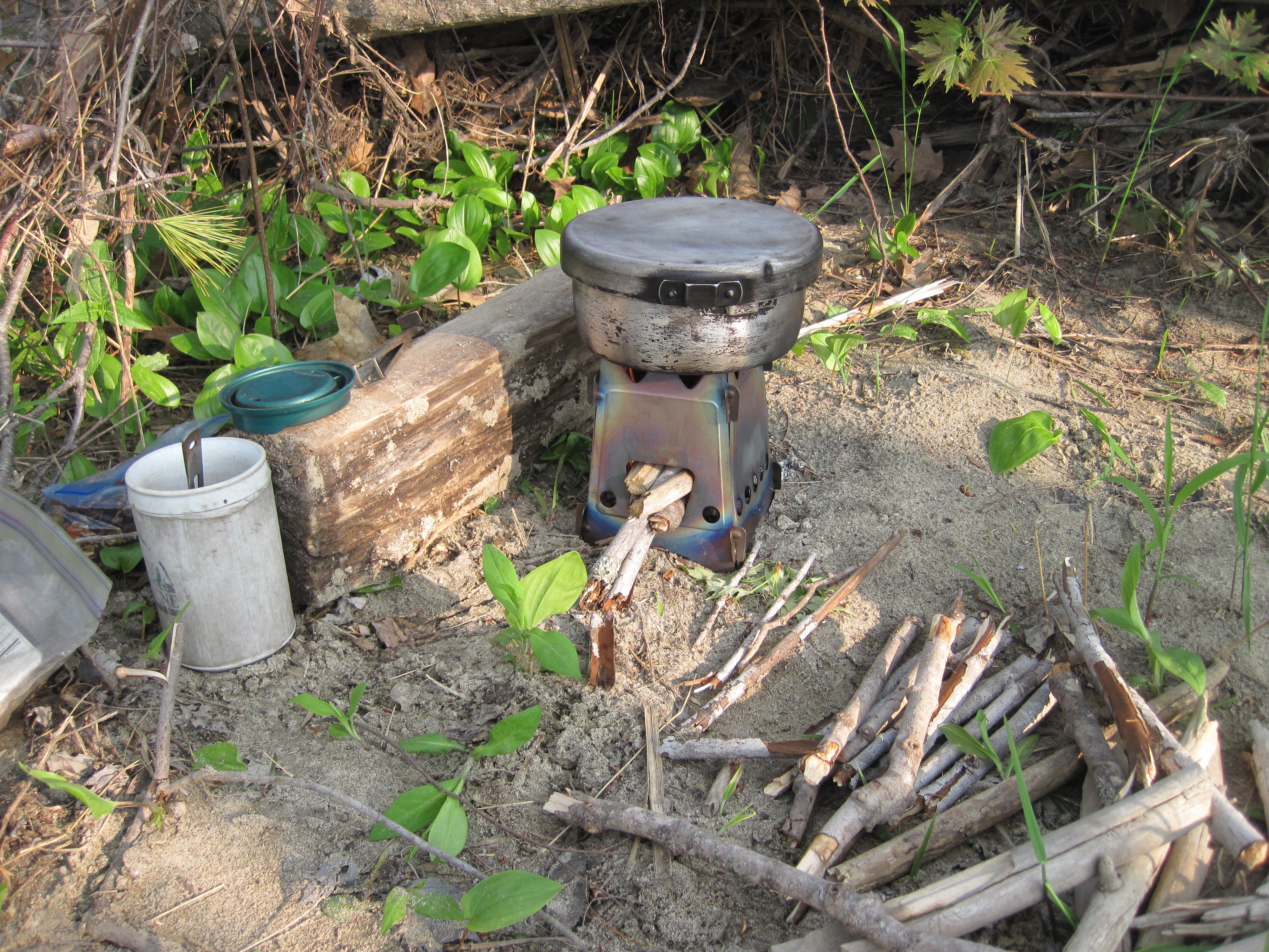
Plenty of wood for cooking
A few blackflies and even fewer mosquitoes put in an appearance, but when their numbers are countable they don't qualify as a problem. There being enough dead wood to use the wood-stove, I cooked a portion of chili. Having added too much water, once I had finished my cup of hot chocolate, I transferred the excess soup into my mug, allowing the solids to fit into the pot lid, freeing up the pot to heat more water for tea while the wood-stove still burned. Dinner was over by about 7:00 pm. I wondered what to do, not being used to having such time available. I had stopped today for about 45 minutes in total, had not worked hard other than when facing a headwind, and was about 3 miles ahead of schedule, having covered about 34 miles. I resolved to take more rests than usual in the upcoming carries, making them less arduous. As the sun lowered in the west I sat writing my journal under an almost clear sky. My noisy neighbours had departed, although the traffic on Route 2 seemed unlikely to abate completely.