The traffic on Route 2 subsided in the evening, but there was a steady stream of long-haul trucks throughout the night. An outside light on the building opposite ensured that I didn't need my own lamp. It soon became apparent that I had not attached my under-quilt properly. The underside got very cold, prompting me to fix it, a good move as the temperature dropped well into the 30s (F) by 4:00 am. I was awake for much of the night, eventually giving up on sleep around 5:30 am, when I braved a chilly morning. There was to be no problem with softening of my breakfast bars. The wood-stove made light work of a pot of tea, and then the main focus of packing was to exclude as much sand as possible. It was around 7:00 am that I left another Gaia waypoint, indicating that I was on the move again. This became a routine: drop a waypoint on arrival at camp and then another at departure.
Under bright morning sun, a clear blue sky and into a chilly north breeze, I set out, rounded a bend to head southeast and was amazed and dismayed to find the wind still in my face. My overall direction for the day was to the east, and it turned out that today's wind was an easterly, not strong at 5-10 mph, but a chilly annoyance.
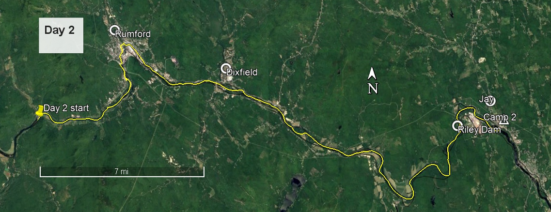
The water was slack to Rumford. The boat launch, where I might have taken out for the longer carry, merely offered an opportunity to use a Port-a-Potty. I then continued around the bend to a take out much nearer the dam, shaving maybe a mile and a half off the carry. I found an easy take-out, about 150 yards above the boom, leading to an ATV trail, and could have followed this, but chose instead to climb up to the parking area. This was to be the first carry and a significant one at 2 miles. My pack was still heavy, over 40 lb, and my legs had had no conditioning. A heavily twisted ankle in early April had precluded any significant training.
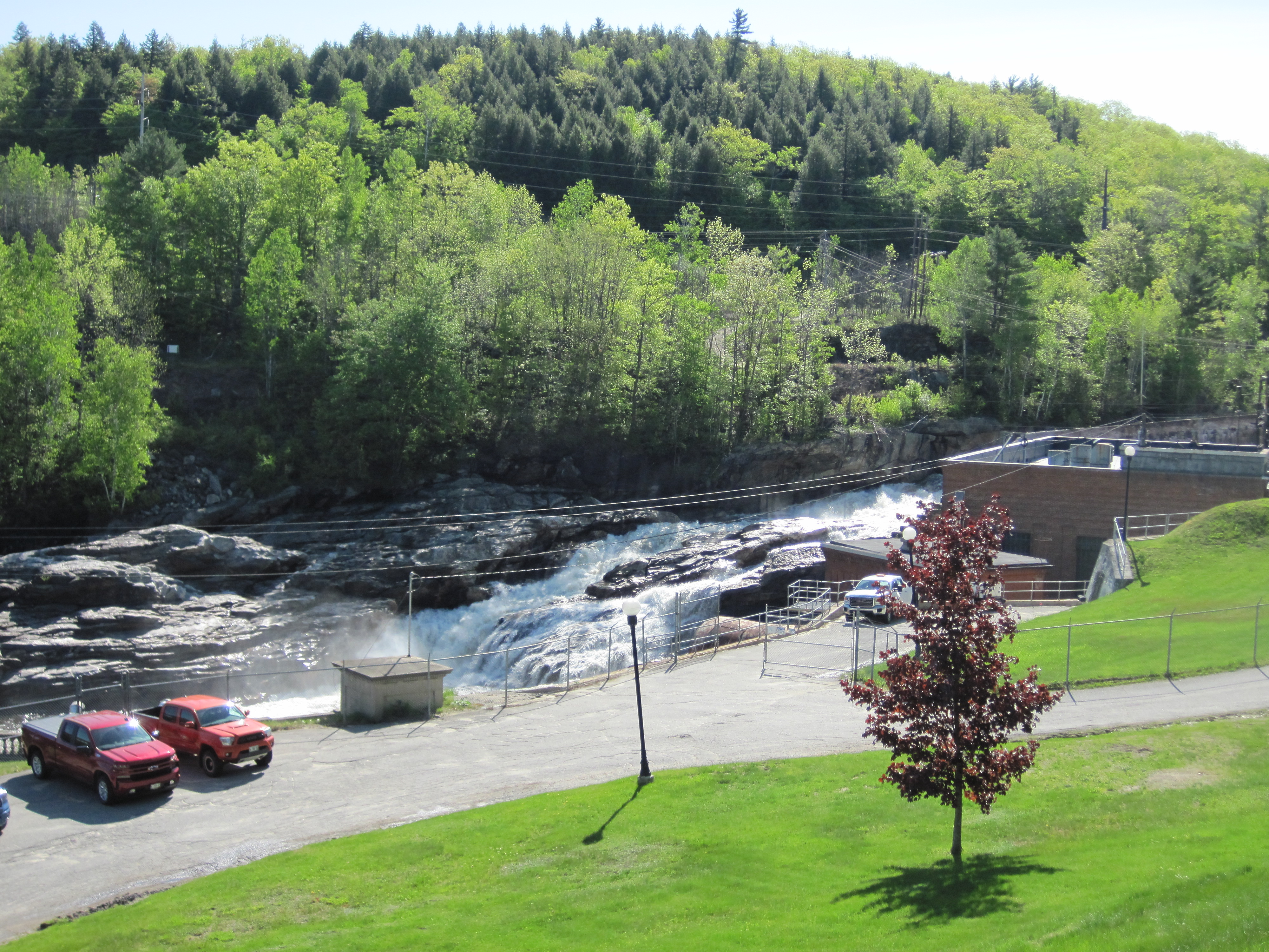
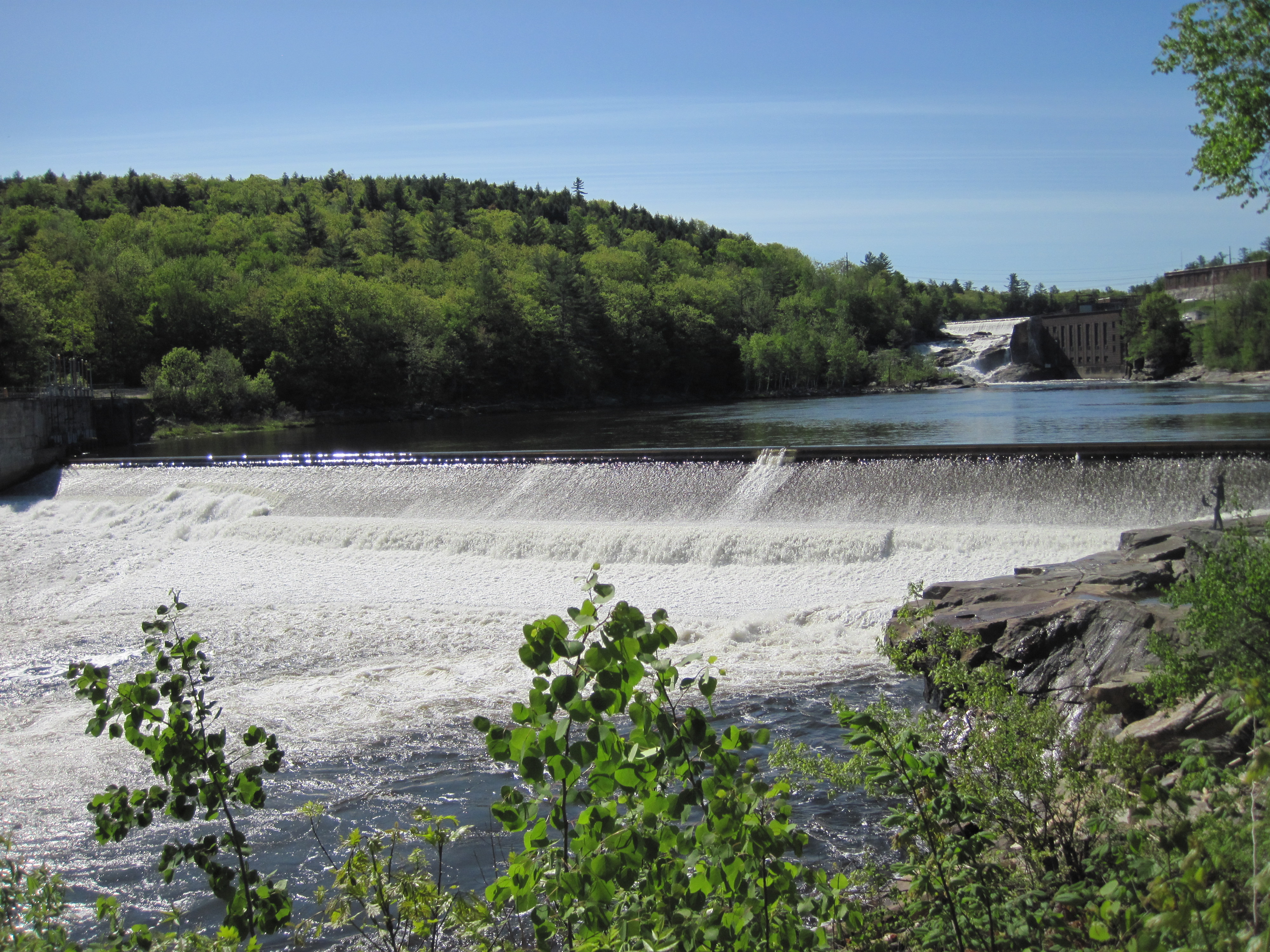
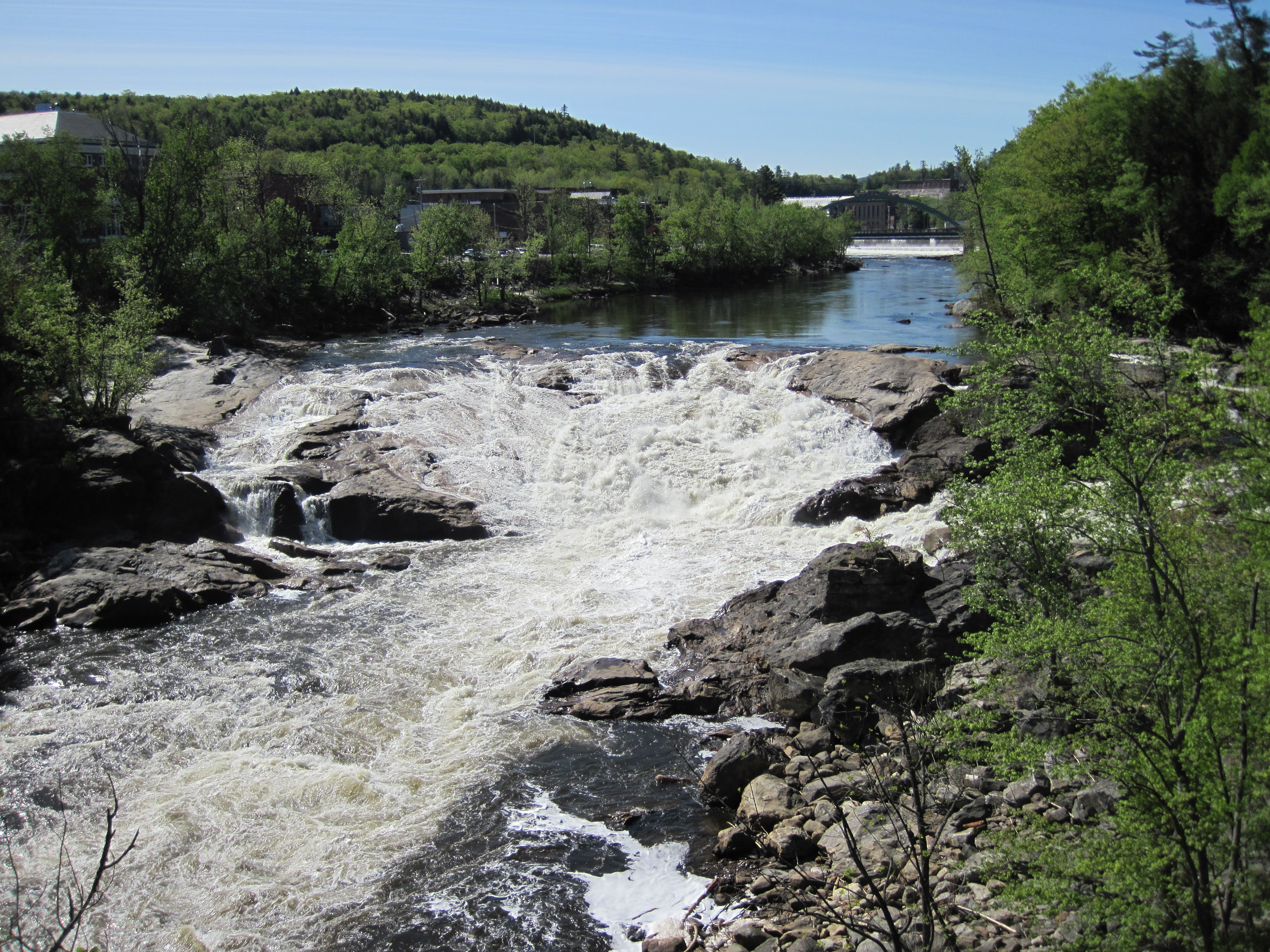
Rumford Falls from above
Rumford Falls
It seems that carrying a rather pretty canoe through a town in Maine is a good way to meet people. At least 6 people stopped to chat, some going out of their way to intercept me. The two miles of carry through Rumford therefore took about an hour, although this did also include some stops to admire and photograph the impressive falls. Having crossed the bridge over the Swift River, I turned left into a small park with access to this body of water, paddled it for a few yards and emerged back into the Androscoggin downstream of all the obstructions in Rumford.
More of Rumford Falls
Yet more Rumford Falls
Downstream of Rumford there were several riffles, some quite large, all with plenty of water. When the rapids were not holding my attention, I was able to take in the wonderful vistas that this valley offers: silver maple riparian forest, some agricultural land, frequent sandy landings. A little past Dixfield, somewhere upstream of Green Island, I found a flat rock which served admirably for a lunch stop. Less than two hours downstream, about 25 miles into the day, I encountered Stevens Island, my intended camping place. It was well that I was ahead of schedule as this island is a nature reserve and so camping is prohibited.
Androscoggin valley
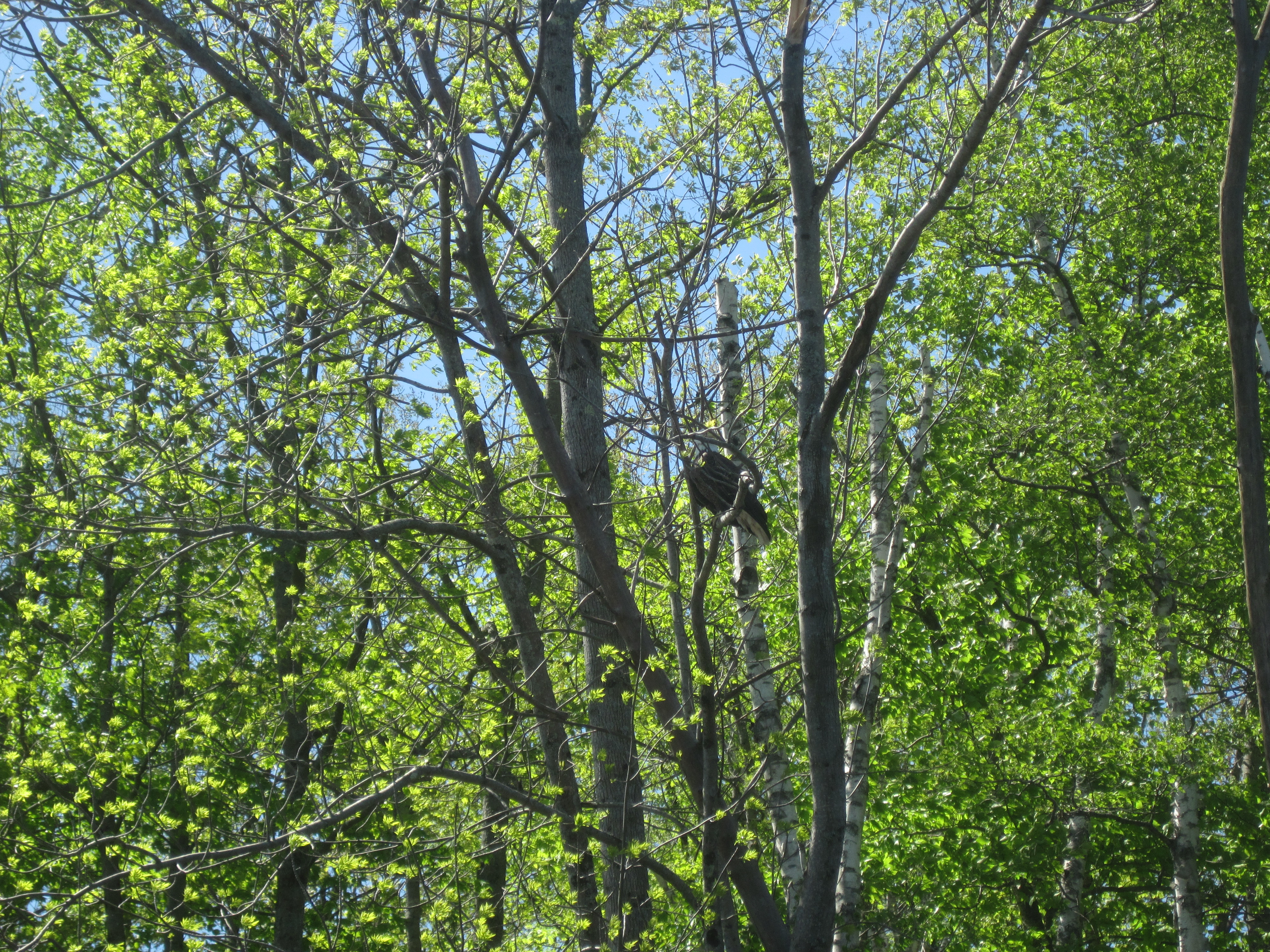
One of very many eagles
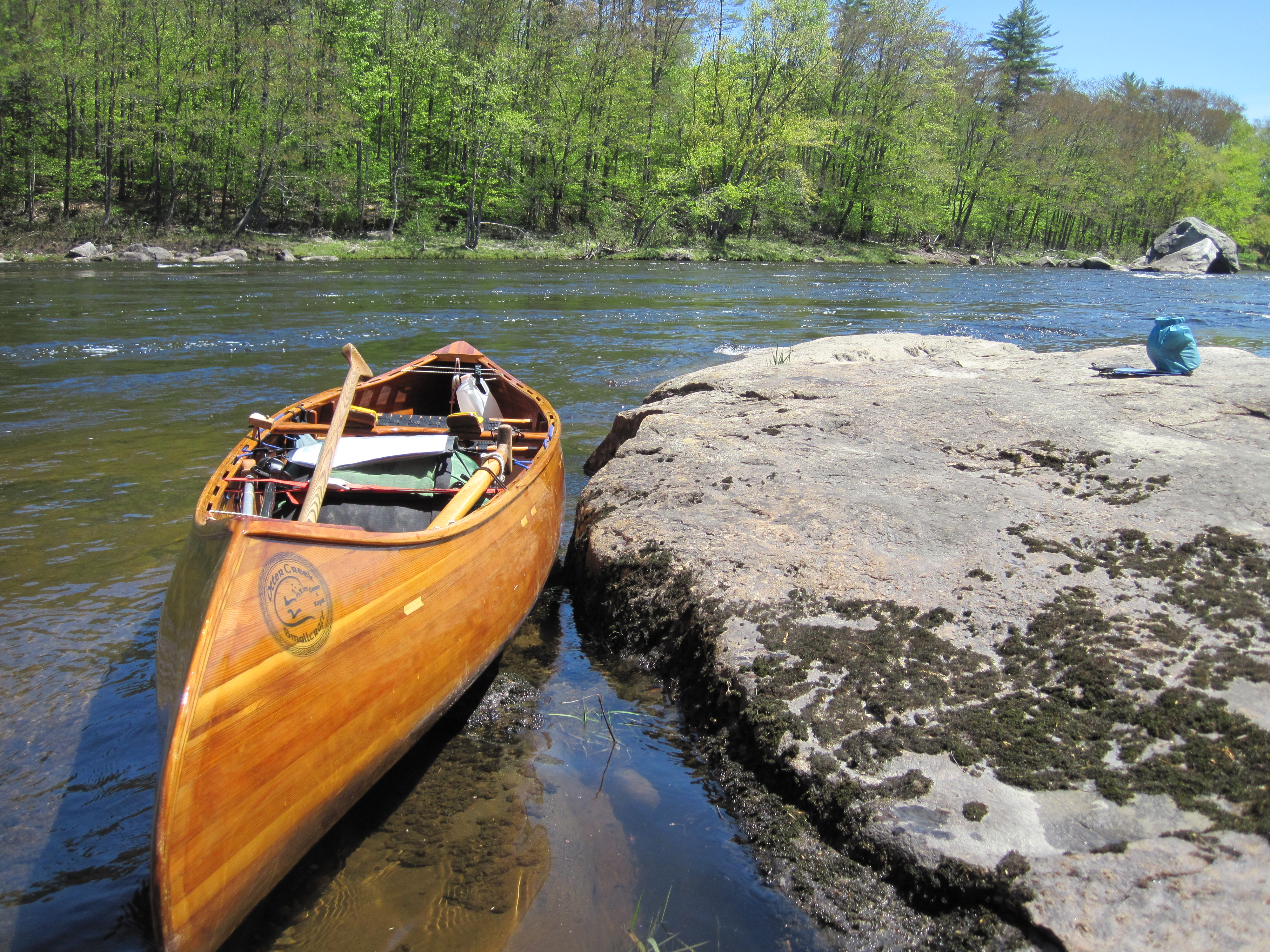
Calm waters
Perfect rock for lunch
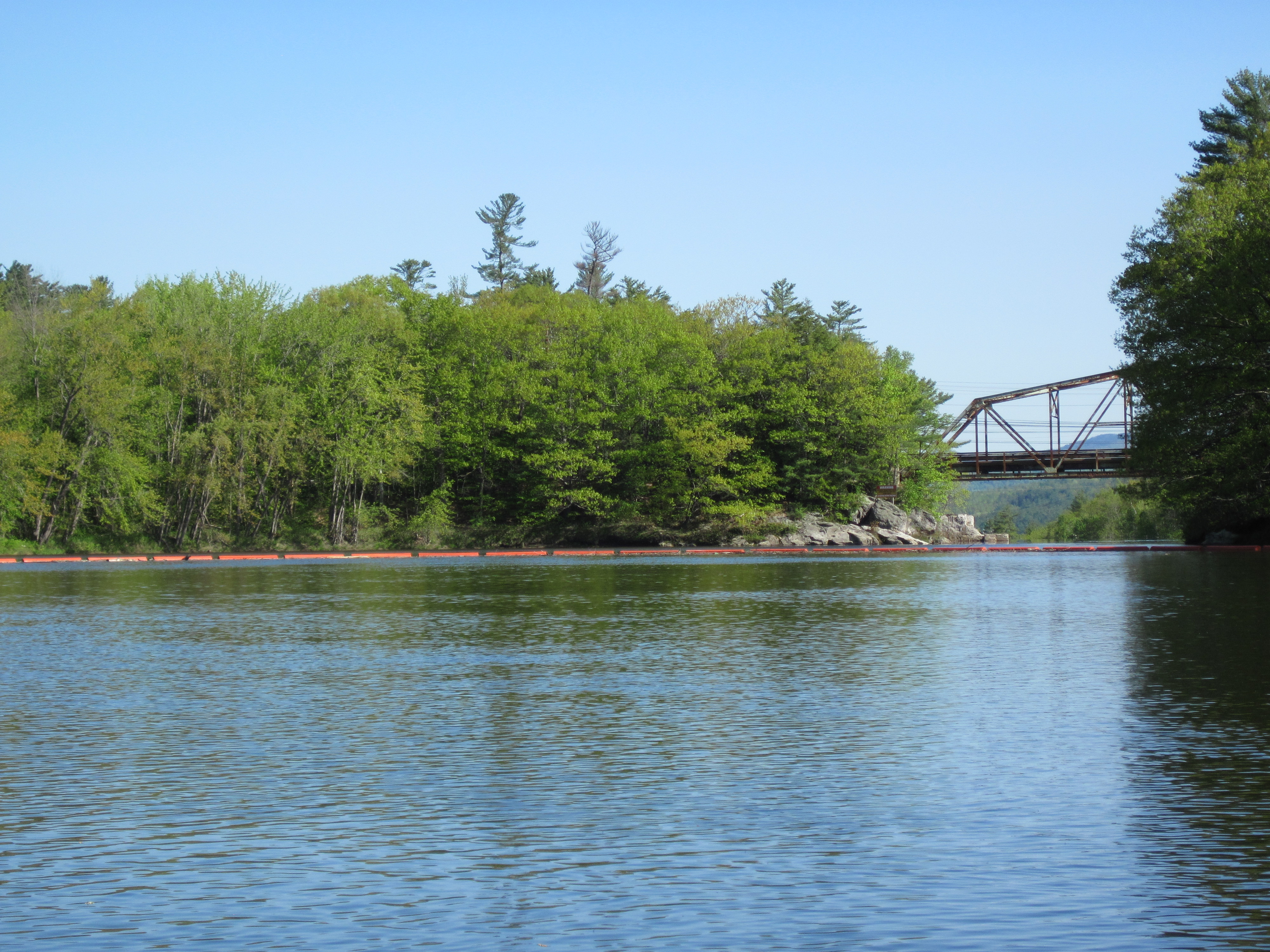
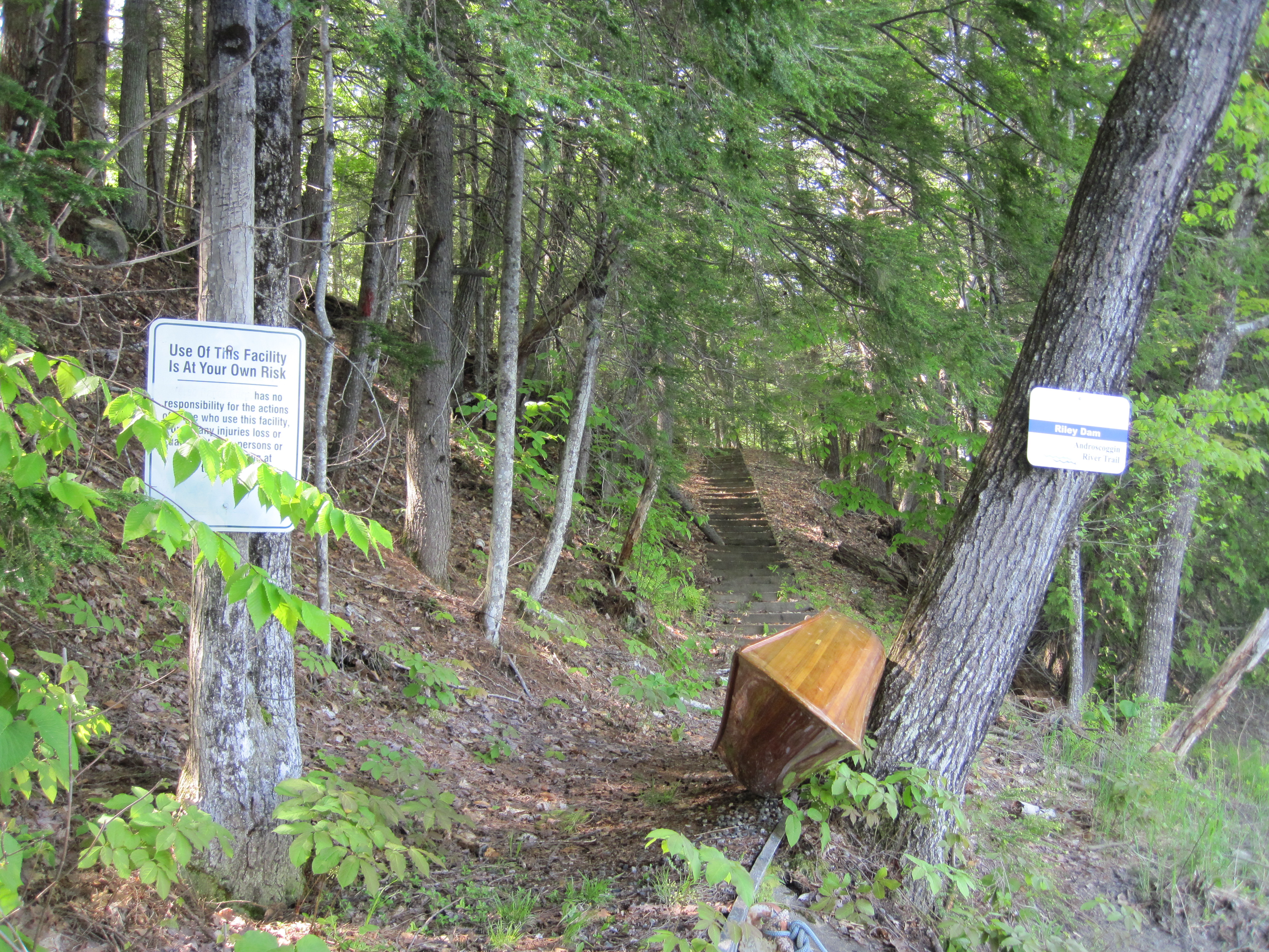
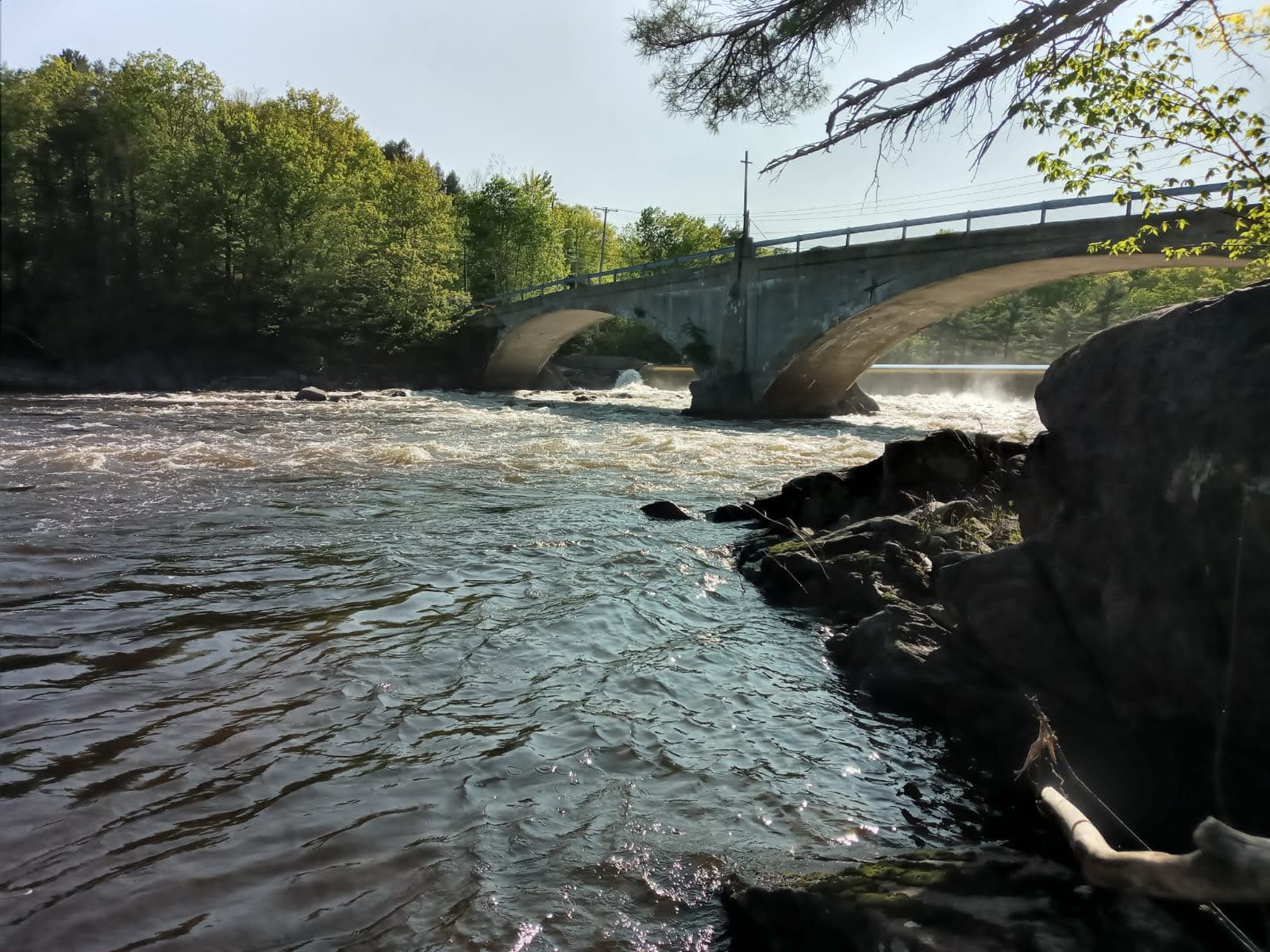
I continued past, coming shortly to Riley Dam. This took me by surprise as I had mis-marked it on my map. The take-out was muddy, but well signed, and the carry led up some steps to start. The put-in, however, was less well maintained. To reach the water required balancing on unstable rocks. And that was only the first hurdle. The only water access was into a vicious recirculating eddy, too fast to paddle against, and leading straight back into the main flow. This had heavy boils, creating slots which held the canoe. I have encountered such conditions before below some of the weirs and locks on the River Thames in England. They are uncomfortable, and require firm, confident handling. I kept my paddle blade in the water for support while applying enough power to shift me downstream.
Take-out at Riley Dam
Put-in at Riley Dam
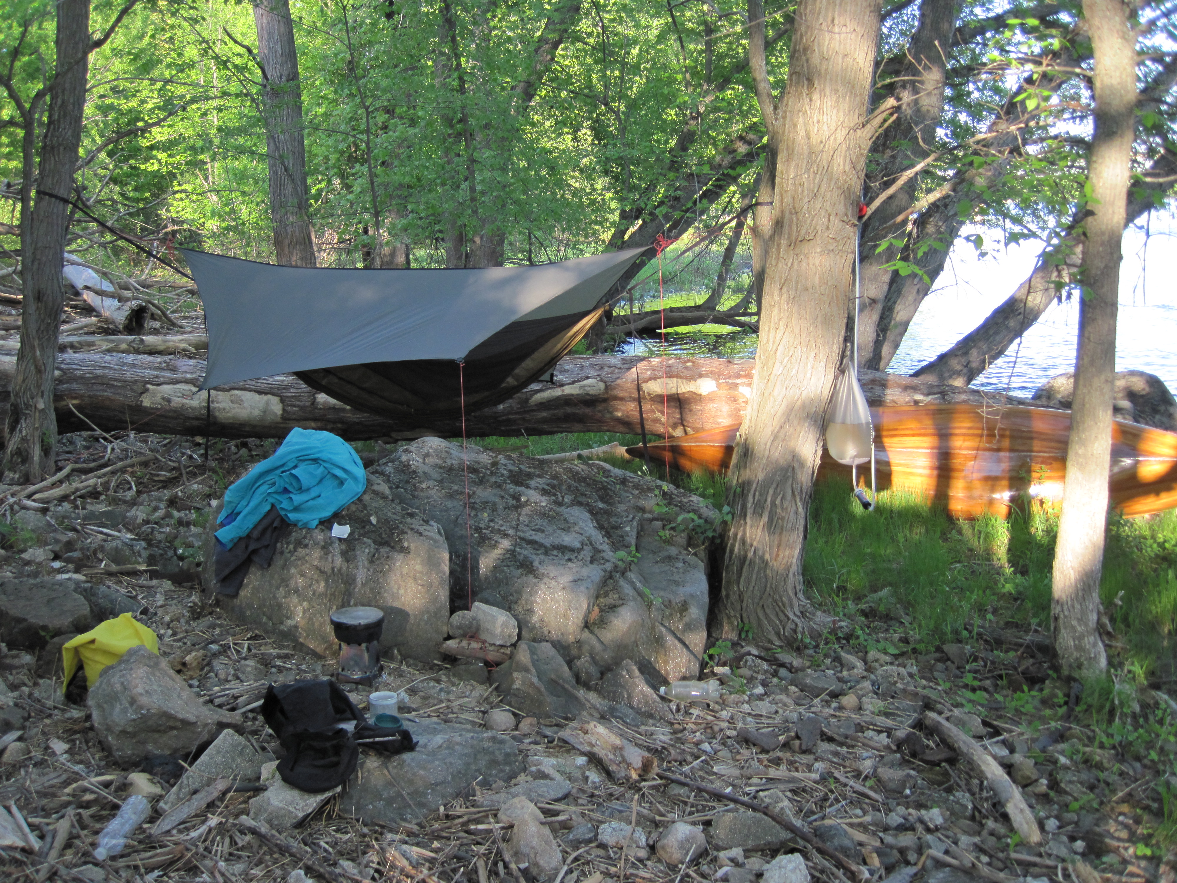
As I escaped the pull of Riley Dam, the cold wind died, and for a while I was hot for the first time today. It was a short, easy paddle to Jay Dam, a pair of dams either side of Pine Island. I took out through mud on to the island, followed the trail to below the dams, and put in through mud, before searching for a camping spot. Initially I headed for river-right, but then espied a secluded spot on Pine Island, so came back upstream to take out there. This was much less exposed to public view. I spent time picking up copious broken glass, stacking it all in one safe place. Then once it was safer to move around, I hung my hammock and used the large amounts of small, dry wood to fire up the wood-stove to cook a curry. Having arrived about 4:30 pm, I had finished eating and drinking, and was brushing my teeth by about 7:00 pm.
Falls at Pine Island
Pine Island camp
I then took a walk over the bridge to river-right where the vehicular access lies. There I found a sign telling me that camping was not permitted. Reasoning that my arrival by water had prevented me from seeing this, and that it was now too late to move anywhere else, the decision to stay put was an easy one. Back at the hammock I put on fleece long-johns and an extra shirt as the clear sky was already adding a chill to the evening.