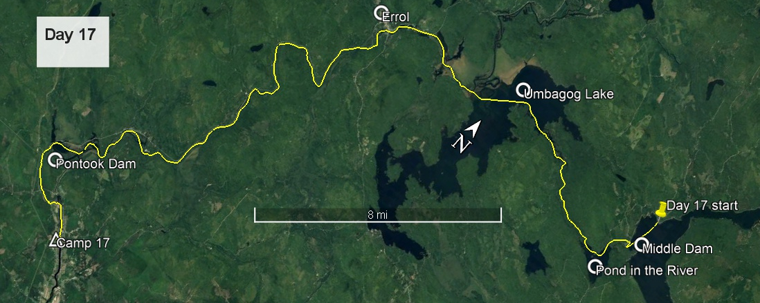
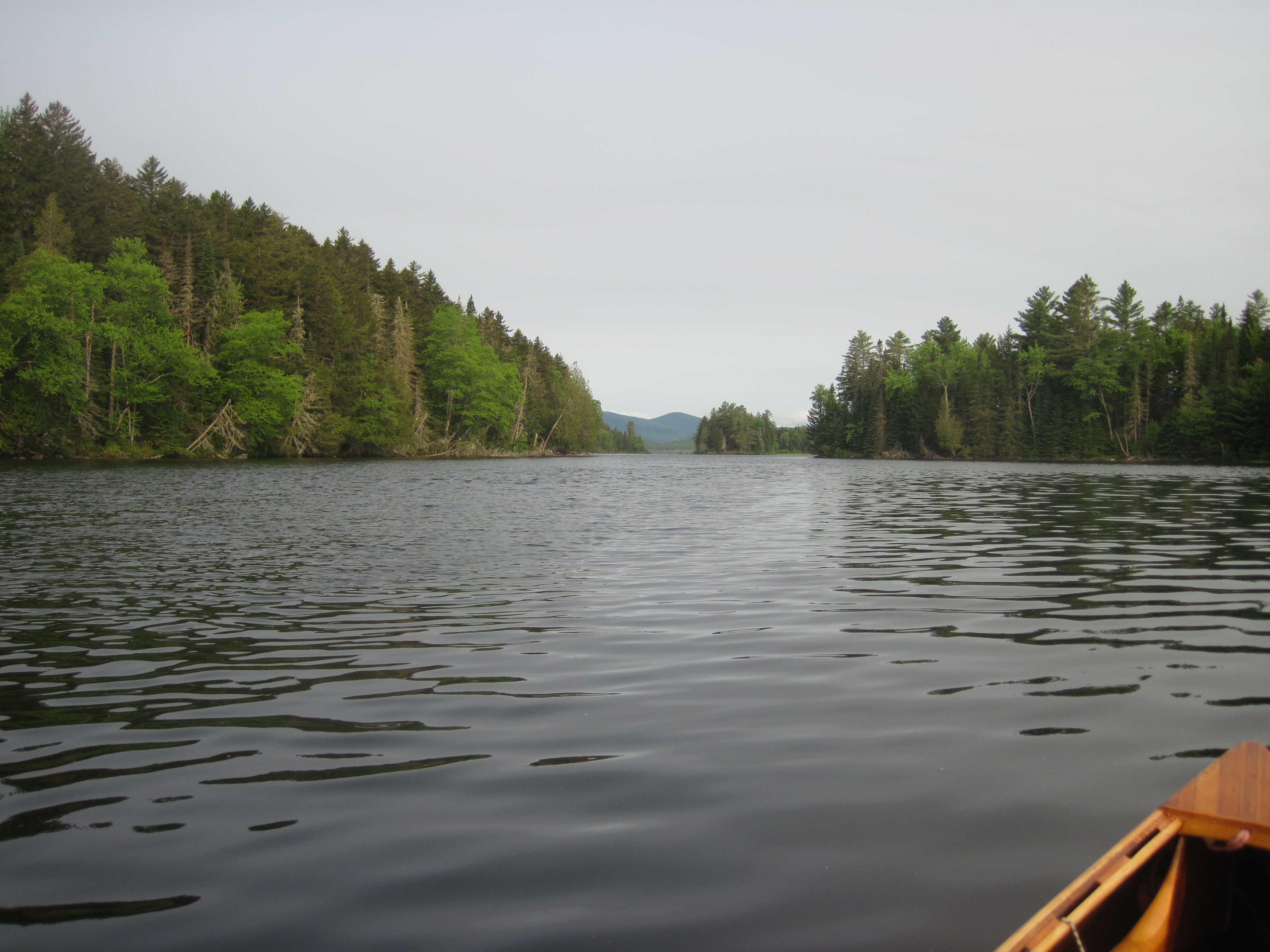
At intervals last night I could see the moon, suggesting that the cloud cover had broken. The night had not been as cold as some, and around 4:20 am I pried myself from bed, put on paddling clothes straight away, once more warmed by lying on them, and packed as far as possible while breakfast water was heating on the gas stove. Packing had to be systematic as I had draped various items around the shack, and wished to leave nothing behind. Within an hour I was leaving the locked shack behind, and at 5:25 I pulled out on to a calm Lower Richardson Lake. Today was slated to be a long one, so my early start was deliberate.
As I set a course for Middle Dam, the start of the Rapid River carry, I happened to glance over my left shoulder and saw a shocking sight: the rising sun was visible, more evidence of the now incomplete cloud cover. The crossing to Middle Dam went smoothly but, despite a systematic search, I could find no sign indicating a take-out for the carry. For such a historic carry, this seemed to me to be a distinct oversight. Eventually I chose the best landing which appeared to be on private property. No-one complained.
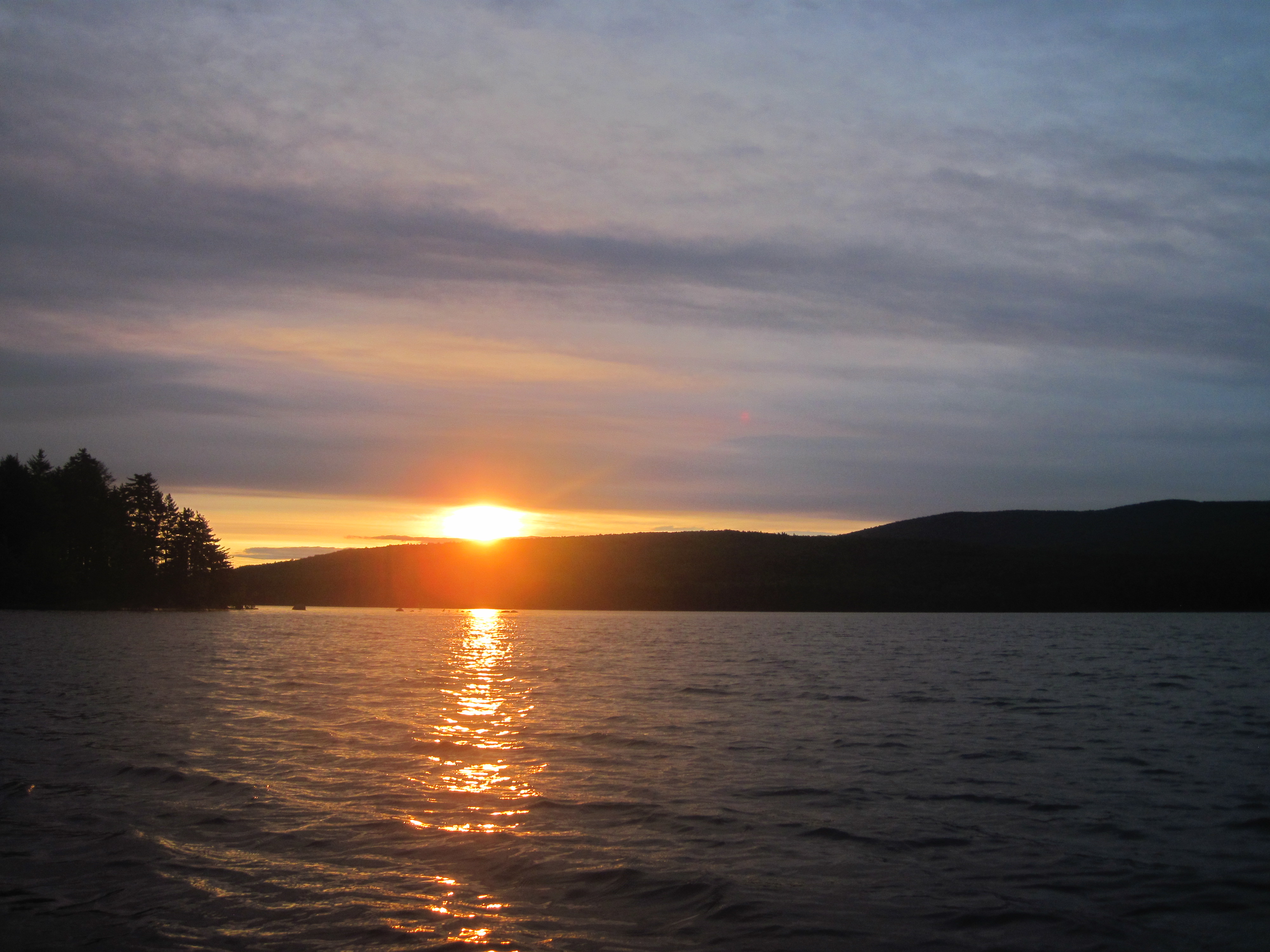
It took only 15 minutes to carry to Pond in the River, an expanded region of the Rapid River. My crossing of this body of water was highlighted by early morning mist shrouding a group of four loons, and illuminated by the early sun.
Sunrise on Lower Richardson Lake
Pond in the River
After taking out by the Alligator, an old steam tug from logging days, the remainder of the carry went by in under an hour, punctuated by only two things. Beside Forest Lodge a fisherman's dog was boisterous enough to grab my left wrist between its teeth. The second time it did this I aimed a kick at it, barely making contact. When I pointed out to the owner what his dog had done, he merely asked if the dog had bitten me after I kicked it. No apology, simply the suggestion that I was the guilty party. And the day became warm enough that I had to shed my paddling cagoule and fleece.
At Cedar Stump, the end of the carry, some camped fishermen were frying bacon, and the smell had been wafting up the carry trail, drawing me on. Now I launched into the calm outflow of the Rapid River and headed out towards Umbagog Lake.
Departing Cedar Stump on the lower Rapid River
Heading down the Rapid River towards Umbagog Lake
The sun still occasionally appeared, although the wind was less than helpful. The forecast north wind had a definite westerly component on Umbagog Lake, and so impeded my motion yet again. Nevertheless, I nailed the crossing, aiming always in the right direction and hitting the outflow into the Androscoggin River with perfection. The early part of this river was frustrating, there being little flow due to the impoundment behind Errol Dam, and with the wind funnelling up the valley towards me. It seemed to take forever to turn south towards the dam.
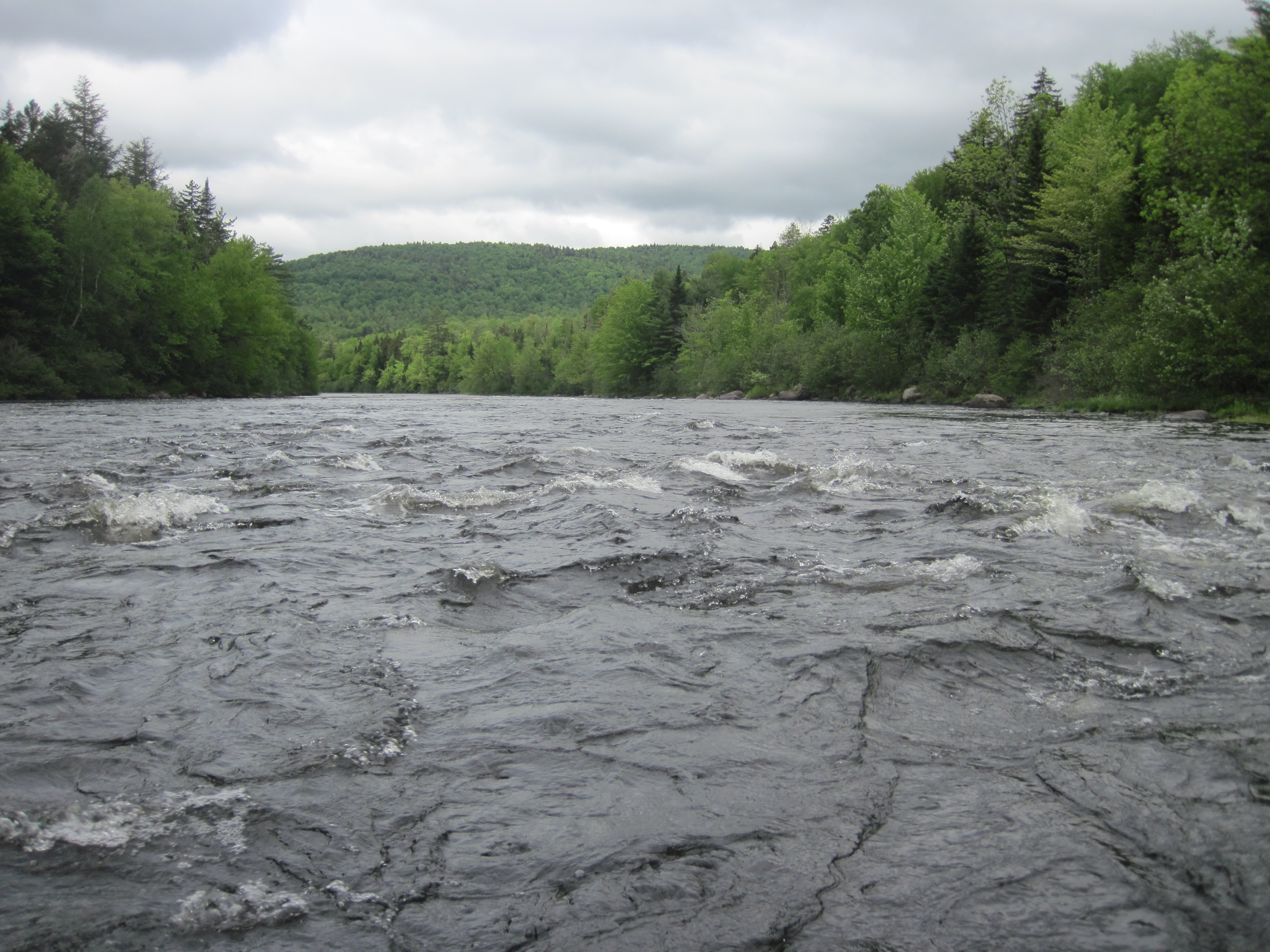
The carry around the dam was short, as was the next stretch to the take-out to carry around the Errol rapids. The upper part of the rapids almost tempted me, looking very manageable, but I was uncertain of the takeout possibilities, and knew that the lower part of the rapids near the road bridge was much less benign. I opted for the half-mile carry. After a brief snack I left Errol at 10:45 am. The next stretch to Mollidgewock was flat with some helpful current. Beyond there I encountered several rapids. The water level was a little lower than when I last ran these, so route finding was more necessary, but all of them had sufficient water depth to be able to run them with no chance of grounding on rocks. The paddling was beautiful, even if the north wind contrived to blow in my face for some of the time that, according to both map and compass, I was travelling south. I sailed through Seven Islands bridge and enjoyed some more rapids downstream before the water flattened in the impoundment above Pontook Dam.
Rapids on the Androscoggin
Androscoggin riffles
Here the northwest wind had grown in strength, and making my way across the top of the dam would have been precarious. I had visions of being blown into the boom and having to tie up to it in order not to be swept over the dam. To avoid this rather alarmist scenario, I cut through a shallow passage into the lagoon above the dam, and followed a curving path around the north and west shores of this lagoon, staying well clear of the dam. This path brought me to the boat landing beside the dam, where I took out to carry around the dam and probably the rapids below.
Following the NFCT portage signs, I headed for the riverside trail. It didn't take much to decide not to run the rapids; they were looking rather bony. The trail, although well blazed, was clearly not well maintained or even constructed. It was narrow, worn, twisty and hilly. Carrying a short, light canoe, and being reasonably strong, I struggled to negotiate some of the bends, having to shunt back and forth to turn corners between trees. Someone with a longer, heavier canoe would have stood little chance. I wish I had just taken the road. After seemingly forever I emerged into some meadow land between river and road, followed this a short way, and then decided that paddling would be more fun than carrying. The largest of the rapids were behind me, so I was confident of controlling my speed and finding the clear channels, despite the low water and the rock garden nature of the river.
Something I had not realised is just how far the rapids extend below Pontook. My only experience of this part of the river had been as far downstream as the junction of Route 110A, the NFCT link to West Milan and the Upper Ammonoosuc River. Below this was new territory, and I was not prepared for the rapids. Nevertheless I took them on, intricately wending my way through channels. These were technical rapids, not powerful. After picking my way carefully downstream I came to a considerably steeper section which was correspondingly shallower. There was no way that I would risk my canoe in that, so it was time to take out. The road was close by, so I followed what was probably a fishermen's path, somewhat overgrown, and emerged just above the road leading into the Bofinger Wildlife Management Area. Taking this road led me back to the river just below the end of the rapids and also below the hydro-electric plant that fed on water streamed from above Pontook dam down a side channel.
The river was now placid, and I could paddle with less intense focus. I was aiming for the house of Tom and Laurie, friends of Ray & Hildy. We had enjoyed a paddling trip around the Moose River Bow with Tom several years previously, and on Aziscohos Lake more recently with both. They had kindly offered me a bed for the night, which was welcome as the clouds were threatening rain and the temperature was still cool for the season. I pulled into their dock, and carried up to their house, arriving there about 4:15 pm. They were out, but had left a key for me, so I let myself in, left my somewhat smelly boots outside to air, found my room in the basement, and was enjoying a hot shower when noise from above told me they had returned home.
We chatted about paddling experiences – they had been on some remote trips involving far more blackflies and mosquitoes than I could have handled – and ate snacks. Then it was time for dinner. Apparently my appetite was out of the ordinary, though it didn't seem so to me. It was 9:15 pm, two hours later than the previous evening, when I retired to bed, grateful to be in comfort. Tomorrow would see the conclusion of this trip.