Peter Macfarlane's 2023 Solo Paddle of a Circuit of the Androscoggin, Kennebec and Dead Rivers
in a Cedar-Strip Canoe by Otter Creek Smallcraft
|
|
|
|
|
|
Yesterday
|
Day 11
18.1 miles
|
Wednesday 31st May
Wyman Lake - Hurricane Island, Flagstaff Lake
|
Tomorrow
|
Home Page
Day 1
Day 2
Day 3
Day 4
Day 5
Day 6
Day 7
Day 8
Day 9
Day 10
Day 11
Day 12
Day 13
Day 14
Day 15
Day 16
Day 17
Day 18
|
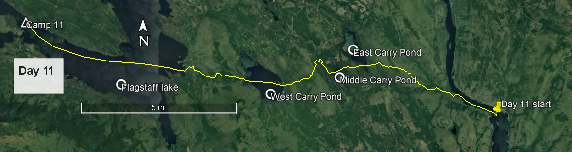
Day 11 route on Google Earth imagery
|
|
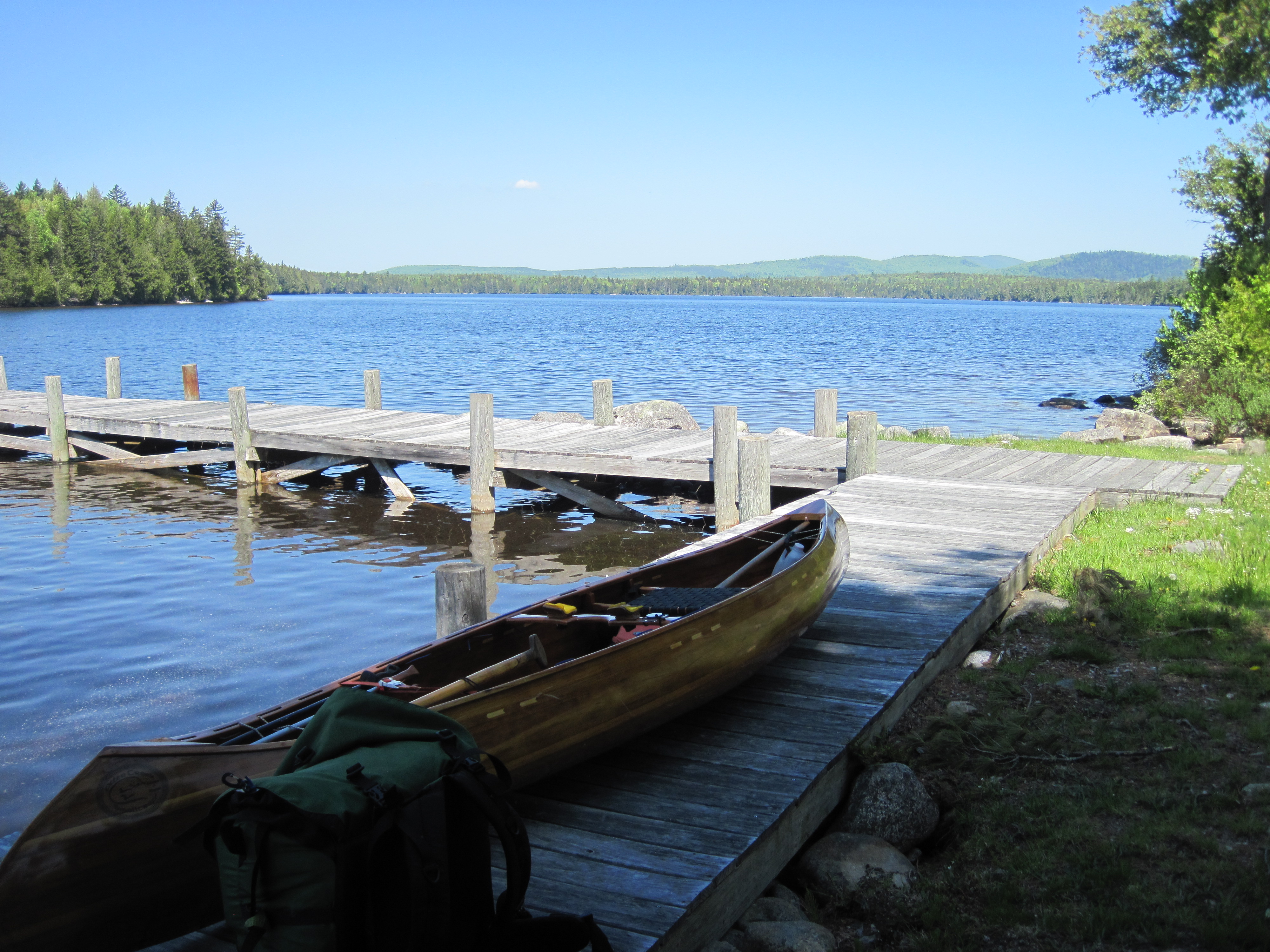
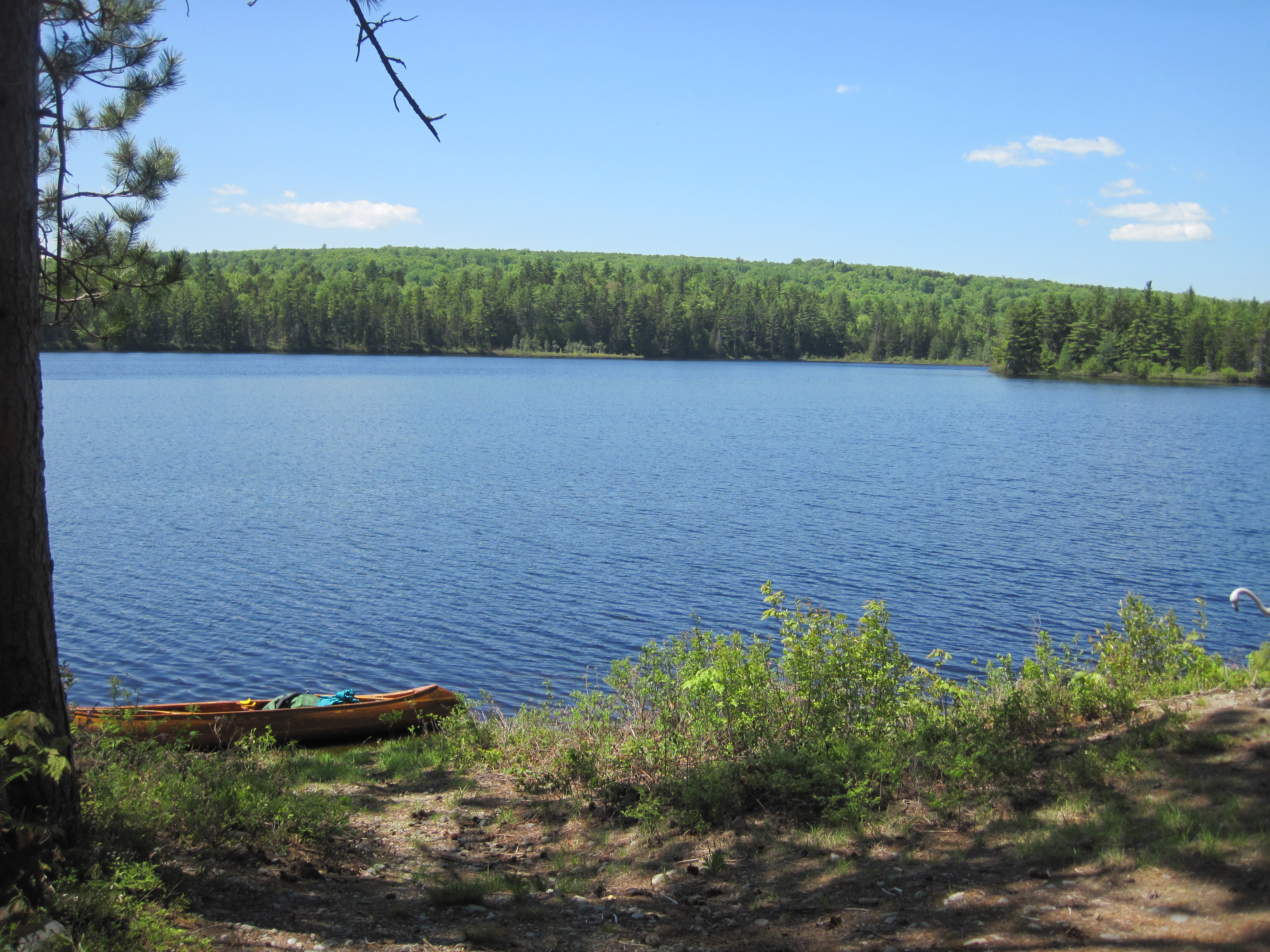
Today began and ended idyllically, but what came between was a different story. I was up early, planning to complete as much of the Great Carry as possible before the main heat of the day. This is the portage, nearly 11 miles, from Wyman Lake to Flagstaff Lake, punctuated by three small ponds: East, Middle & West Carry Ponds. The early paddling west on Wyman Lake was calm, wonderful for limbering up, the rising sun on my back. At the next bend, where the lake turns again to the north, and just south of the Carrying Place Stream, I found some pink flagging tape indicating the take-out. There was a clear path leading west to the road.
|
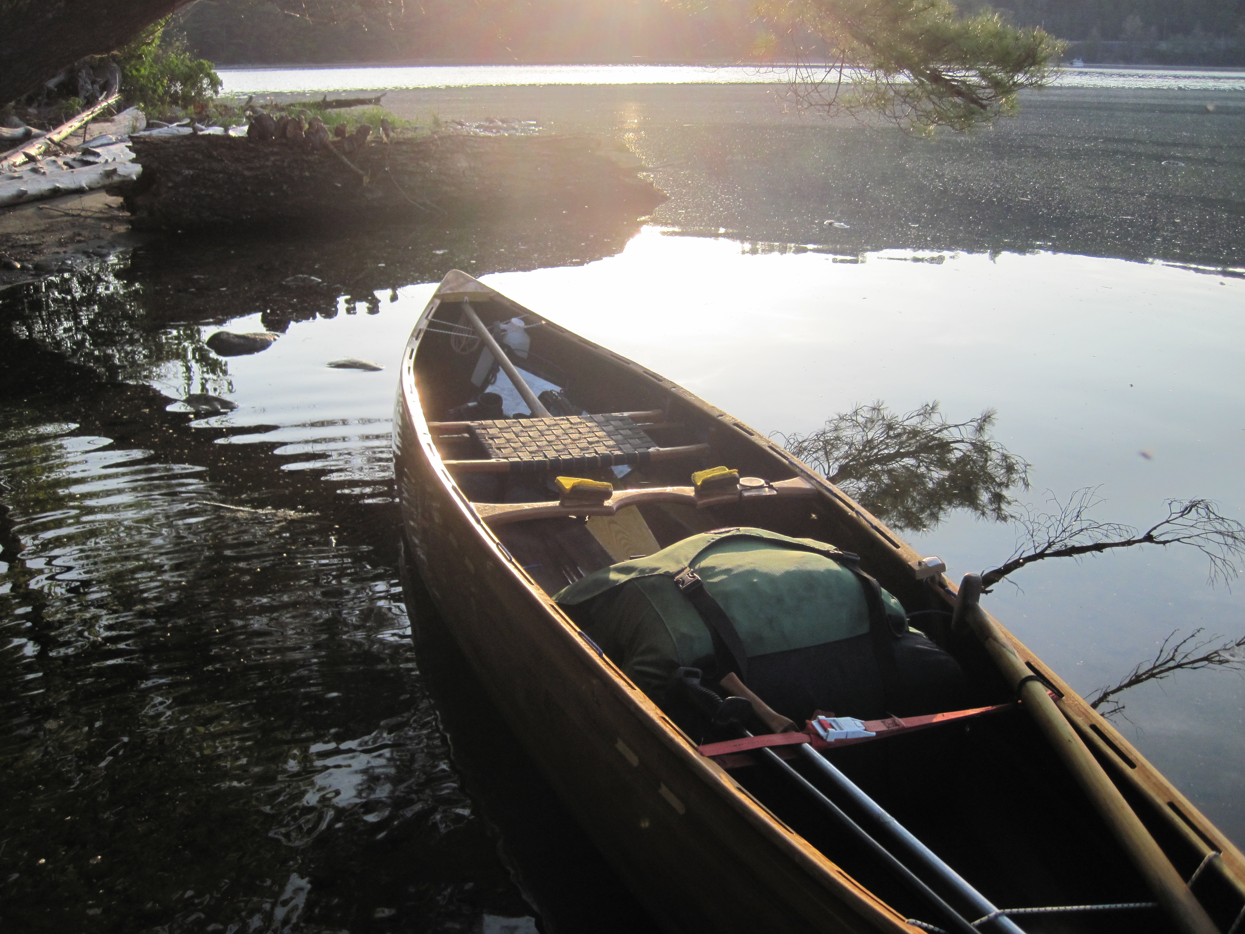
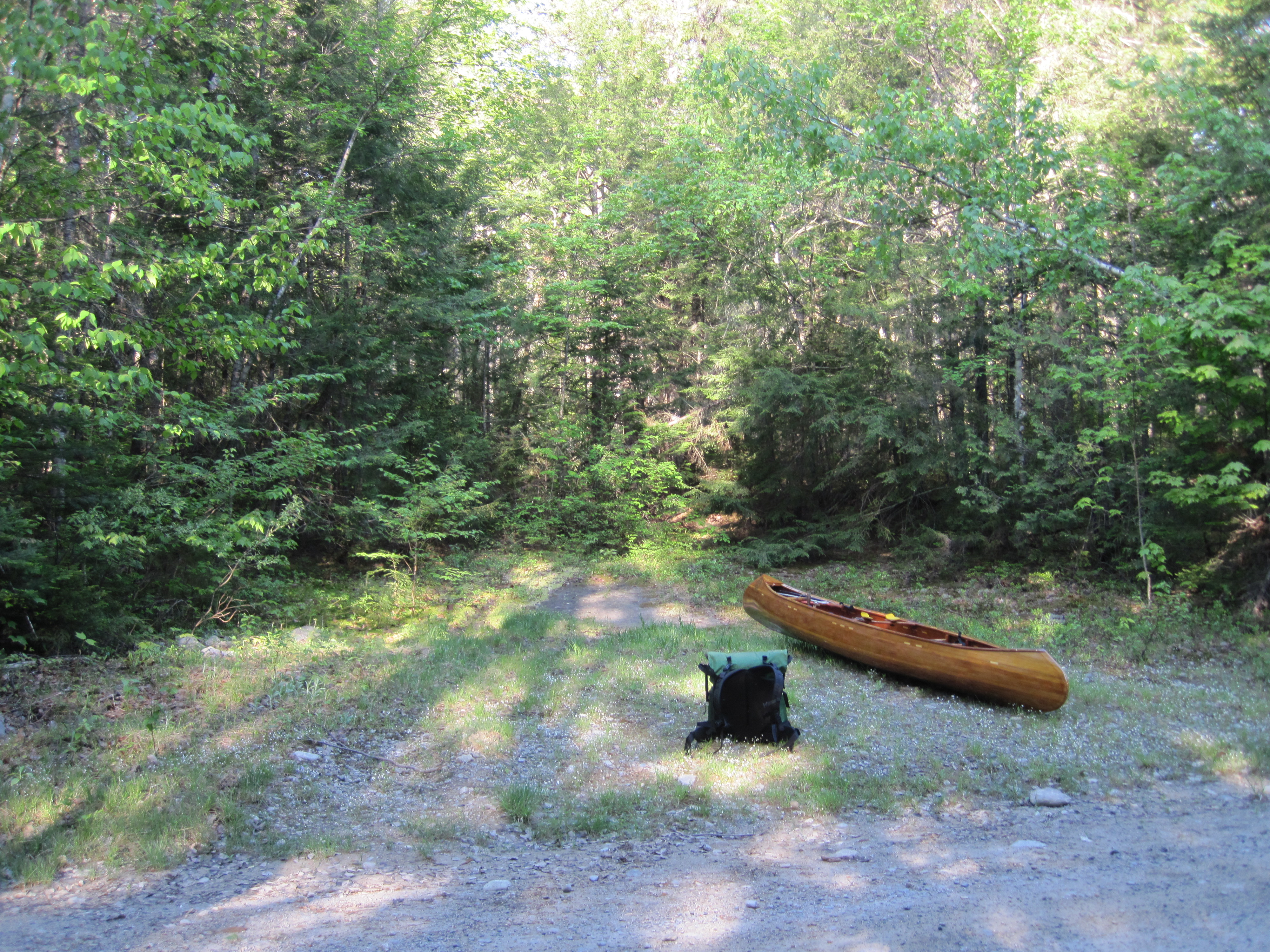
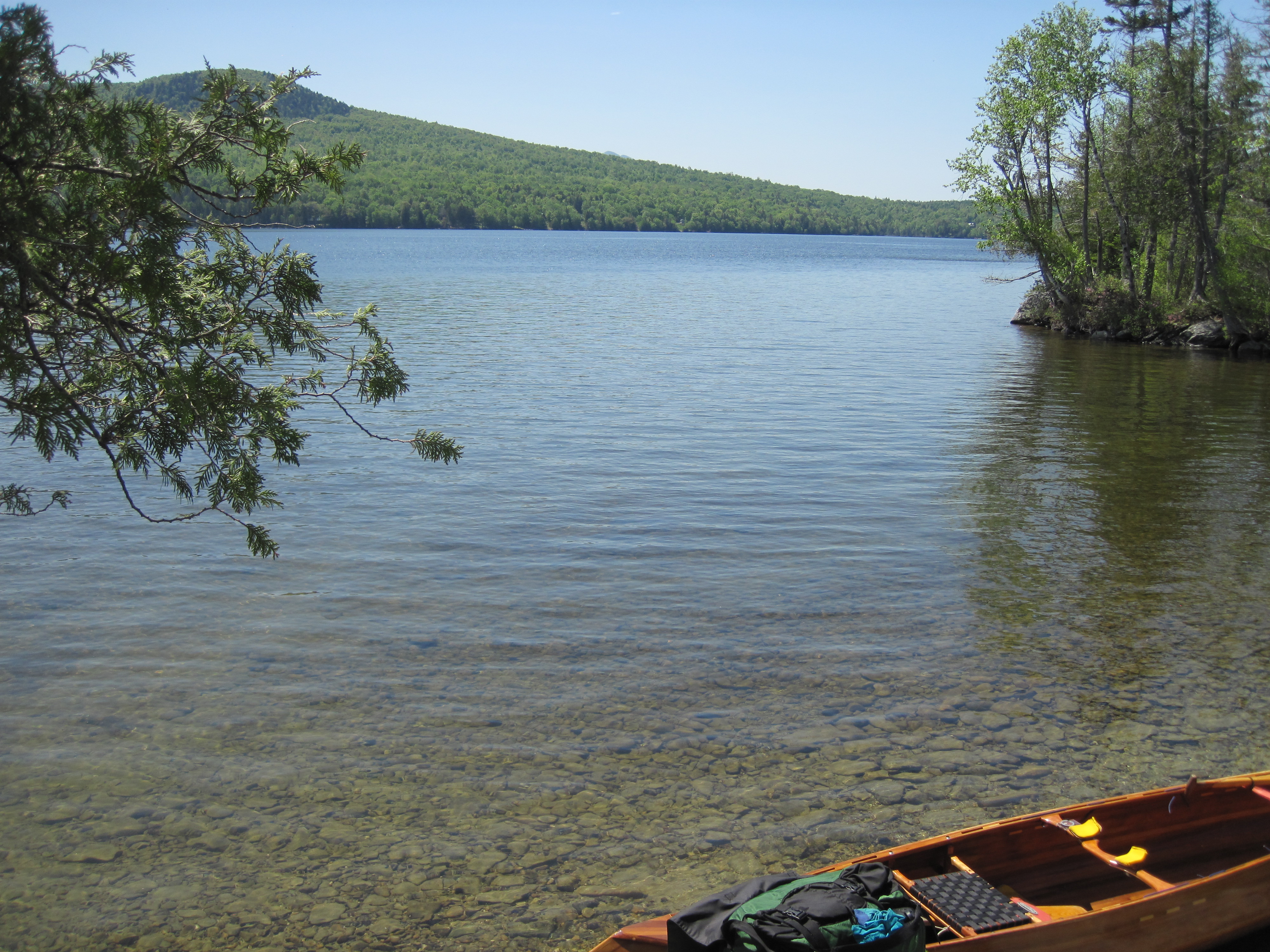
Setting out towards the Great Carrying Place
|
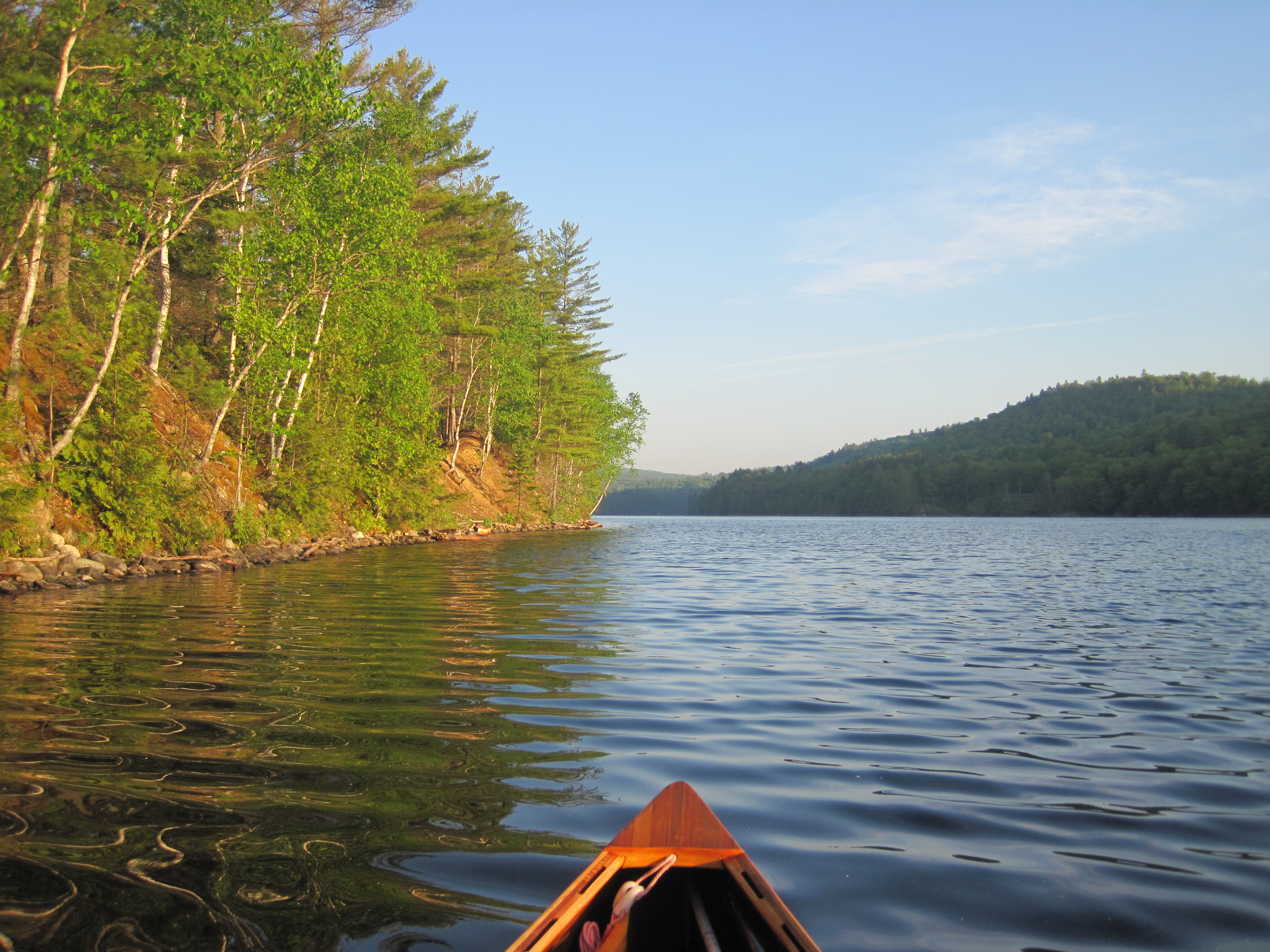
Idyllic early morning paddling on Wyman Lake
|
|
I loaded up, the pack now heavier than it had been recently. The first leg of the carry to East Carry pond was 3.3 miles. I expected this to take up to an hour and a half, not least because it was substantially uphill. I started up the trail, turned right on to the road, and, at about the right distance based on my speed of progress, I encountered some pink flagging on the left in a recess into the woods. The instructions were to turn left on to a ‘worn tote road’. I looked into the woods and could see something of a clear trail extending away to the west, so, lured by the same coloured flagging as at the take-out, I set off along this trail.
|
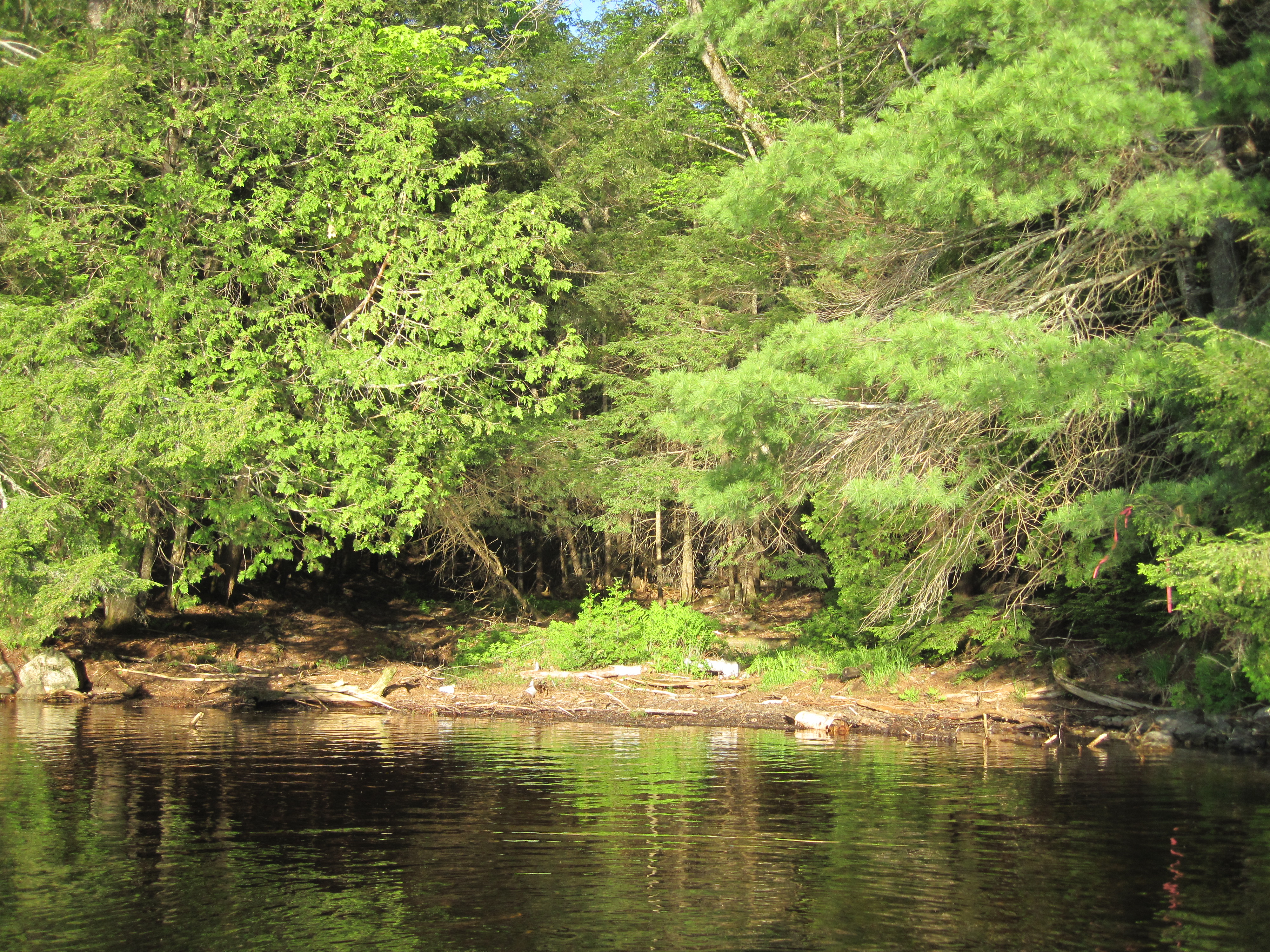
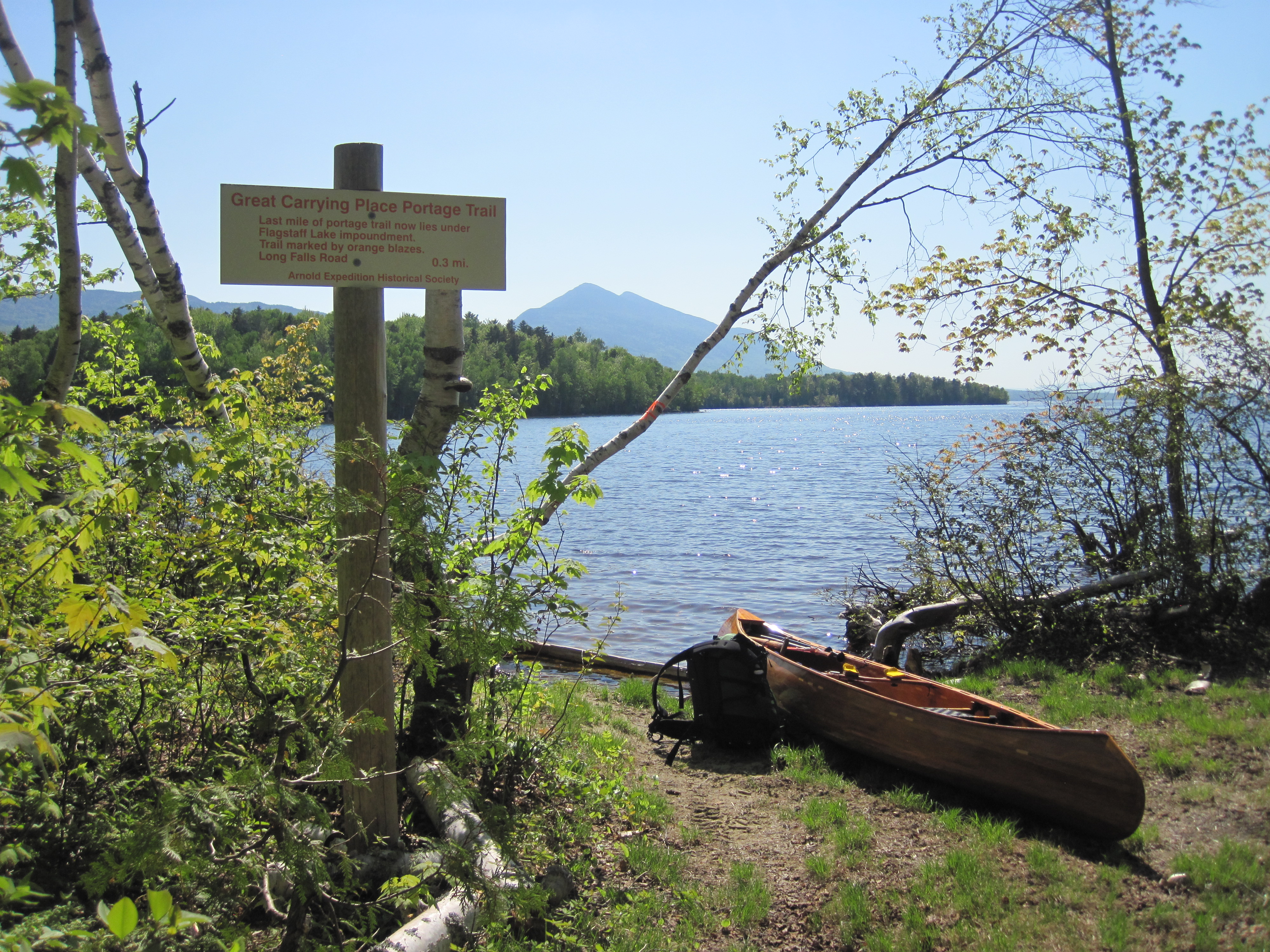
Take-out for the Great Carrying Place
|
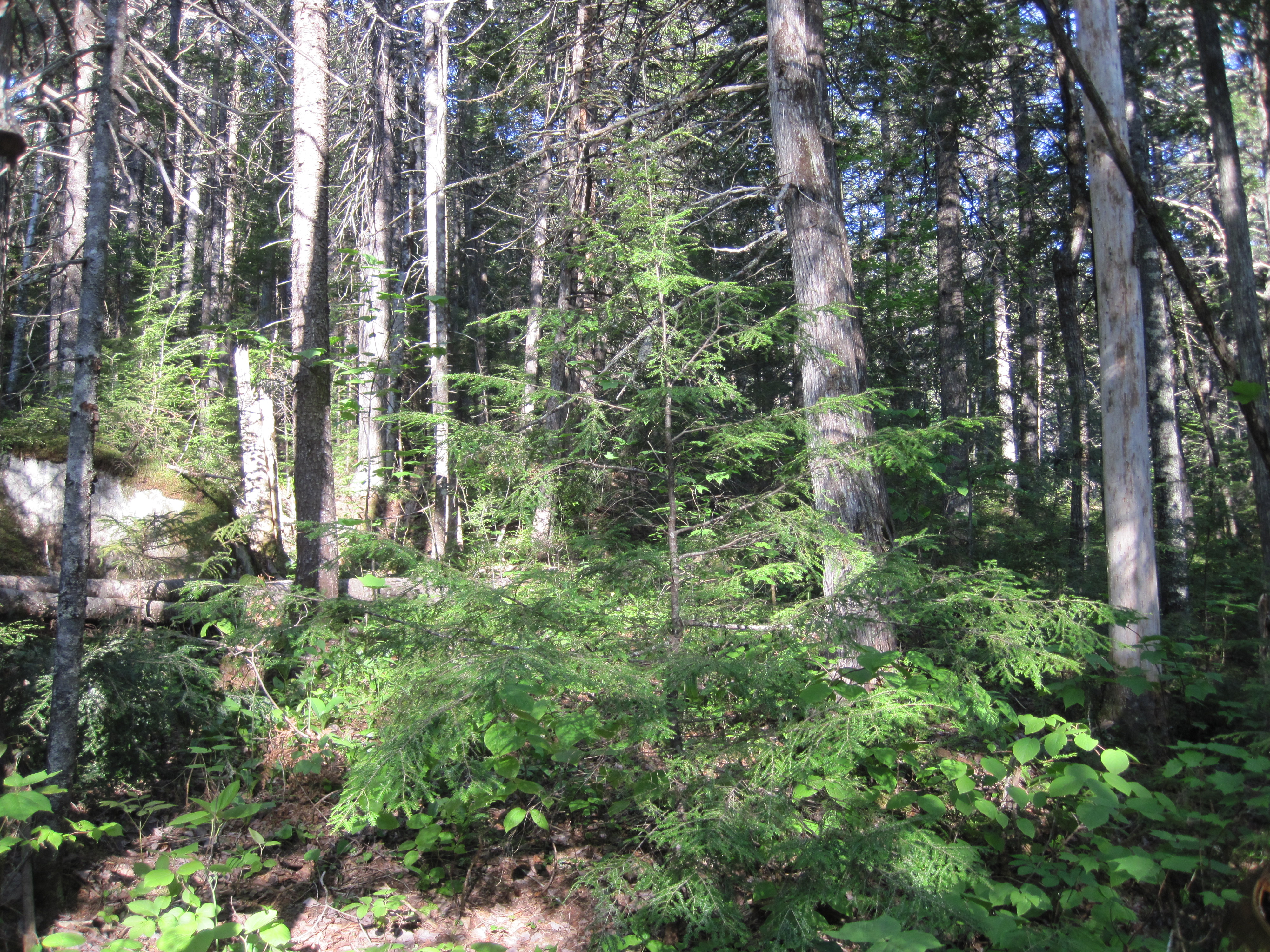
The ‘worn tote road’?
|
|
This trail became ever less distinct. The brain is enormously adept at seeing patterns, even where none exists. Maybe I was identifying a clear path even though there was none. The trail also became steep as I climbed out the south side of the Stony Brook valley, a tributary of the Carrying Place Stream. I knew that Arnold's men had grumbled at the amount of ascent, and was beginning to empathise. Eventually, even my brain recognised that I was not on any kind of recognisable trail. The young growth crowded in on me, leaving insufficient room to push the canoe through. Piles of rocks swallowed my shins as my feet descended into abysses. This was turning into another instance of my Mud Pond Carry debacle (see NFCT Through-Paddle, 2018, Day 5). I could not believe that I had been so stupid as to push this far before thinking about turning back. Now the route to retrace my steps was as uninviting as continuing forwards.
|
Tough going
|
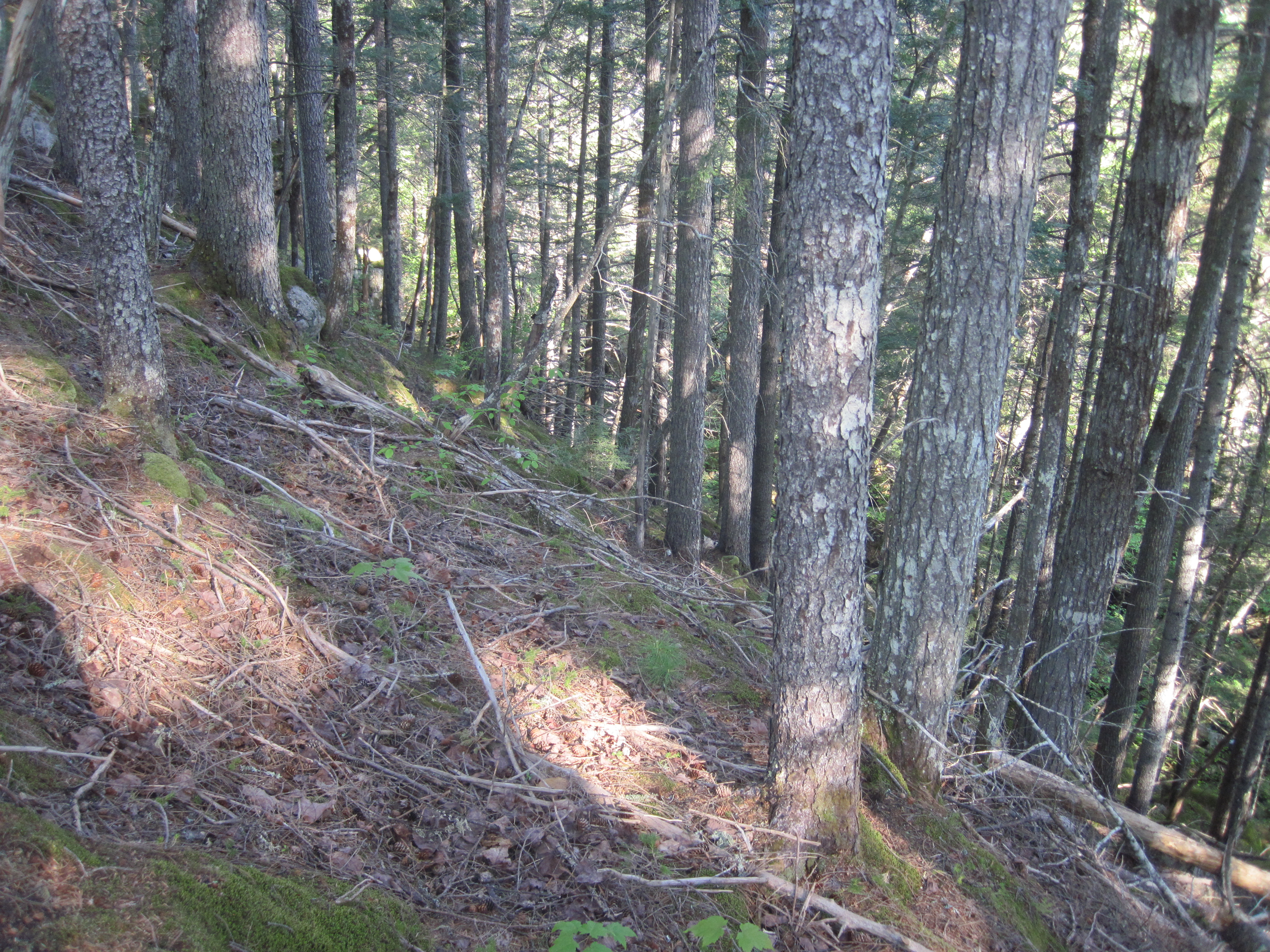
Tougher going
|
|
In a rational moment I got out my phone and fired up Gaia GPS. I had laid down a route along the approximate trail, and the satellite locator could tell me where I was relative to that route. It was a shock to see that I was about a quarter of a mile south of the trail and on totally the wrong side of Stony Brook. I should have proceeded farther along the road before turning off. Looking back at the waypoint I dropped when leaving the road, I had climbed over 200 feet in less than a quarter of a mile. I toyed with the idea of aiming around the head of the Stony Brook valley, but that would be an even longer bushwhack. My chosen solution was to head north, as closely as possible. This was the shortest route to the trail. Once more I rammed the canoe between trees. Sometimes, when there was sufficient soft vegetation, I set the canoe down and dragged it between trees, anything to be able to make progress. Here and there I found clear paths, maybe the remnants of old skidder trails, and if they led to the north or northwest I followed them until they petered out. But my northerly course was leading me into the valley, and this valley turned out to be more of a ravine.
|
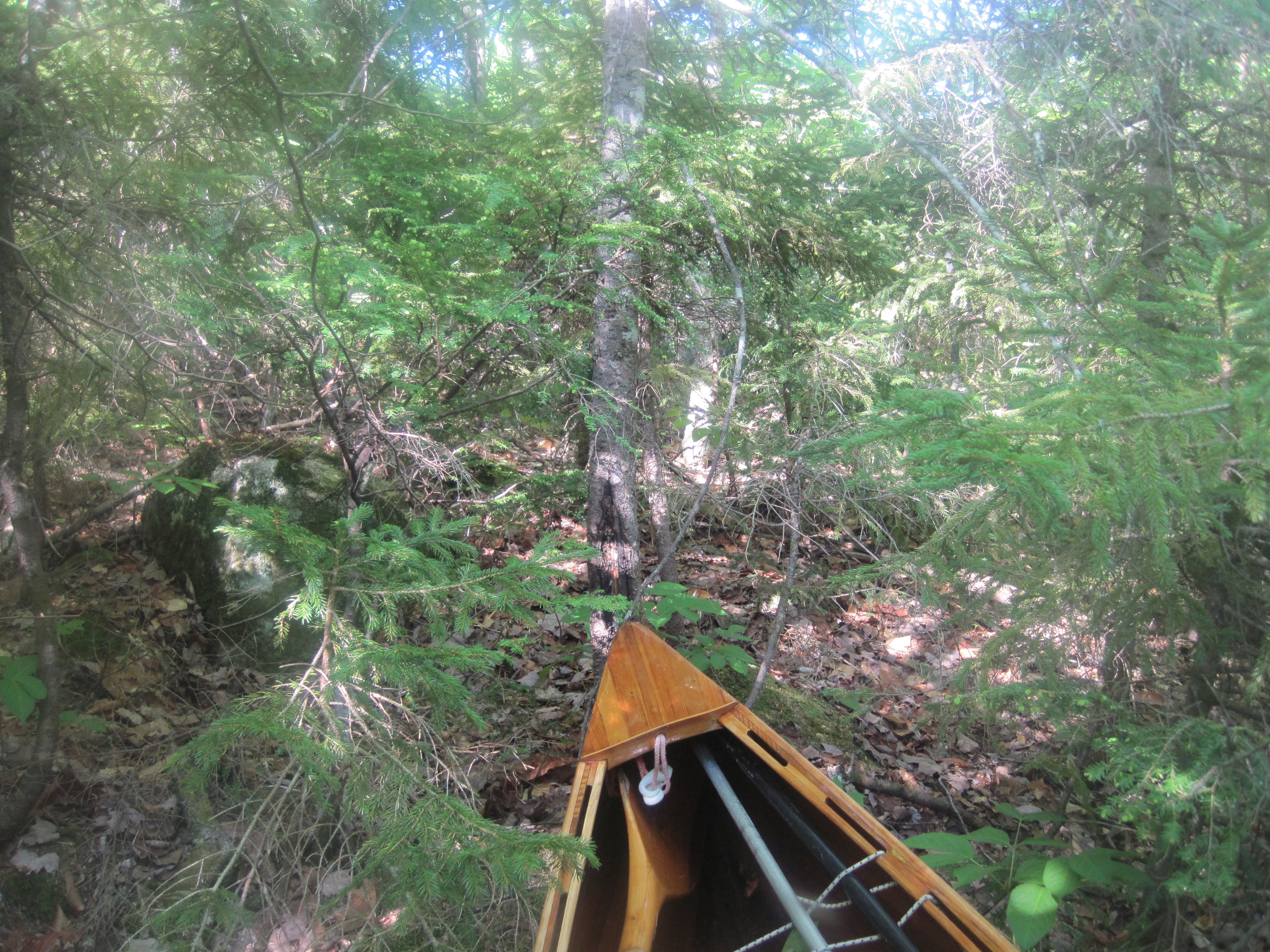
This is getting ridiculous.
|
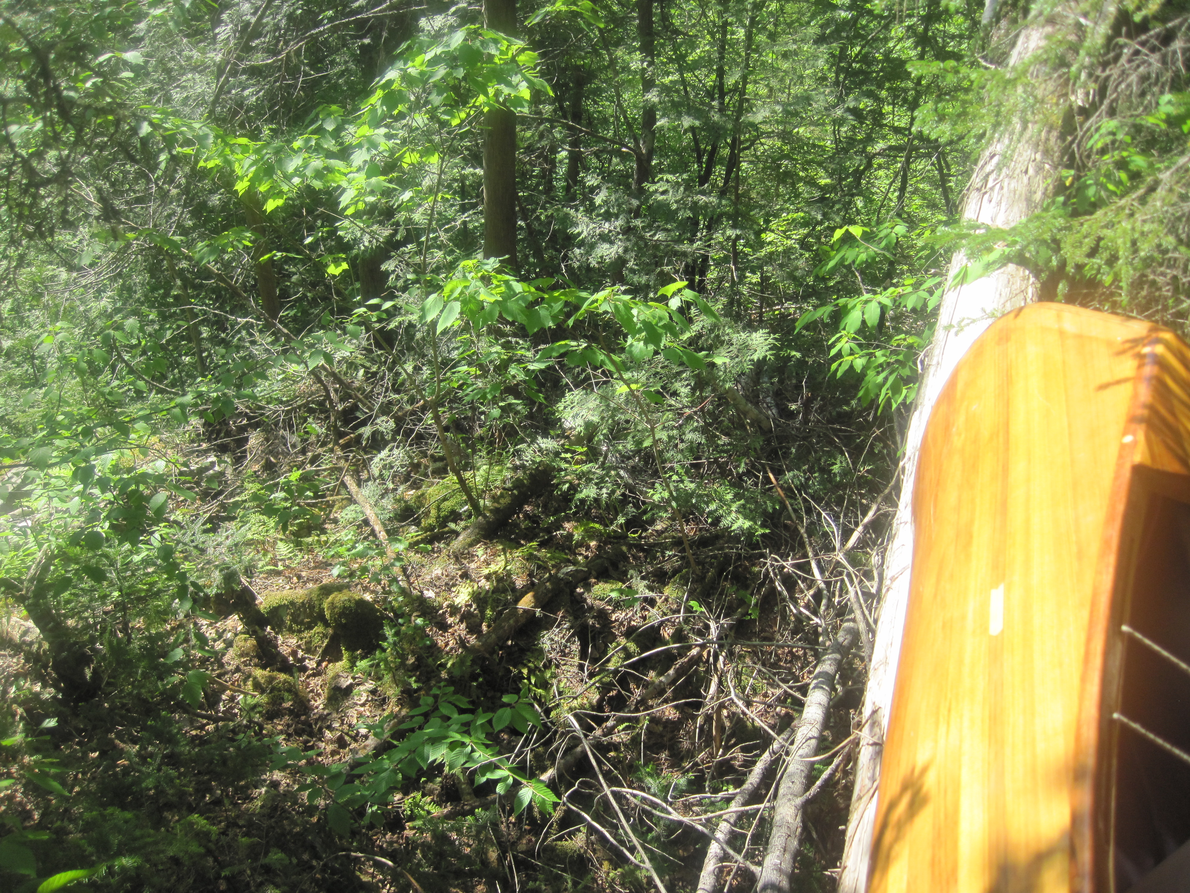
You cannot be serious!
|
|
The walls were rocky, not vertical, but not far from it. At this point there was no realistic way back, so into the ravine I descended, lowering the canoe gently until it came to rest on something solid, and then climbing down after it, all with a 40 lb pack on my back. After a few such manoeuvres I was in the bottom of the valley, splashing across Stony Brook. Now I faced a similar wall, this time an ascent. I shoved the canoe upward, using vegetation as much as possible to cushion it, until I could rest the stern on something solid. Leaving it balanced there I now climbed up to where I could repeat the process. At each lift, my legs were hoisting my body weight plus pack. It was like doing single-leg squats with a backpack. Long before I was out of the valley, my legs were approaching muscle failure. It took substantial rests to disperse the lactic acid before I could move on again.
Little by little, though, I gained the more level ground at the top. Here I found more old skidder trails and followed these northwest. This, together with more bushwhacking through young growth, suddenly brought me to where I could see an opening. Closer inspection revealed that it was a road, so I made my way there, emerging just south of where the trail crosses that road. From where I had dropped my waypoint when hopelessly lost, I had travelled about a mile to the northwest, mostly on steep, rugged, densely vegetated terrain, and involving a certain amount of rock-climbing. The new activity that I had discovered – canoe rock-climbing – is not one that I recommend. My legs were dead. The distance I should have travelled from the previous road was 0.8 mile, maybe 20 minutes uphill. Instead, this had taken me 2.5 hours of extremely hard work. Now I faced the remainder of the Great Carry.
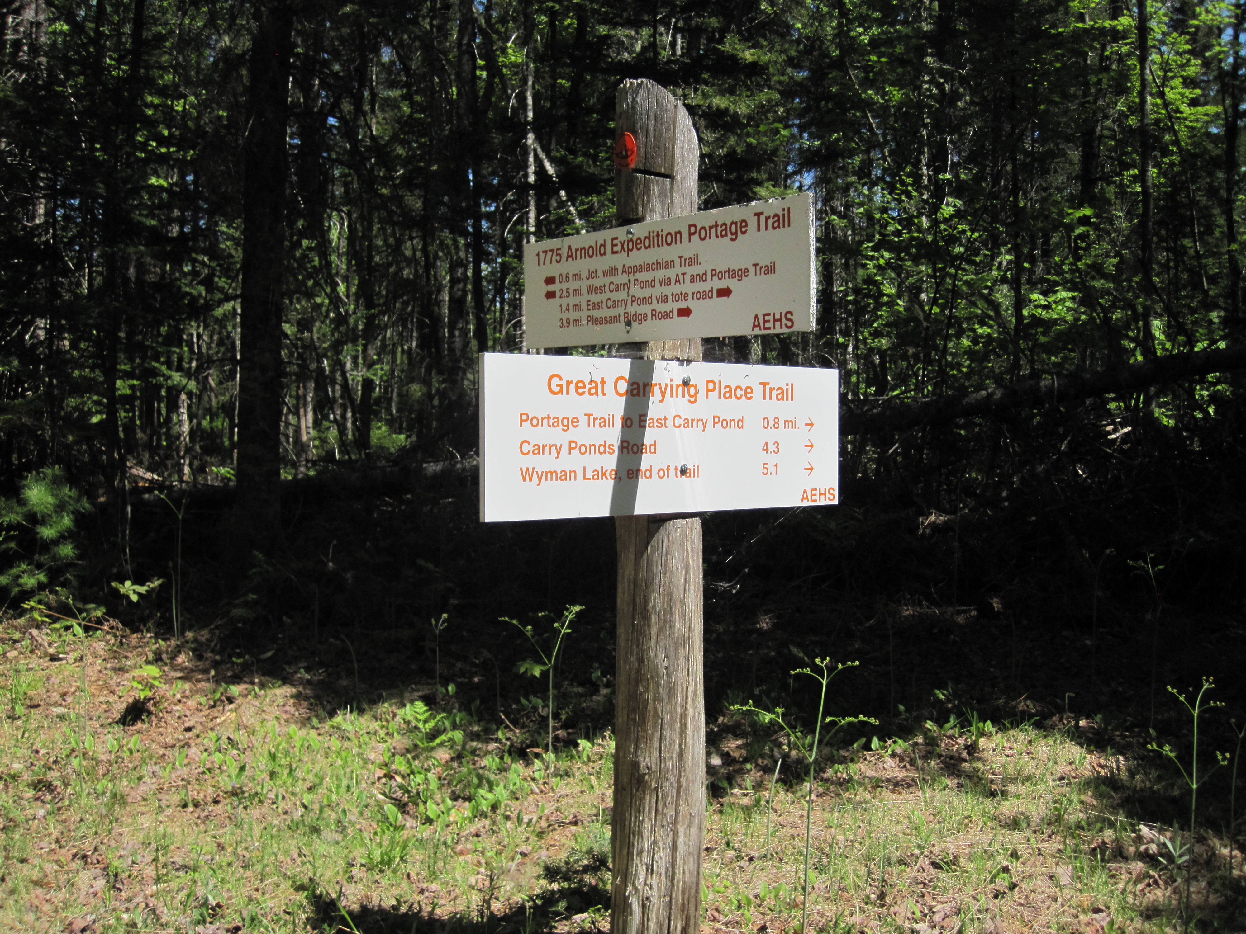
After a drink and a snack, I set out, now guided by the very obvious signposts. My legs trudged uselessly below me, offering little control. I had to make exaggerated movements to avoid roots and rocks, lest my feet merely collide with them, tripping me up. The remaining 1.7 miles to East Carry Pond took nearly an hour. When I arrived I was exhausted, hot, sticky, dehydrated, generally fried. The day was now hot, and I had wasted about 2 hours by getting lost. At East Carry Pond the trail crosses some private land at some cabins. Looking around for someone to ask permission, I saw someone working, so walked up to him and hailed him. Believing he was alone, his reaction was spectacular, complete shock as he jumped round. For permission he suggested I contact the owner who lived somewhere remote. This being unrealistic, I suggested I might merely cross to the pond and disappear with no trace. He agreed, and was kind enough to refill my water bottle.
|
Relief at East Carry Pond
|
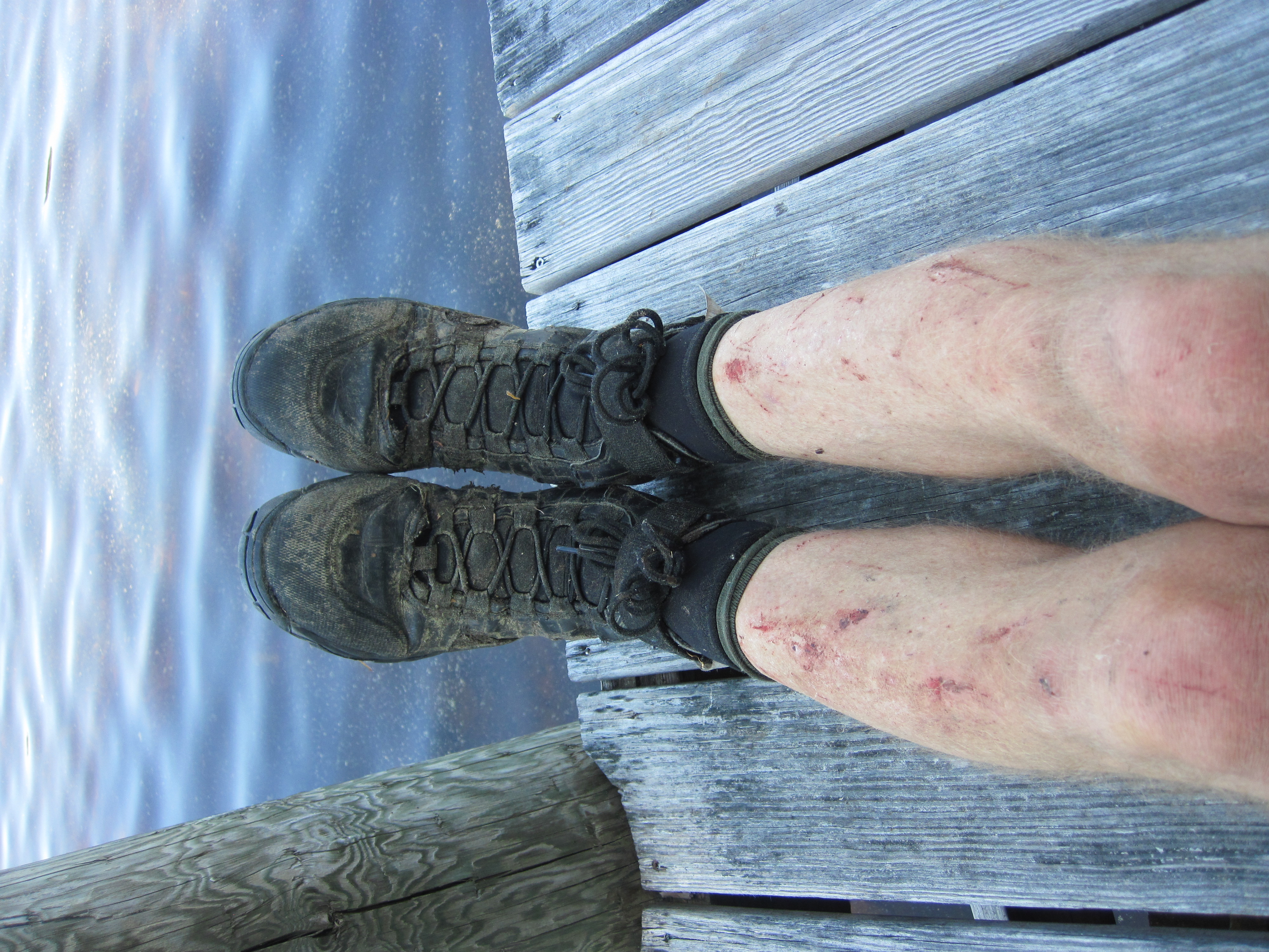
Collateral damage
|
|
For a while I sat on the dock in the shade, drinking water and snacking for calories. This was only delaying the inevitable, so I soon departed, crossing over the narrow southern arm to a tall spruce tree marked with some orange flagging, as I had been advised. Confident that all the markers were aligning, I took out. Paddling had been awkward: my thighs were cramping at the slightest hint of a bend of the knee. I couldn't kneel, but rather had to sit with my legs out straight in front of me, not the most efficient position for paddling. Now I faced a 0.8-mile carry to Middle Carry Pond. My legs resented being asked to walk again, but there really was no option. I returned to stumbling along an uneven trail, my T-shirt and long-sleeved shirt soaked with sweat. I had been swarmed by mosquitoes for much of the day, hence the long sleeves, as well as a liberal coating of repellent, which I usually avoid. Strangely, in the throes of the bushwhack, my mind had been so focussed that I had barely noticed the bugs. The trail brought me to the White & Nichols Cabin, owned by the Arnold Expedition Historical Society. If prearranged, I could have stayed here, but my intention had always been to cross to Flagstaff Lake in one day.
|
More comprehensive than pink flagging tape
|
Middle Carry Pond
|
|
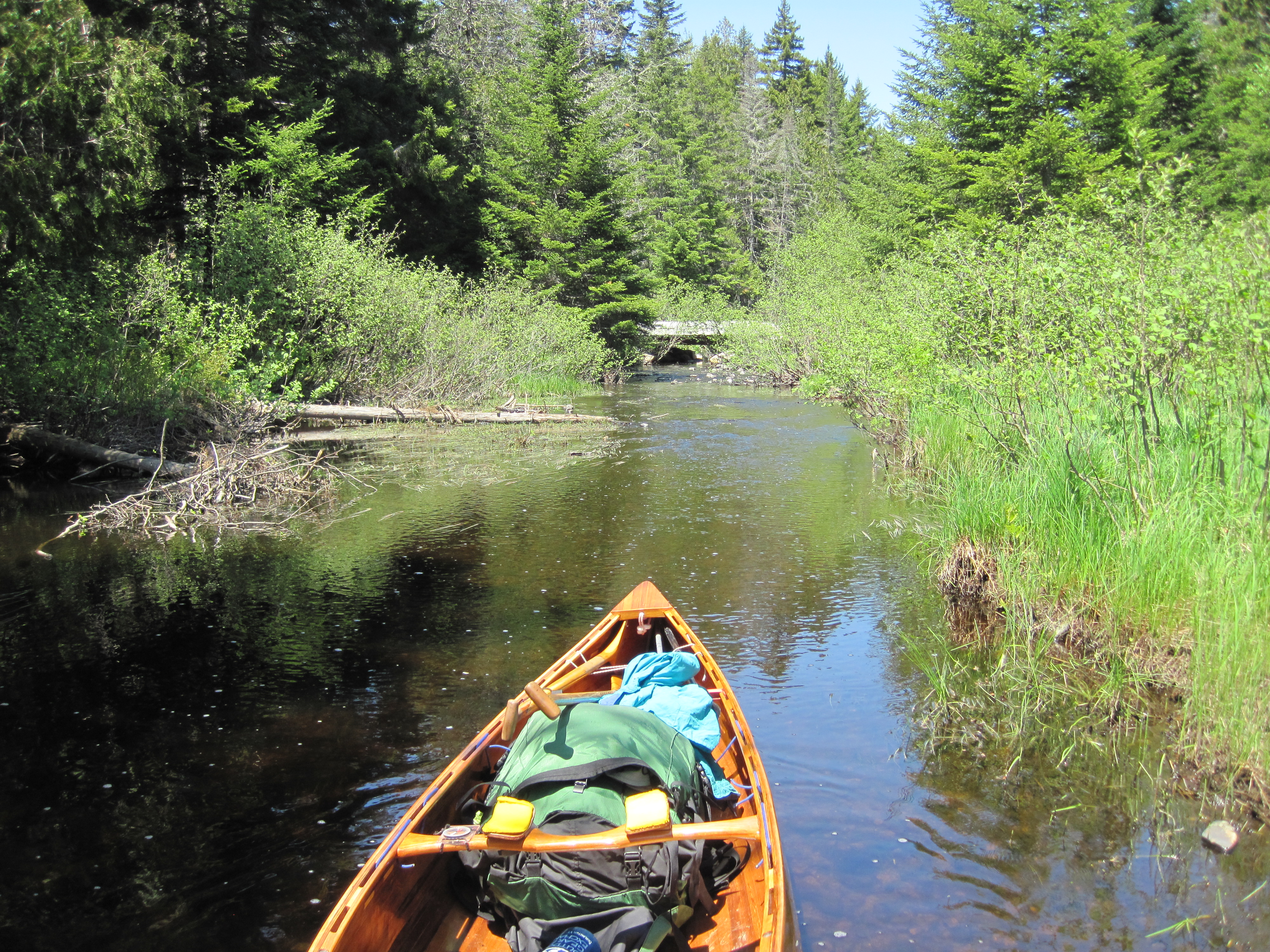
I launched into Middle Carry Pond, another delightful body of water, still paddling with straight legs. Here I crossed to the west for about half a mile and then proceeded up the lovely but misnamed Sandy Stream inlet for at least another half mile. With the bridge in sight I ran out of water, so started to carry mid-stream. At the bridge I joined the Appalachian Trail, and followed this southwest and west for 1.8 miles. The trail was clearly marked, although quite uneven under foot. Just occasionally my legs began to swing a little more, rather than just trudge.
|
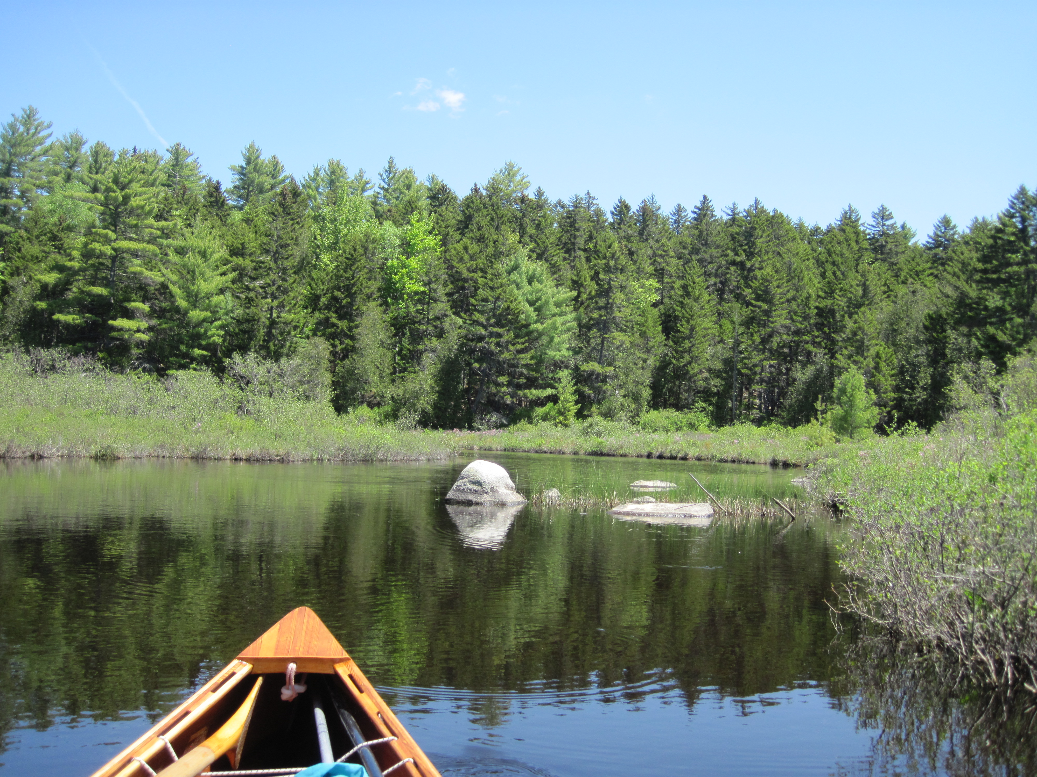
Ascending Sandy Stream from Middle Carry Pond
|
Sandy Stream approaching the Appalachian Trail
|
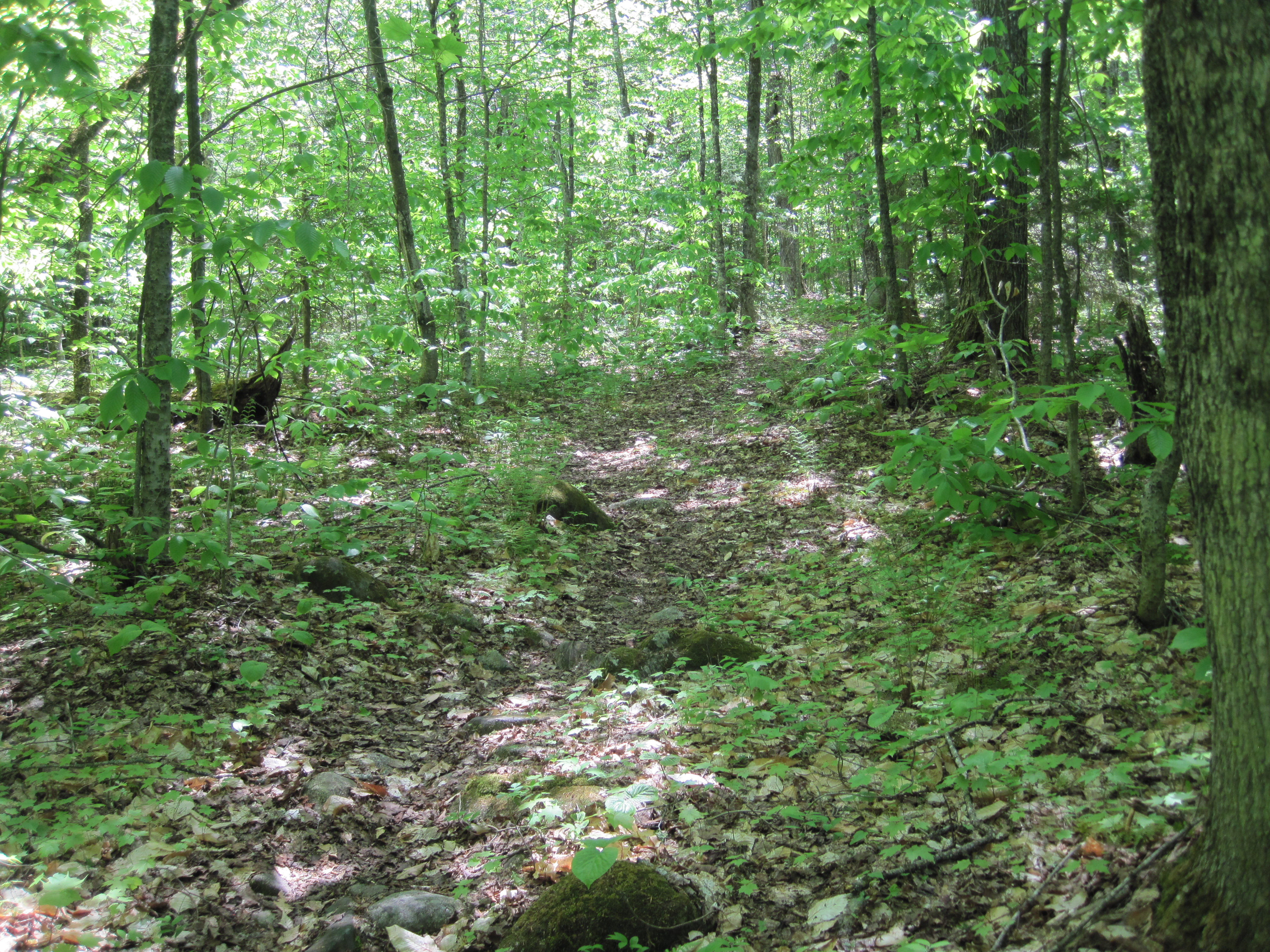
On the Appalachian Trail
|
Inviting waters of West Carry Pond
|
|
Diverging from the AT for the last few yards, I now met West Carry Pond. Here the water looked so inviting that I stripped off my shorts, but still wearing underwear, shirts and socks and boots, walked into the water, sat down and submerged myself. The temperature of the water didn't invite lingering, but the refreshment was very welcome indeed. It also washed away some of the sweat. I then filtered some water in order to drink another litre and top up my bottle. (No, this was not the logical sequence of activities!) West Carry Pond is another delightful expanse, and was calm as I set out to the western shore, 1.3 miles away. Still the sun shone brightly in a cloudless sky, and the temperature was in the high 80s (F). At the far side, the trail crosses what is now private property. The only way to ask permission would be to enter the private property to reach the door of the house. As the road was only about 6 feet from the edge of the pond through a couple of small alders, I simply pushed through here to start the last leg of the Great Carry, 2.3 miles to Flagstaff Lake, all on road. After an initial climb away from the pond, which brought me to a young couple who also refilled my water bottle, this part of the trail was mercifully mostly flat or even slightly downhill. My legs at last began to swing with some reliability, and my pace correspondingly increased. But this was something of an illusion. The slightest rise which required work revealed that my legs were shot.
At Long Falls Dam Road I turned right for a little way, and then signs pointed me down a trail which led to the eastern extremity of Flagstaff Lake. Here Arnold and his men had to portage a mile farther to reach the Dead River, but this has now all been flooded by the creation of Long Falls Dam in about 1950. There now remained 5.3 miles to reach Hurricane Island. Mercifully Flagstaff Lake was calm with minimal wind. As I paddled through the evening light I succeeded in occasionally bending one leg or the other, but frequently had to kick them straight to avert cramp. With such an inefficient paddling position, my progress was slower than expected, or maybe my state of exhaustion had something to do with this. The crossing of Flagstaff Lake seemed to take forever, nearly 2 hours.
|
Arrival at Flagstaff Lake
|
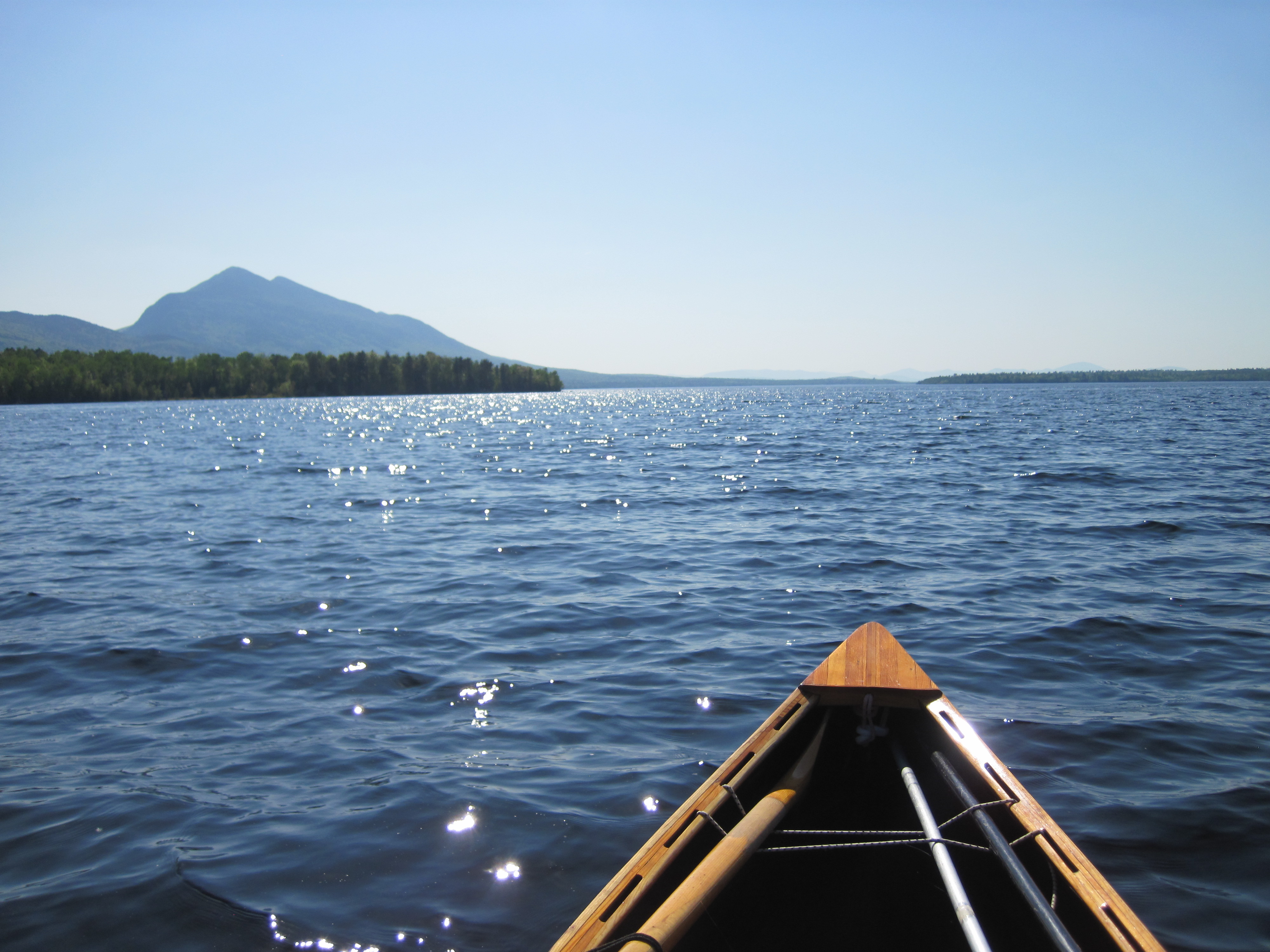
Heading west on Flagstaff Lake
|
|
As I closed on Hurricane Island, whereon lies a camp-site maintained by the Northern Forest Canoe Trail, I was disappointed to see another canoe already there. I need not have worried, though. Before I could ask Bobby if he minded if I shared his island, he was at the steps asking if I needed any help. Apparently on my approach he had reached the conclusion that this person had had a tough day – very perceptive. Having been assured that I was not intruding, and that there were two sites here anyway, I hauled out to the top of the steps and set up camp. After cooking dinner and brewing a drink of hot chocolate, I took these over to Bobby's site and we sat and chatted. He was indeed through-paddling the NFCT, having a wonderful time facing up to challenges. A little while into our conversation he suddenly seemed to recognise me; he had read my article on crossing Lake Champlain and had read some of my journal. He was happy to be able to share some of his experiences with someone who would understand them. As darkness fell we retreated to our respective abodes, and I turned in for one of my latest bedtimes yet.
|
|
|
Yesterday
|
Website design & Photography © Peter Macfarlane
|
Tomorrow
|
Top of page
|
|