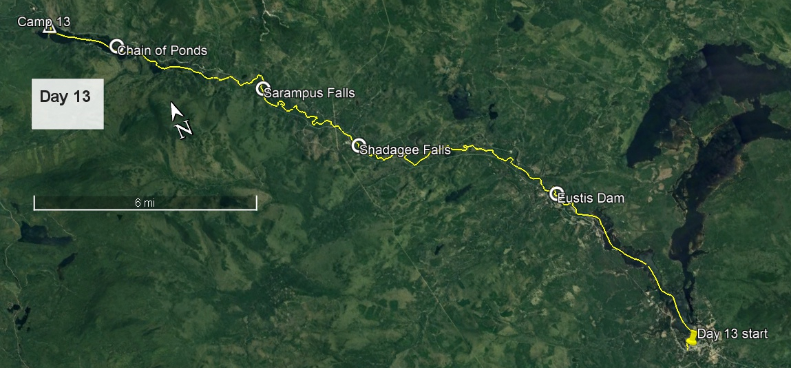
Day 13 route on Google Earth imagery
|
|
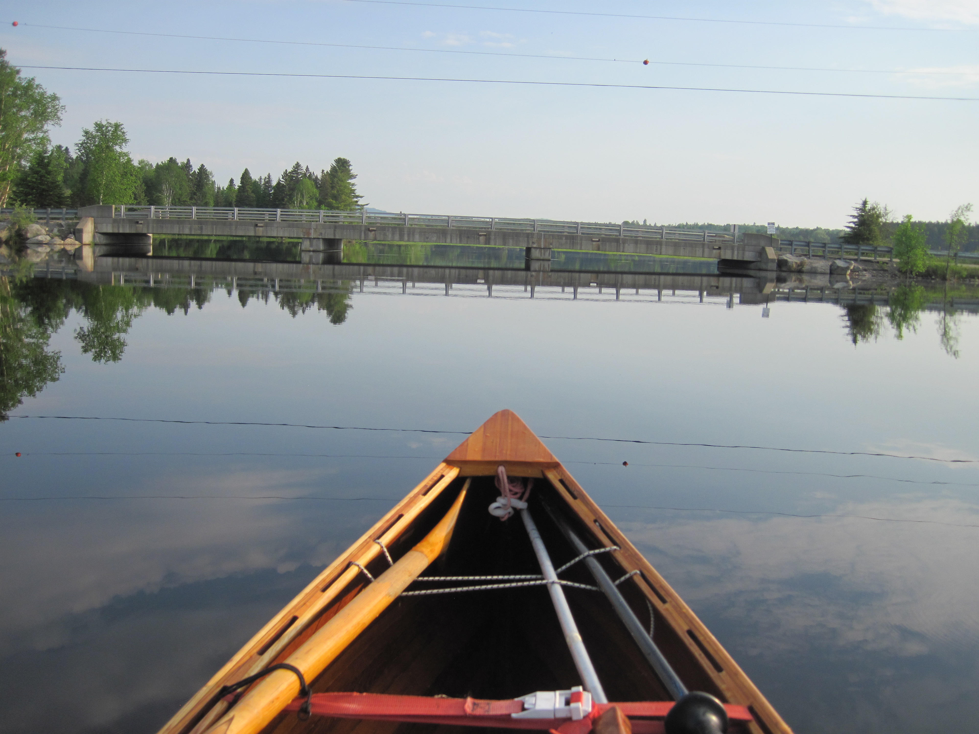
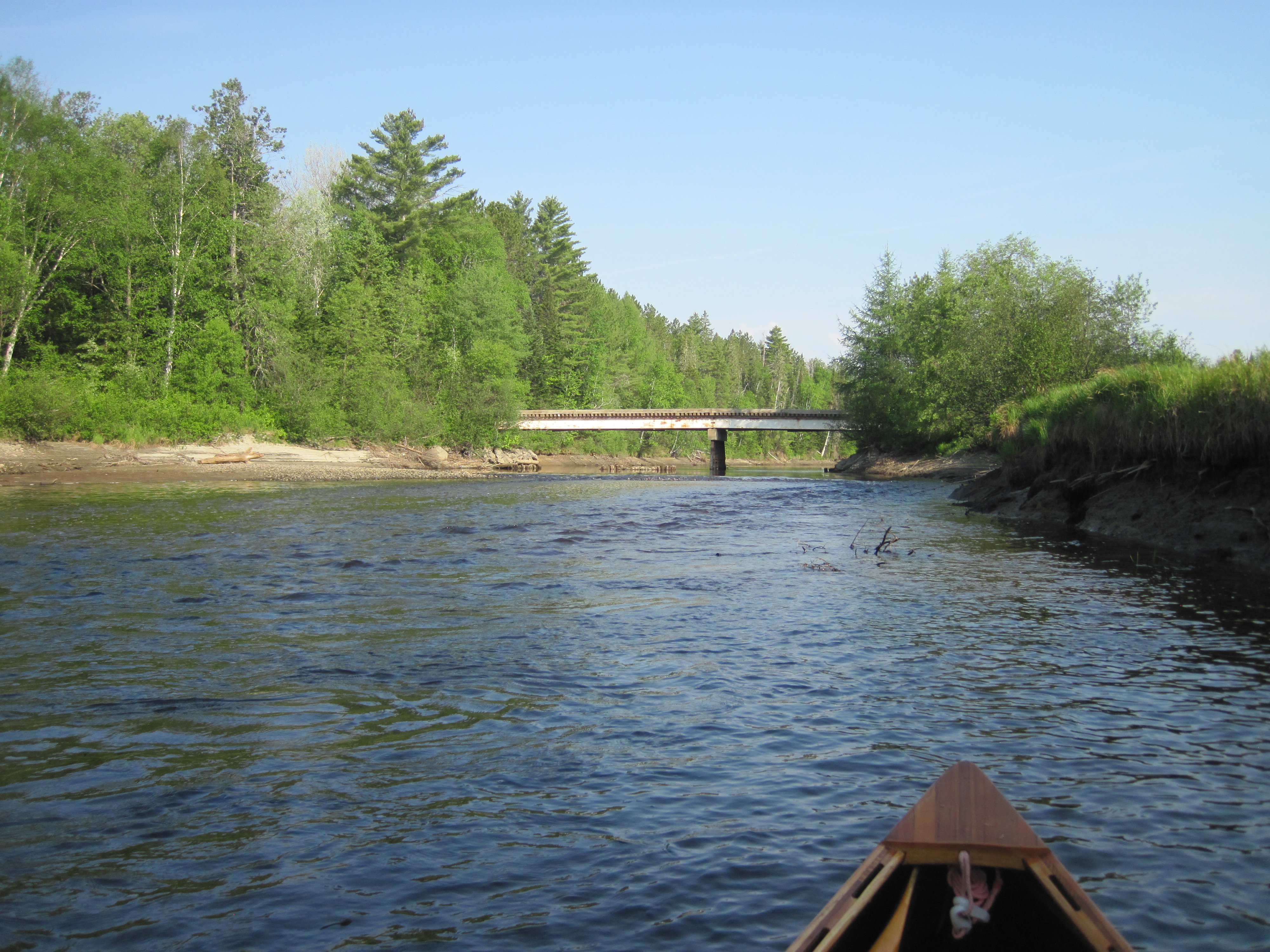
Even though my body resisted, I pried myself out of bed at 4:30 am, and set to use the microwave to boil water for tea. It initially frustrated my attempts, but, after much beeping, which seemed excessively loud at that time of the morning, I finally wrestled it into submission. Leaving the comfort of my room, I was soon at the dock, paddling away from Stratton by 5:45 am. Flagstaff Lake was calm and the early sun was promising another fine day. Yesterday's dragonfly had disappeared; I suspect the end was not a happy one.
|
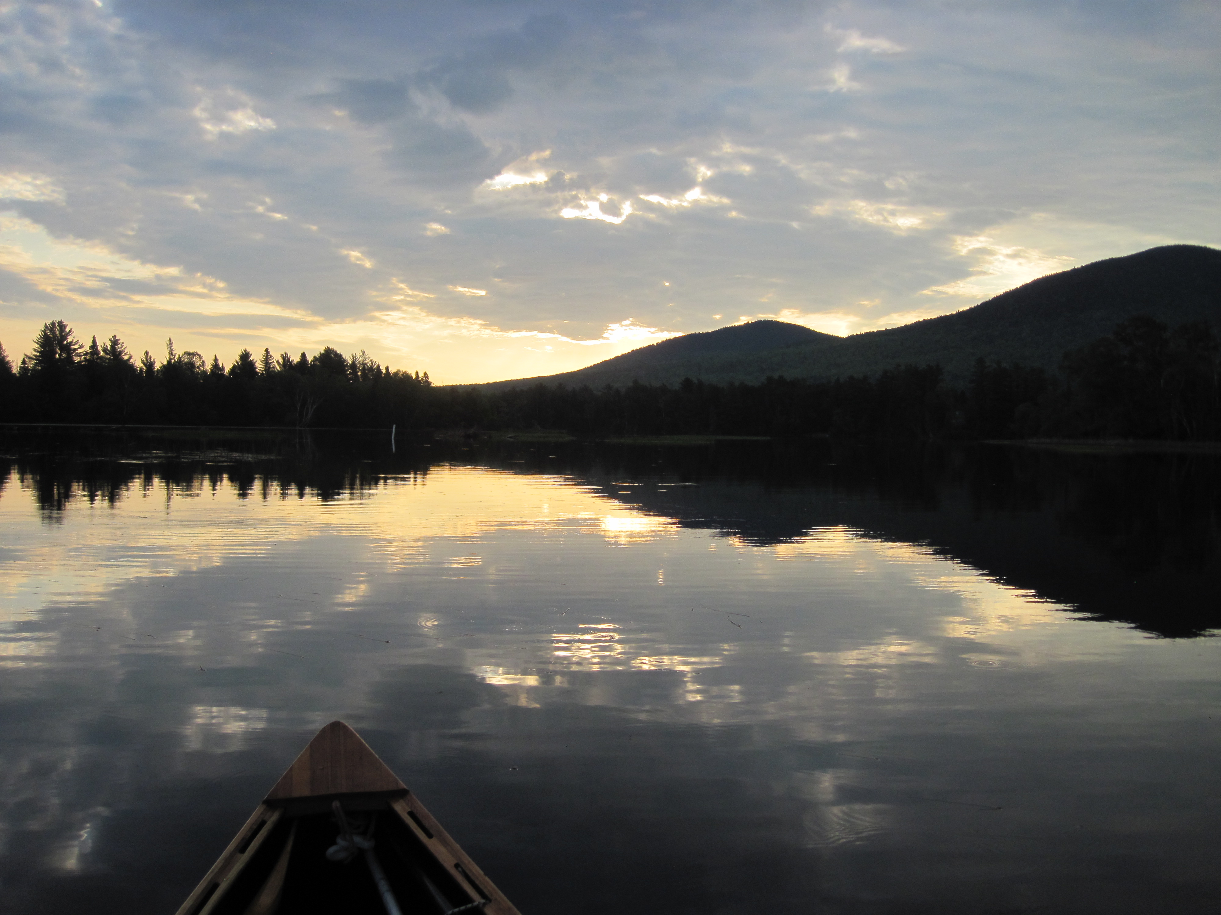
Sunrise on Flagstaff Lake ...
|
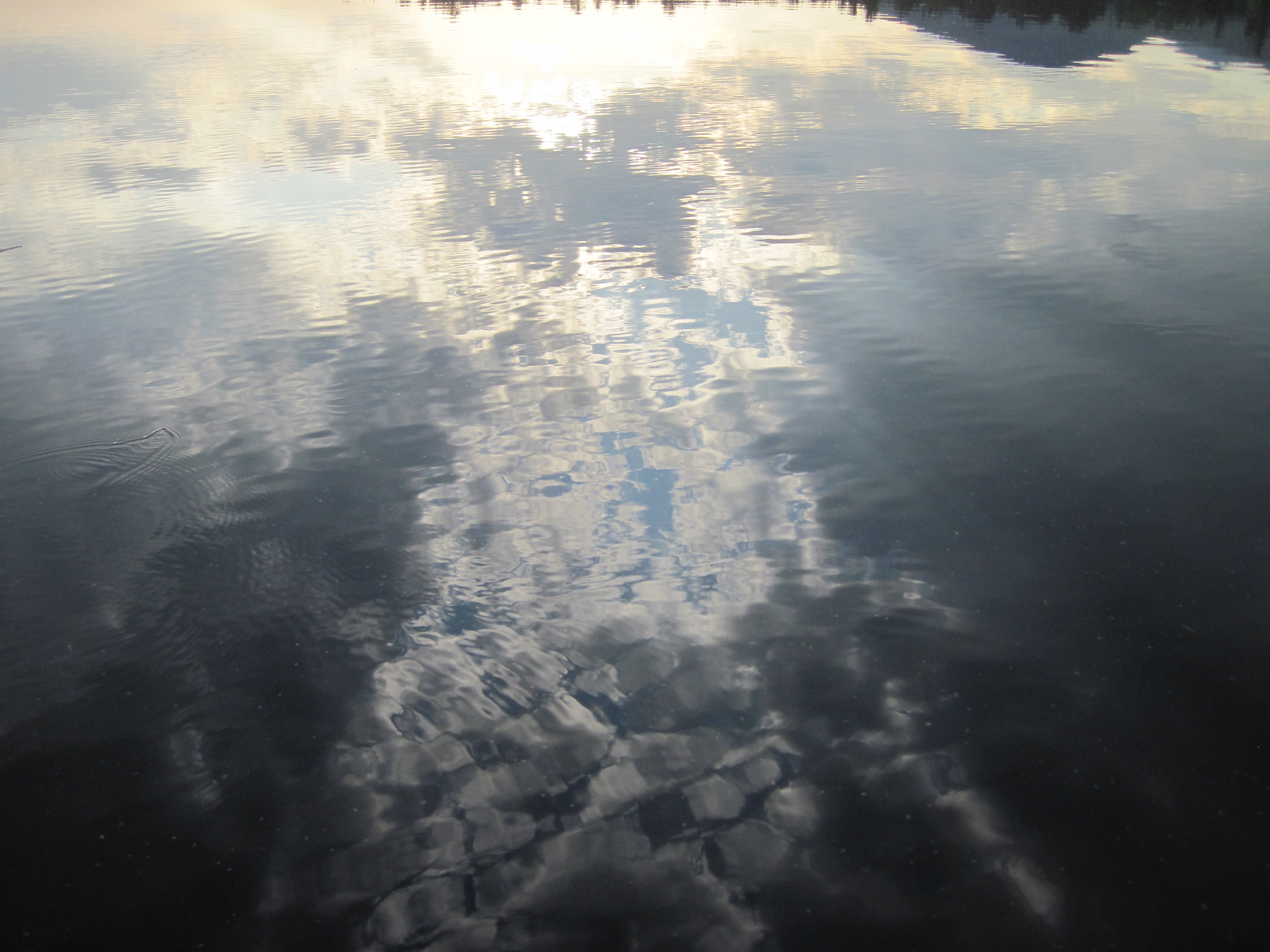
... leaving Stratton
|
|
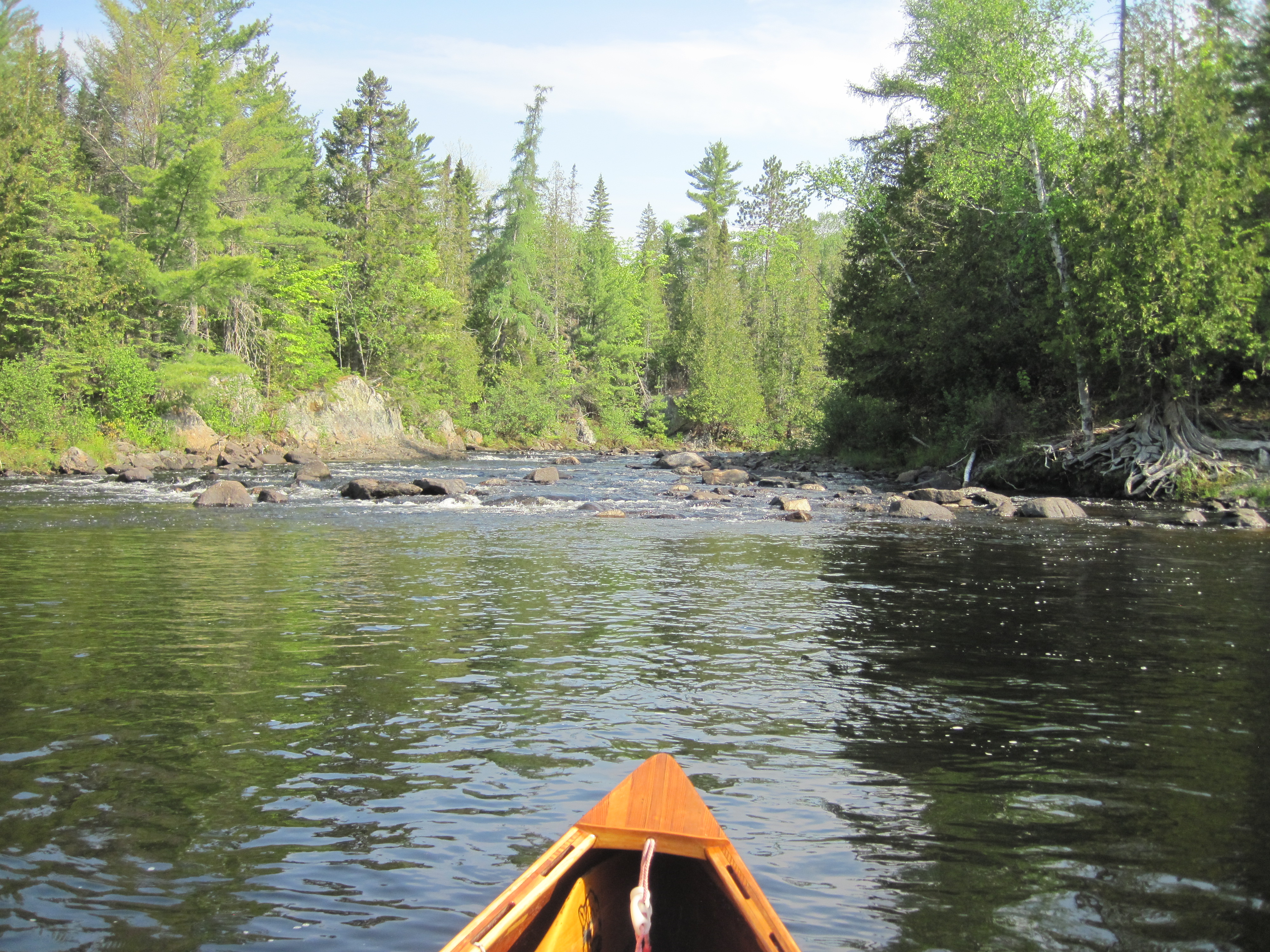
Heading north I found the entrance to the North Branch of the Dead River, and followed this around a few bends, the river gradually narrowing, and all illuminated by low-angle morning sun. The shoreline was dotted with cabins and camps. A low bridge, very low, required me to generate enough speed and then duck as low as I could. After about 2 hours Eustis Dam came into view. Its appearance did not inspire confidence; clearly it had seen better days.
|
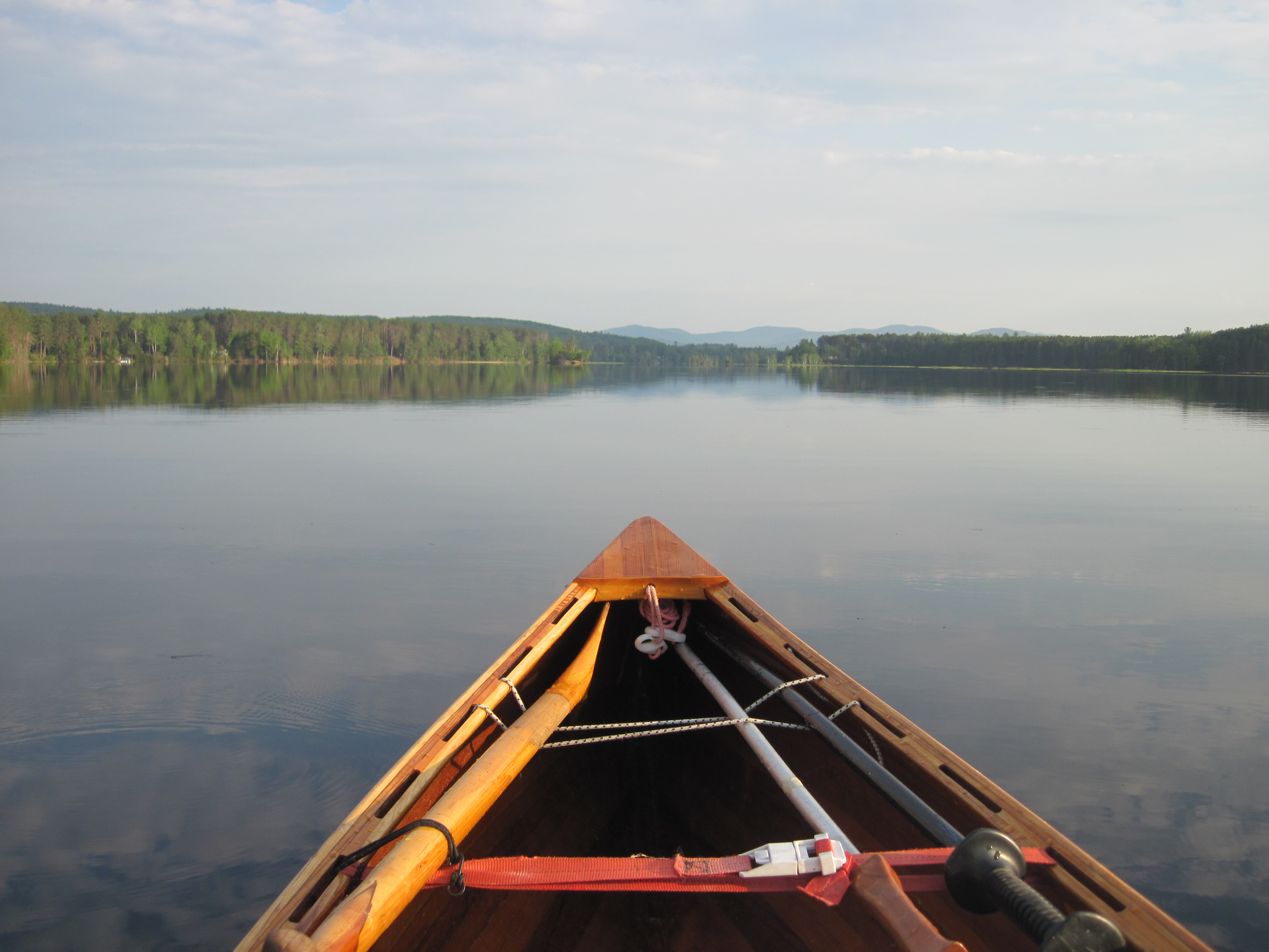
Approach to the North Branch Dead River
|
Minimal headroom
|
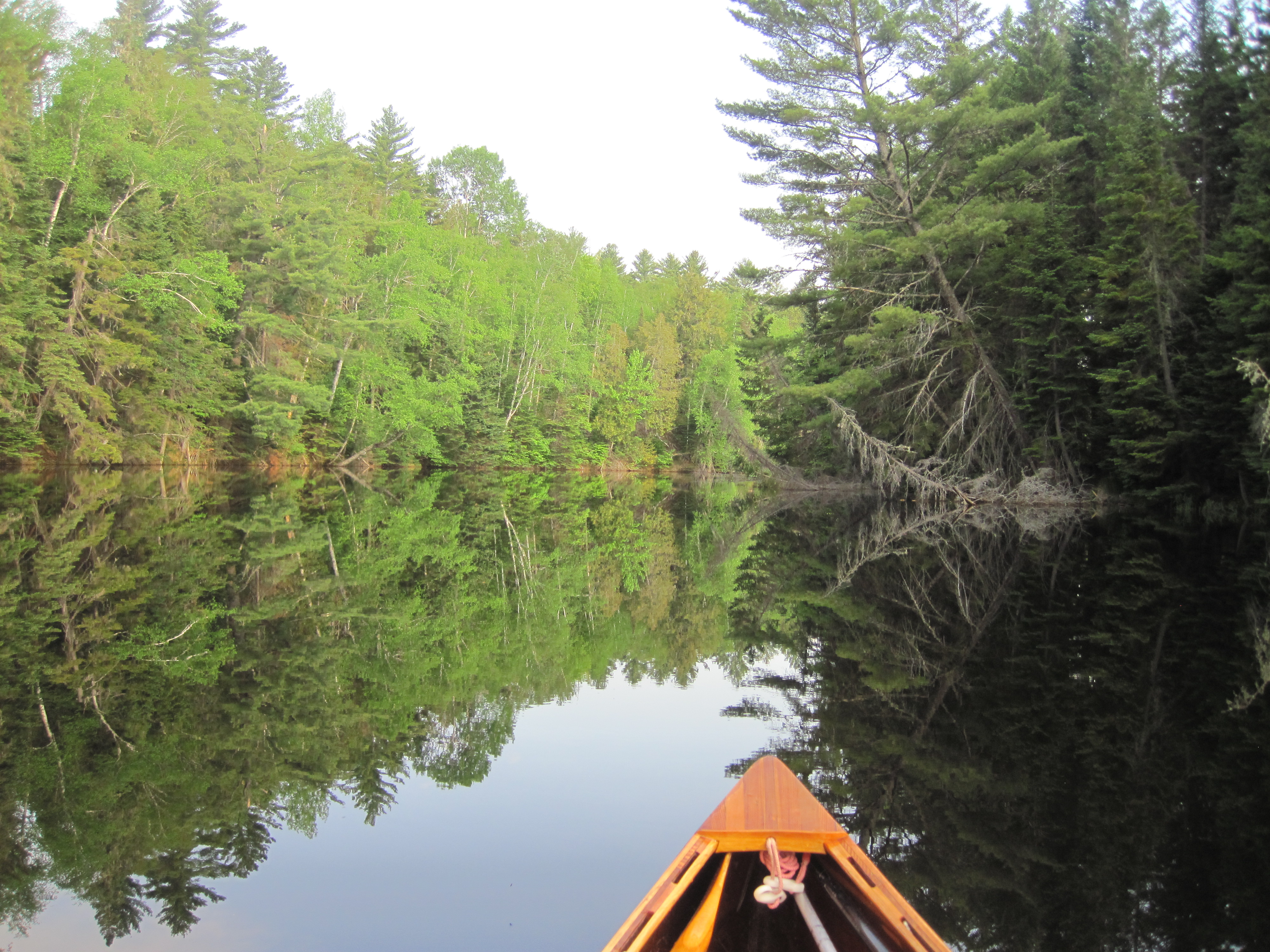
North Branch Dead River
|
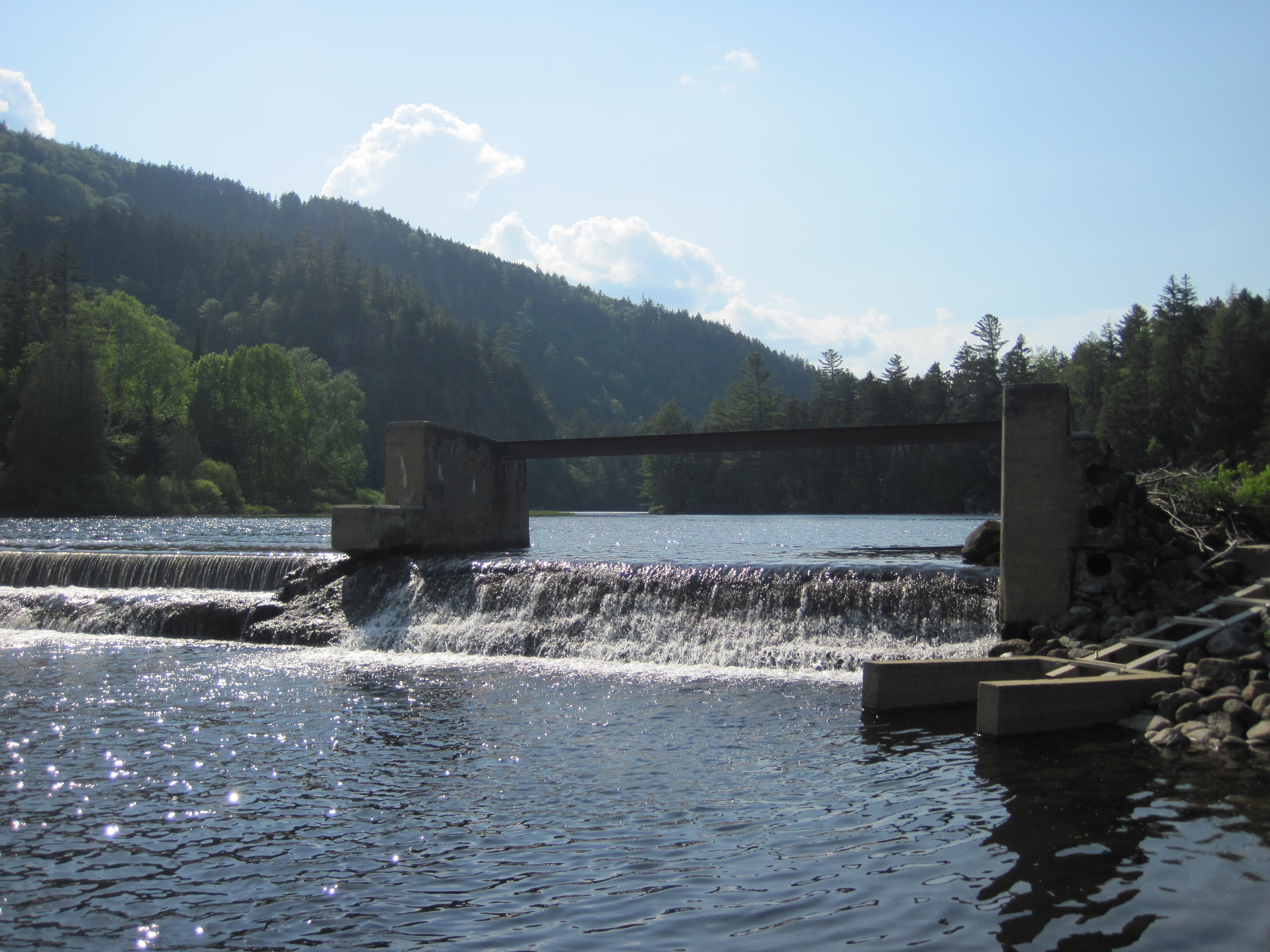
Eustis Dam
|
|
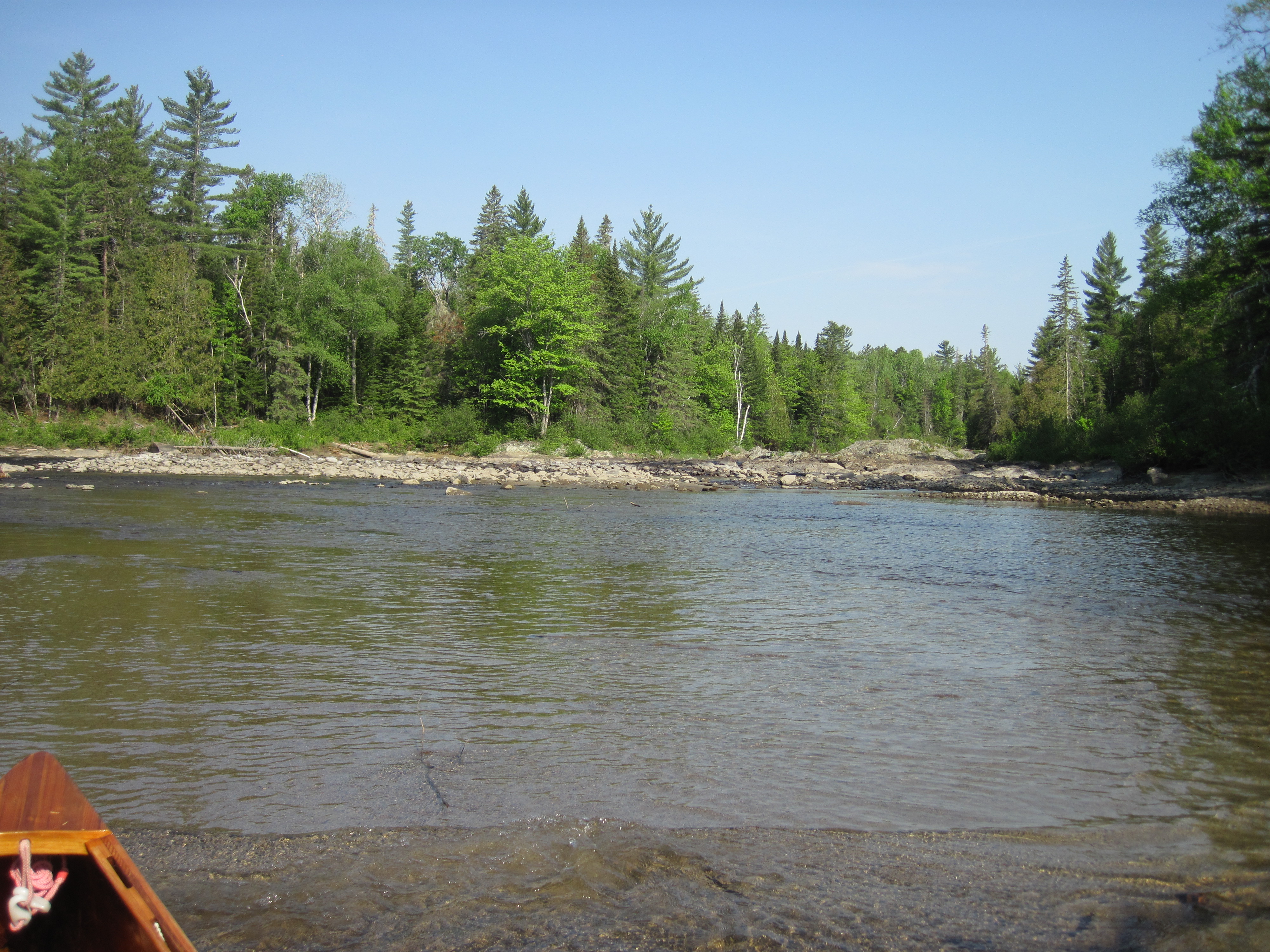
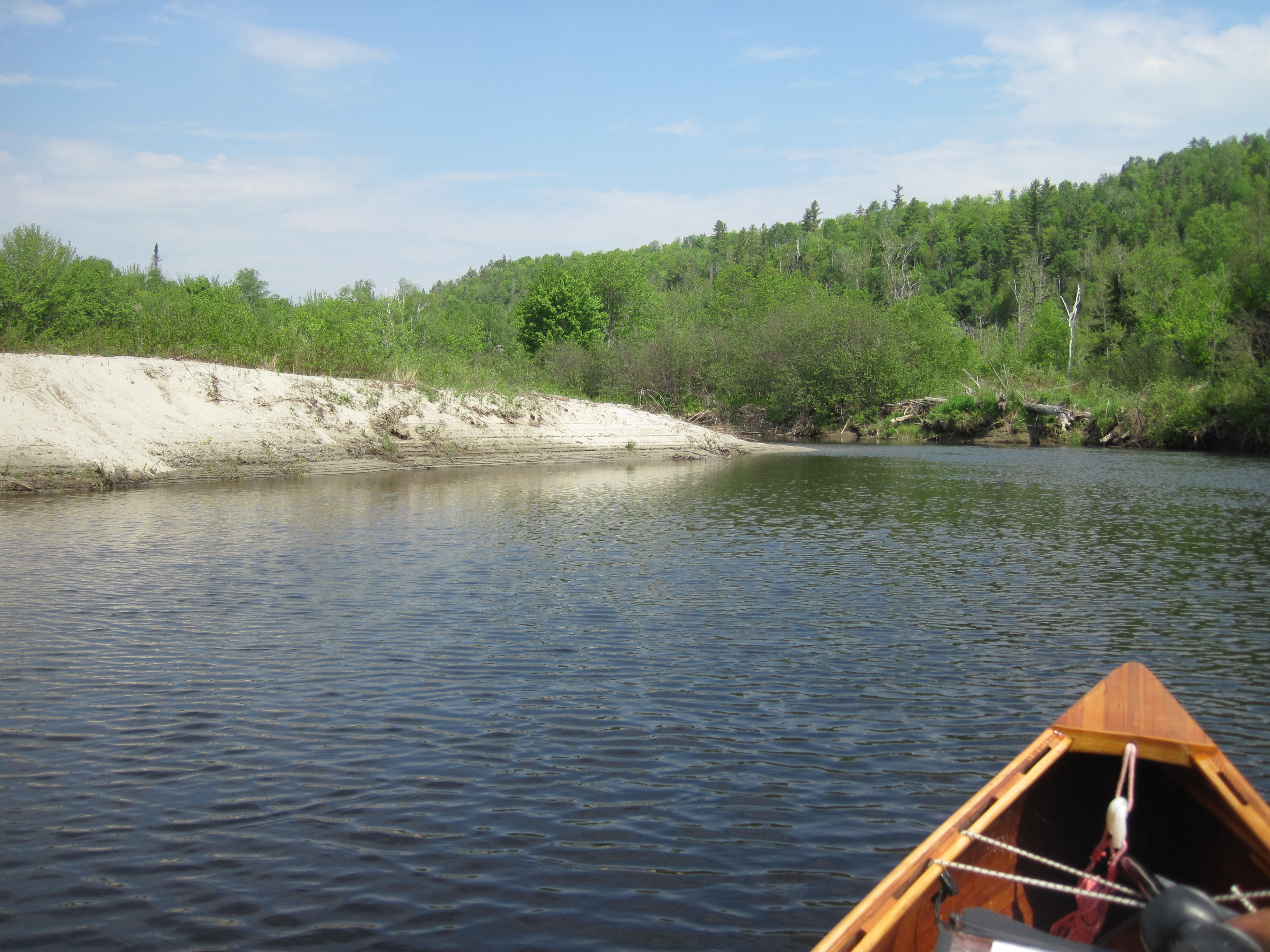
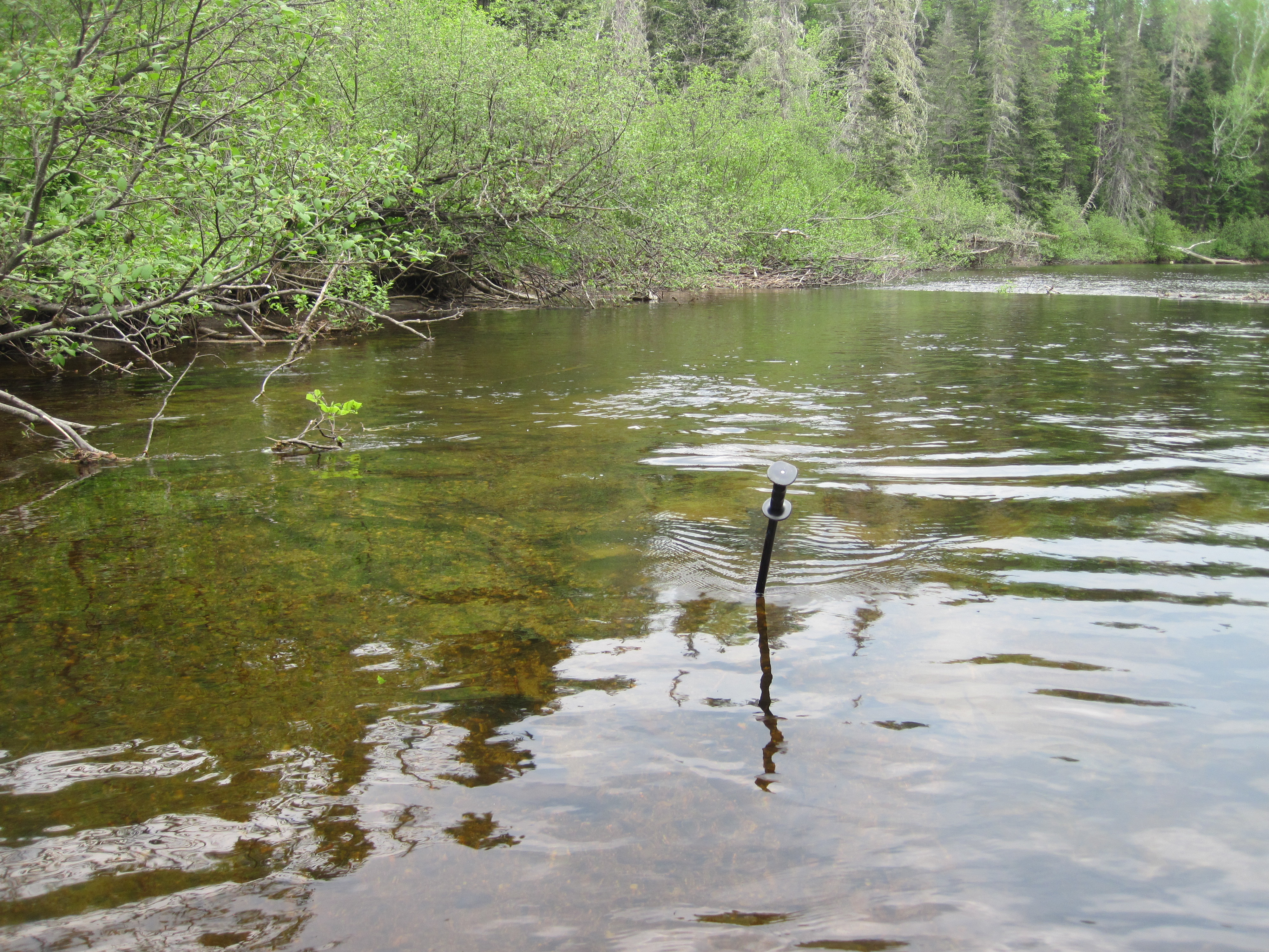
The short carry around the dam revealed what the rest of the day would entail. The water level was very low indeed; nearly 3 feet of bank was exposed that, judging by the erosion and lack of vegetation, is more usually immersed. Regardless, I pushed north. The insides of bends were heavily silted, forcing me to the deeper outsides where the opposing current was greater, not yet fast but certainly a hindrance. And then the rapids started.
|
Low water in the North Branch Dead River
|
Riffles beginning
|
More shallows
|
Even harder upstream travel
|
|
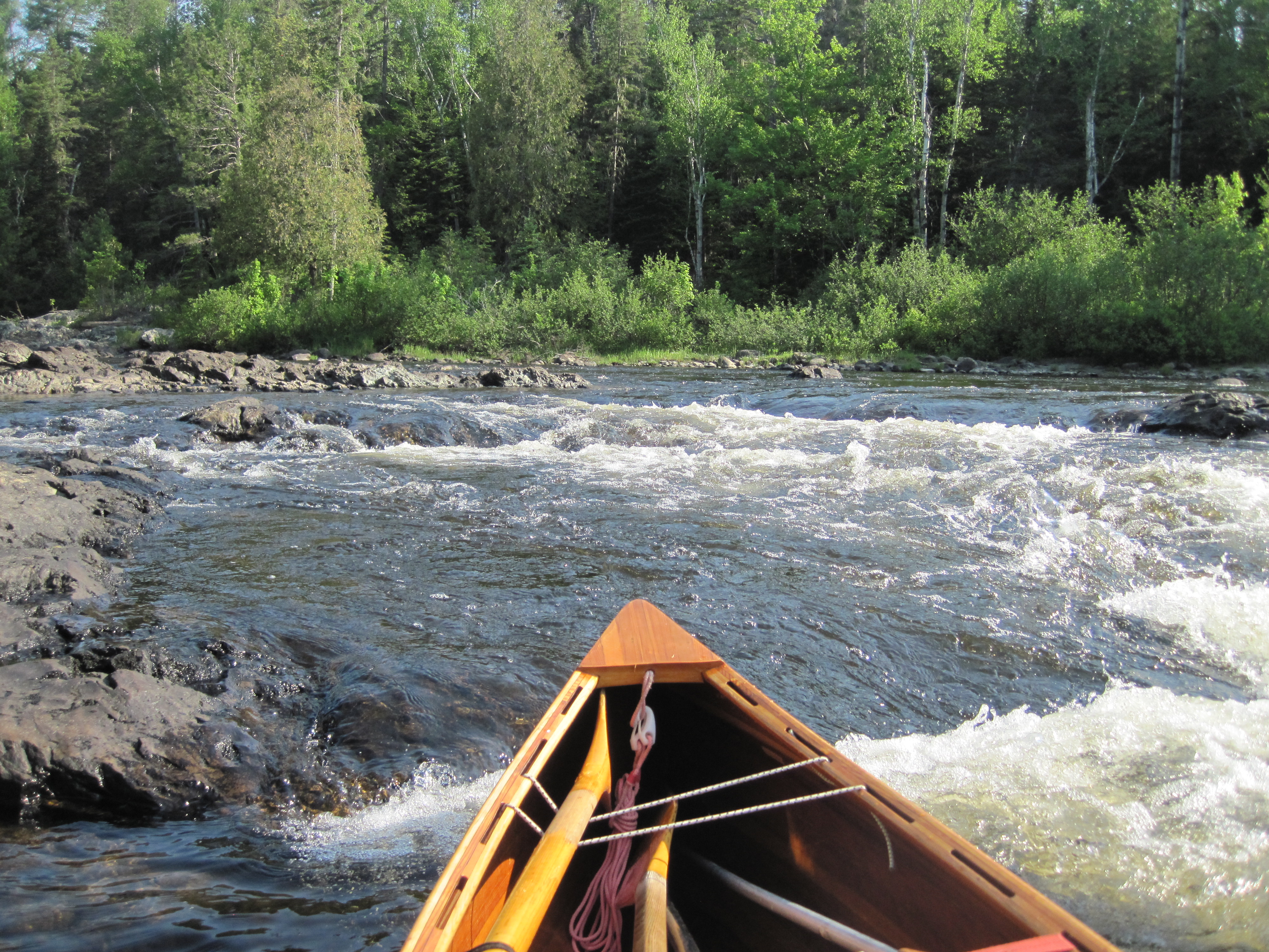
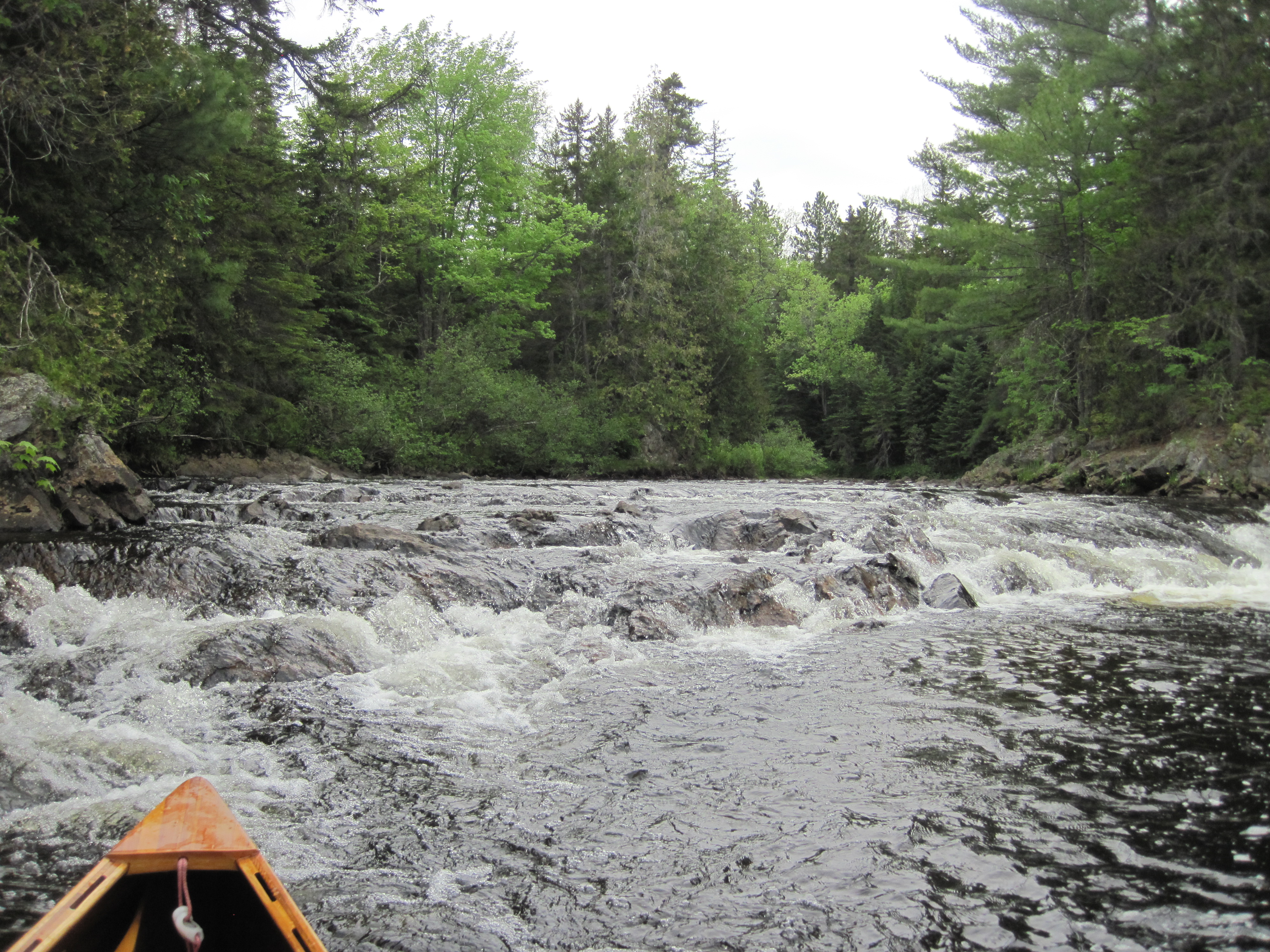
The first set of rapids I had labelled in my notes as ‘significant’. There was no marked portage path, no easy access to the road – I was wary of bushwhacking so soon after my experience on the Great Carry – so I was forced to remain in the river bed, ascending the rocky rapids. I waded, climbed from rock to rock, slipped and nearly fell many times. My shins, already a mess from my island fall in Fairfield and from the Great Carry, added new decorations and opened prior wounds. All the while I was heaving my loaded canoe up the rapids, choosing channels where contact with rocks could be minimised, sadly not avoided entirely. Then the lack of water made it too shallow to float the loaded canoe, so I took to wearing my pack, balancing on slippery rocks, manoeuvring the now unladen canoe. Once again I used a ski pole as a third leg for balance, and it proved invaluable.
|
No easy route
|
Easier, but no route
|
|
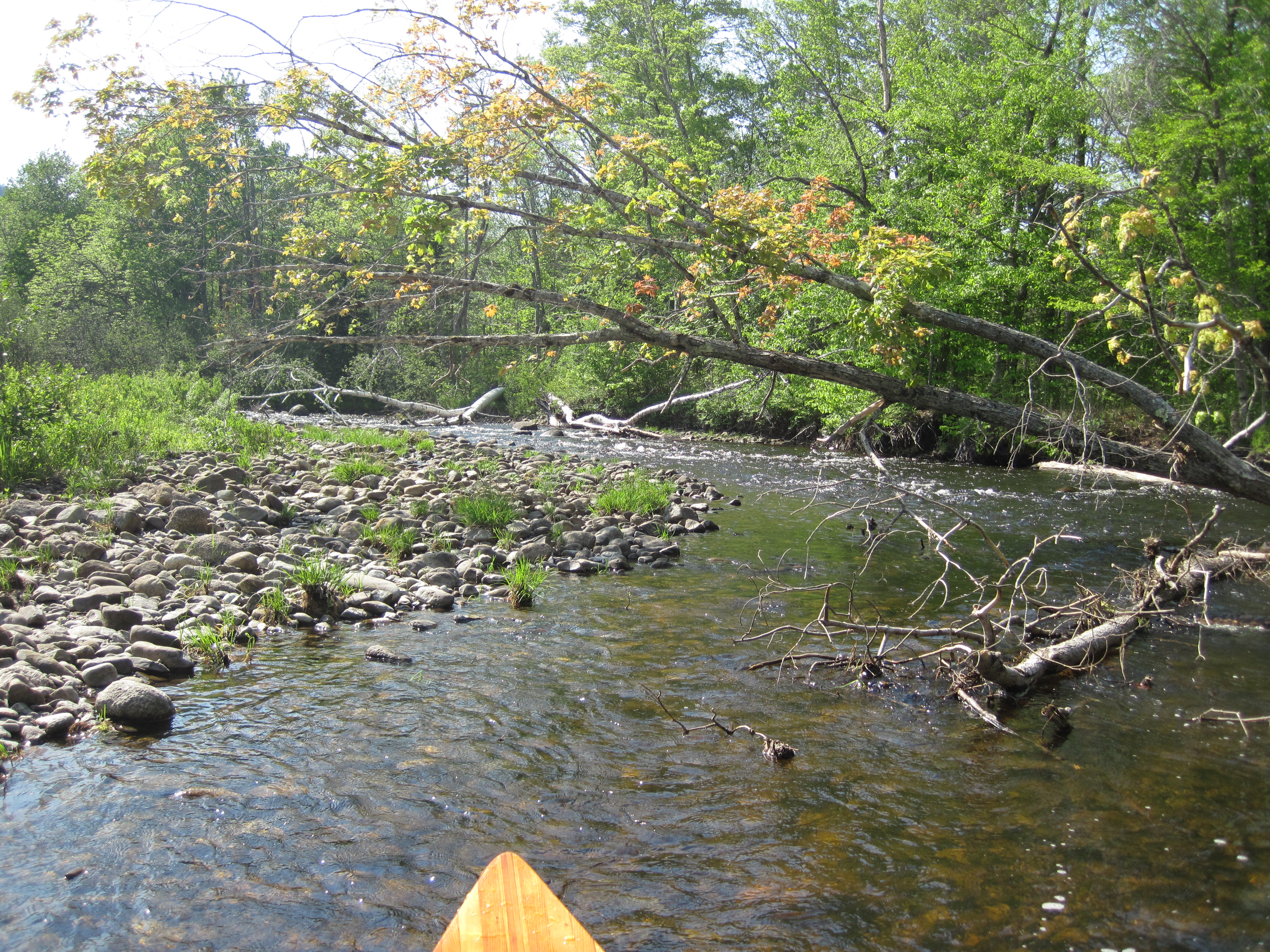
More than once during the ascent of these rapids, at least half a mile long, I seriously contemplated turning back, giving up on the North Branch because of the lack of water. But something kept telling me to continue, that I really did wish to see the Chain of Ponds. And so I hauled the canoe up ever shallower channels, still struggling to maintain my own balance. For a while above the rapids a new pattern developed: slightly deeper sections, where I could paddle, punctuated by shallow riffles where sometimes I could pole but more often I had to unload the canoe and wade. Hidden rocks were brutal to the canoe; for some reason they were not having any visible effect on the surface of the water, not producing the usual tell-tale signs. Even the flat sections of river were often too shallow for a paddle, so I poled several miles, switching to a paddle if the depth permitted.
|
Relief from rapids ...
|
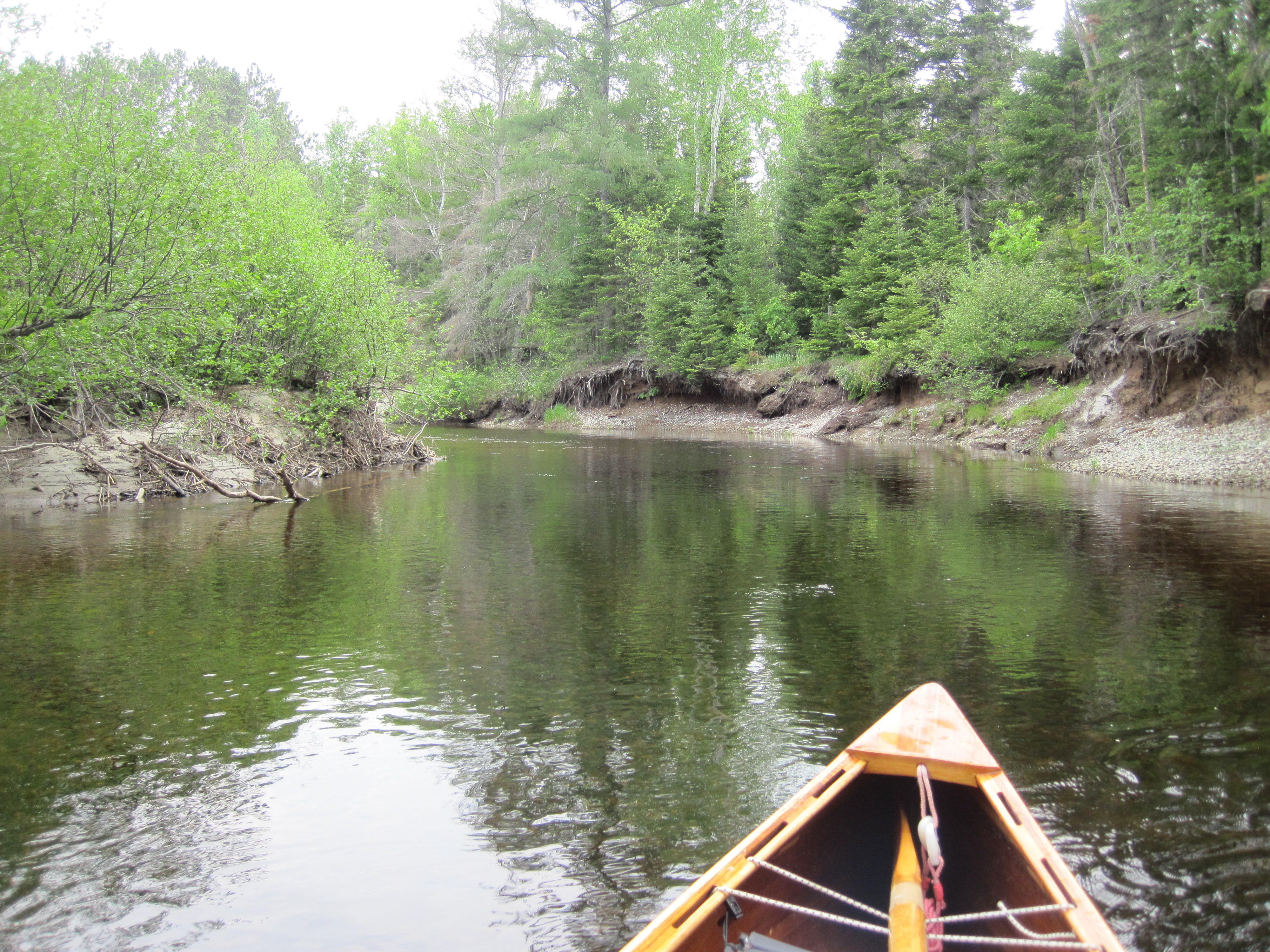
... but still shallow
|
|
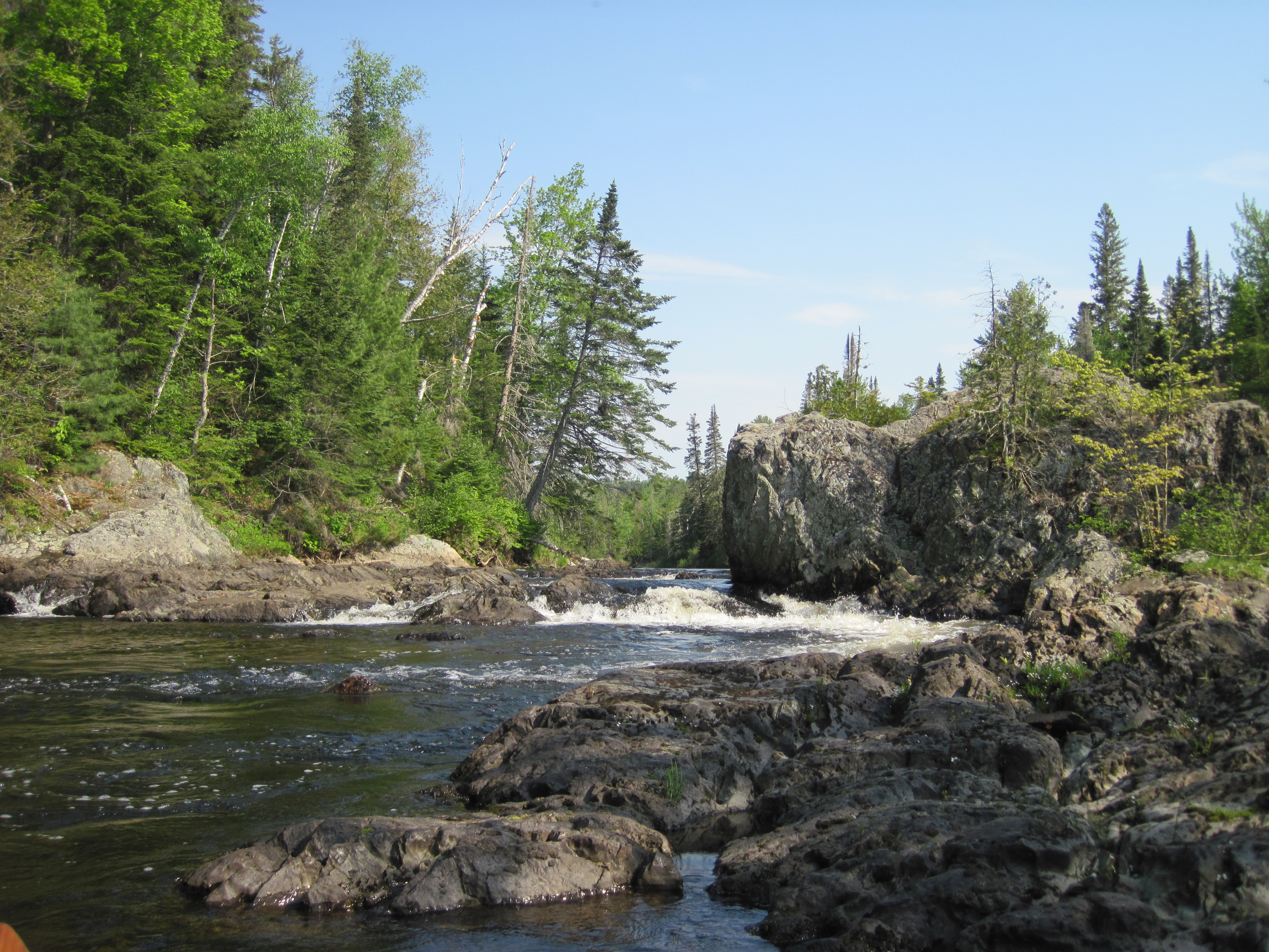
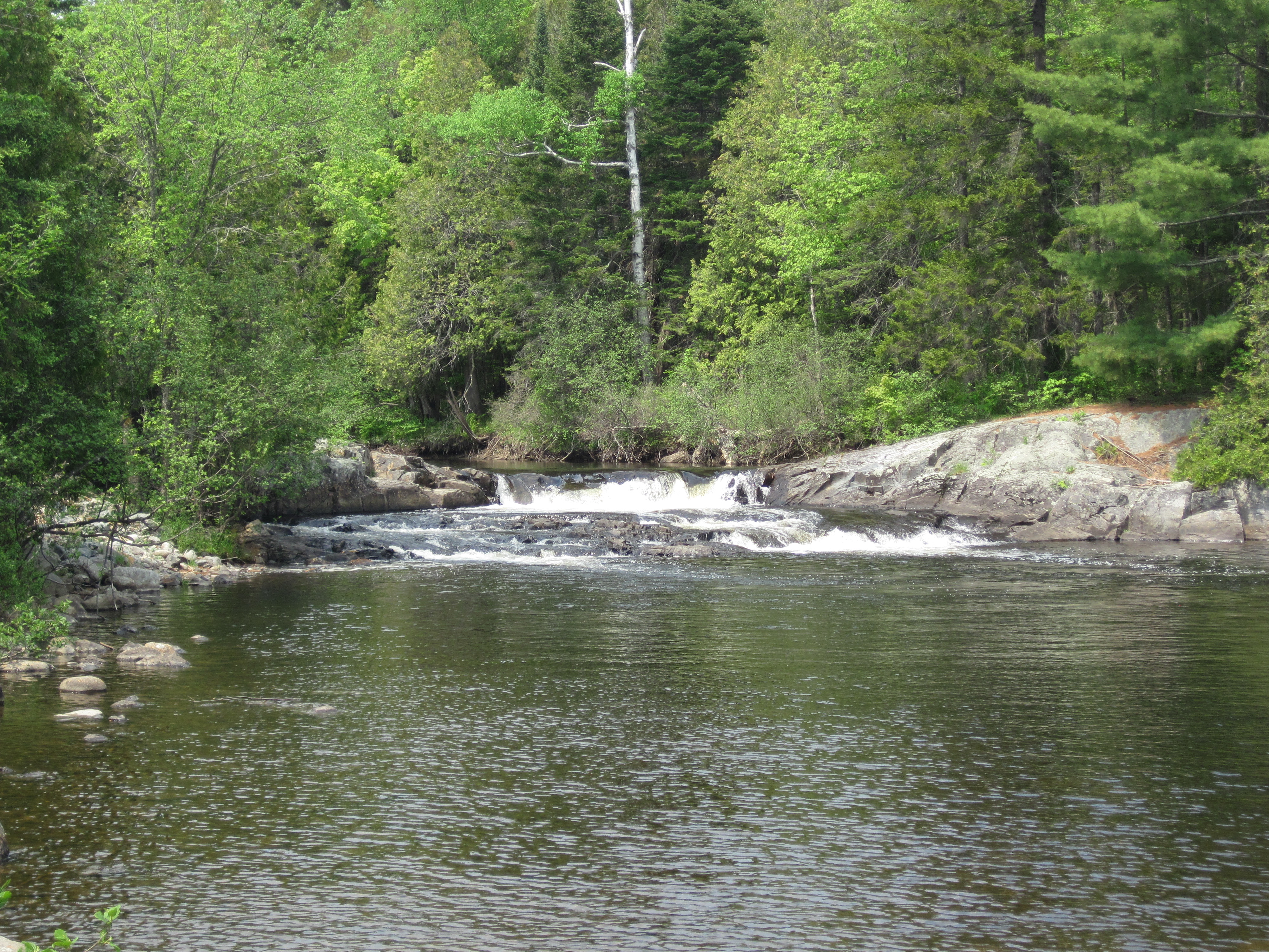
The Alder Stream confluence had come and gone. The next landmark was Shadagee Falls, a ledge drop of about 2 feet. Here a short carry trail had been cut through the trees on river-right, probably by a NFCT crew, judging by the yellow and blue arrow aimed at the downstream paddler. A little farther on, while wearing my pack, I tried to re-enter the canoe to cross a short deeper stretch, too deep to wade comfortably, not bothering to unload my pack for such a brief section, and had, let's say, a moment of instability. It was not a capsize, but was certainly a significant wobble, being too top heavy. This was not repeated.
|
Shadagee Falls
|
Jammed pole
|
|
The river swung away from the road and then found it again, offering an easy take out to by-pass the next ledge drop and Sarampus Falls. A road sign indicated that the Sarampus Falls Rest Area was only 1500 feet away, a short, easy carry. I took a break at the rest area – it seemed appropriate – and reconnoitered the easy ledge put-in above Sarampus Falls as well as filtering some water to replenish my now empty bottle. A Montrealer, now living in Hong Kong, pulled in and came over for a chat. Alain was back for a family reunion and was borrowing his brother's camper van to do some touring.
|
Sarampus Falls
|
Even less water
|
|
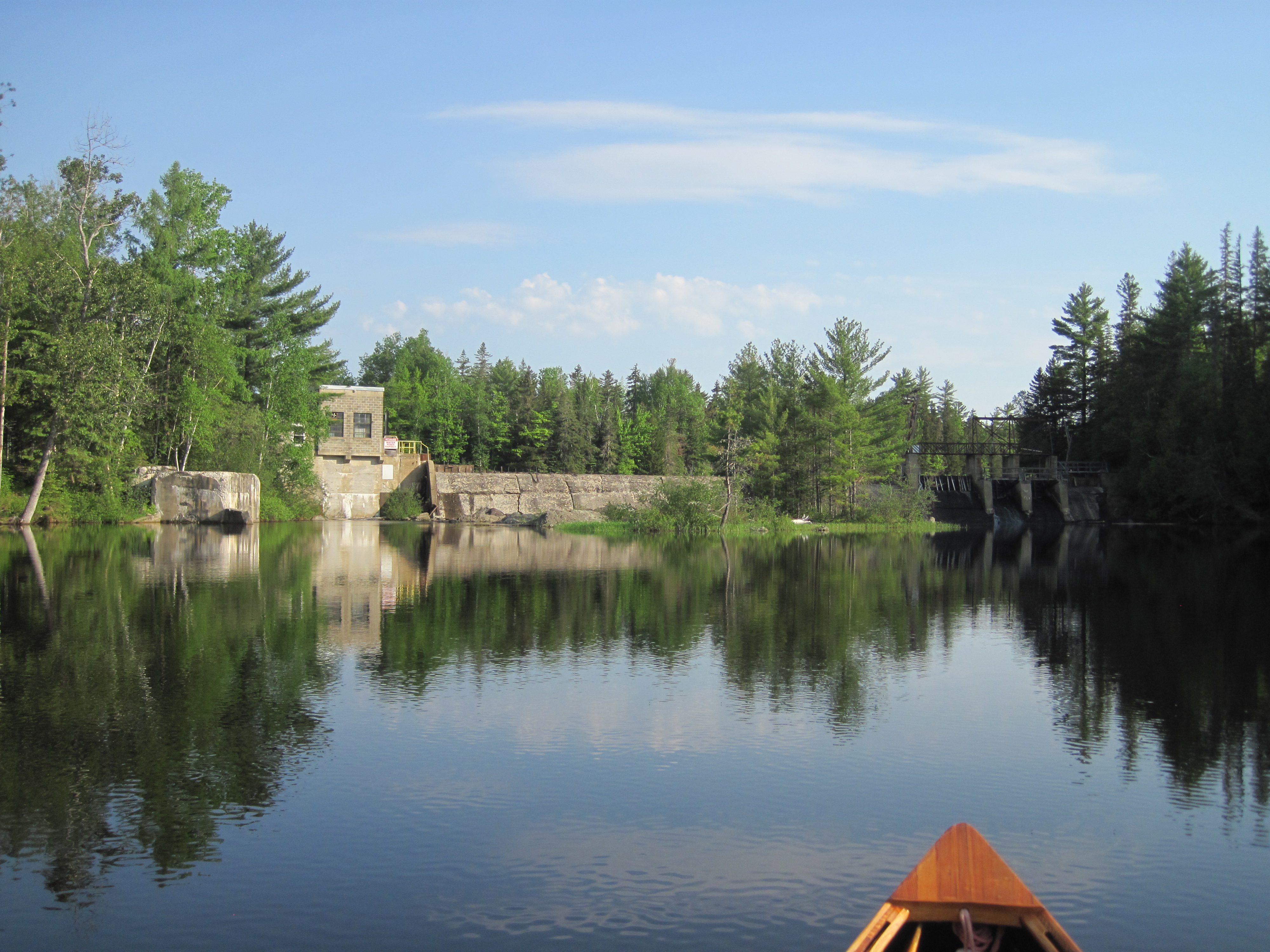
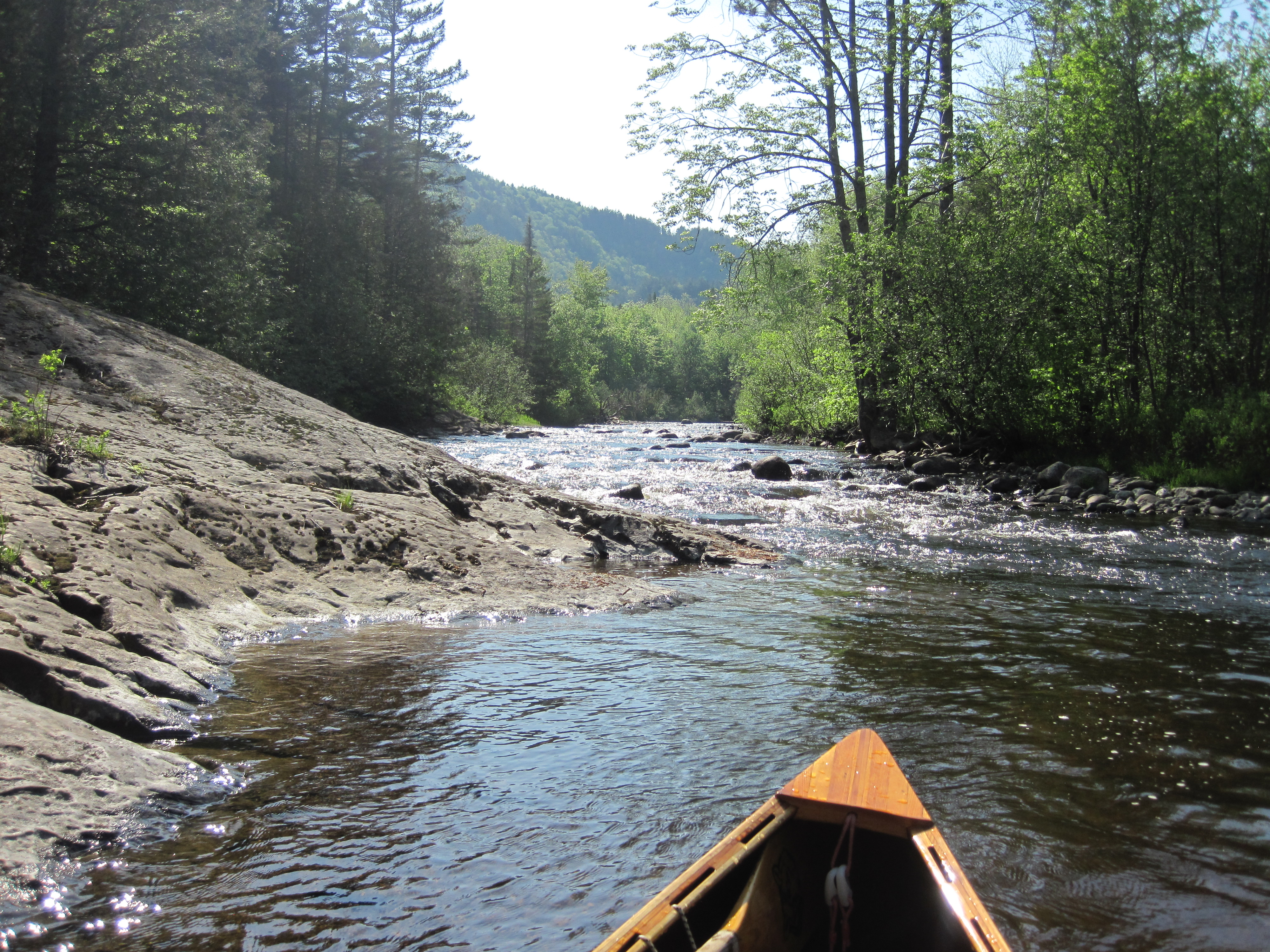
For the last couple of miles to the dam at the foot of the Chain of Ponds, I was more out of the canoe than in it, and this stretch took well over an hour. The skyline, though, gave me hope that I was nearing this destination, distinctly opening out. Finally, poling around a bend, and perplexing a fly-fisherman who was puzzled by the noise, the dam came into sight, a mere 2-3 feet high. The easy carry on river-left included some granite steps, leading me down into Lower Pond, the first (or last) of four ponds in the Chain of Ponds.
|
Approaching the Chain of Ponds
|
Lower Pond Dam at the Chain of Ponds
|
|
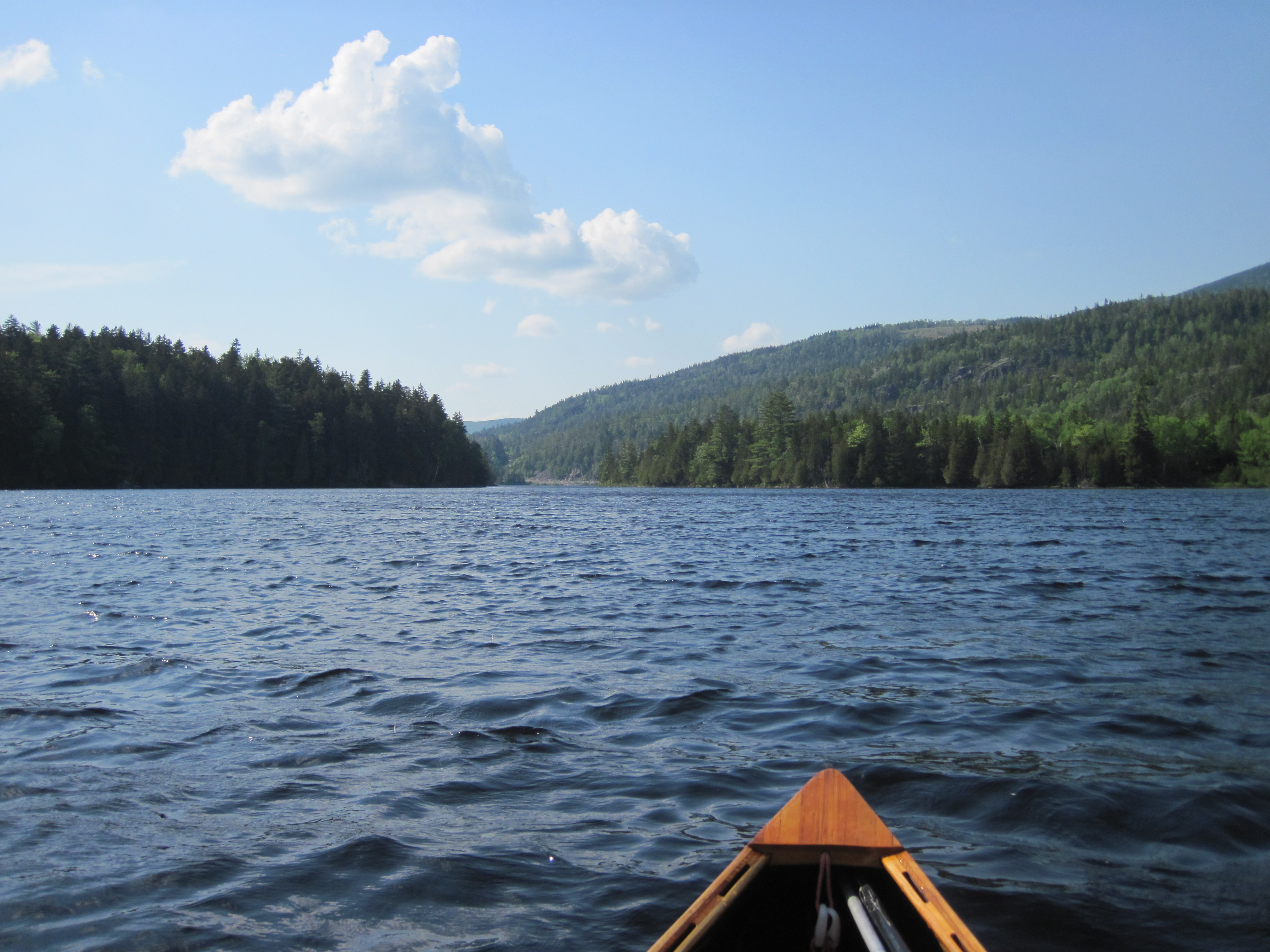
The wind had been light all day, occasional puffs of headwind but nothing significant. Now it instantly rose to 10-15 mph from the northwest, in other words a headwind. At least I was not paddling-fatigued, having done relatively little over the last several miles, and so I made reasonable speed into the wind. The ponds provided no shelter, barring the occasional island. At the west end of Lower Pond, nearly a mile and a half from the dam, I passed under a footbridge across some narrows to enter Bag Pond. This pond led to some narrows, opening out about a mile farther on into Long Pond, nearly another mile and a half. Finally this squirted me through some narrows into Natanis Pond, named for an Indian guide who had served Benedict Arnold. At the far end, about a mile and a quarter distant, lay the Natanis Point Campground, my destination for the day.
|
Lower Pond
|
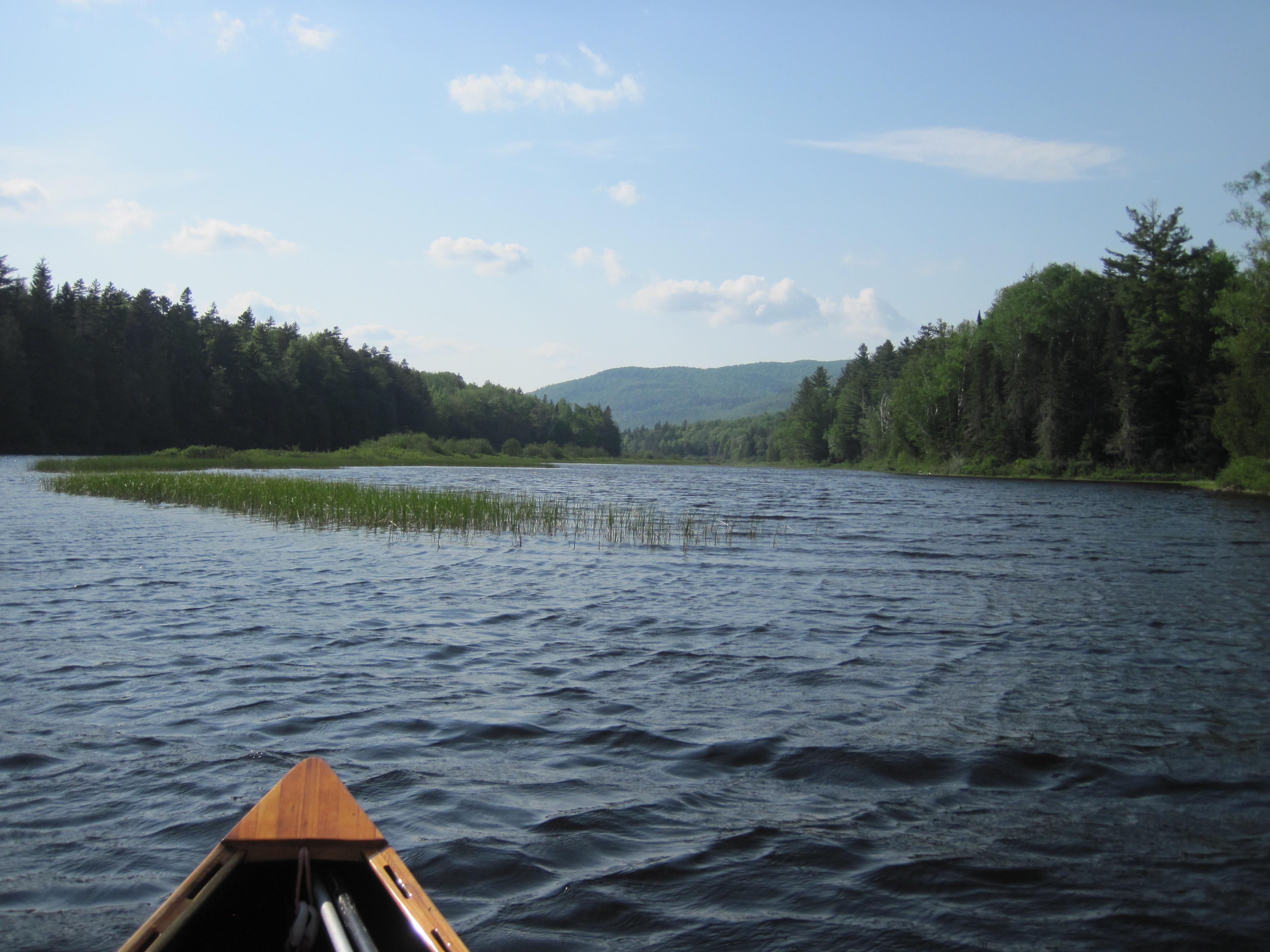
Approaching Long Pond from Bag Pond
|
|
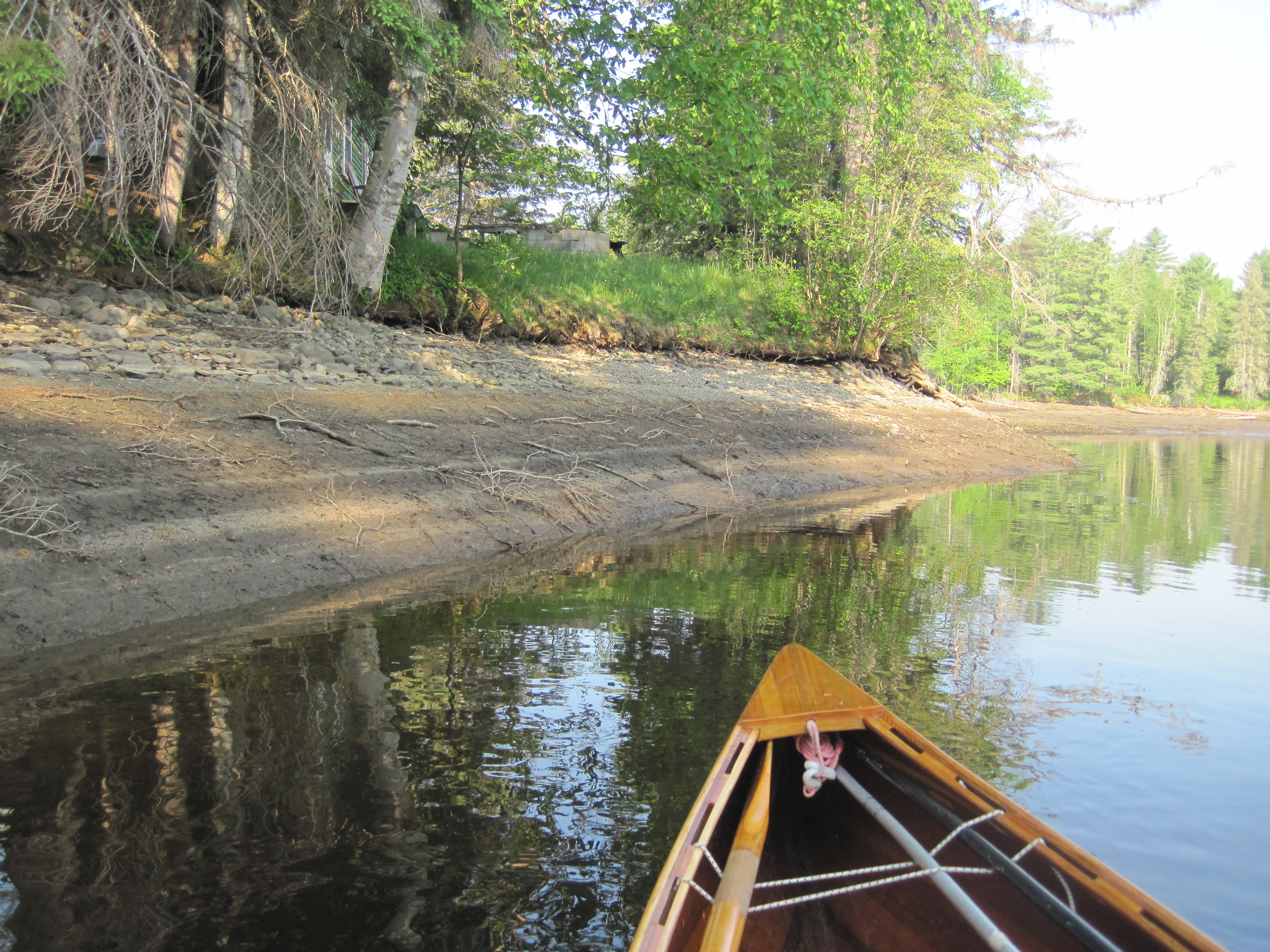
As I pulled into the beach, it was just over 12 hours since I had left the dock at Stratton, and the effort of moving up the shallow North Branch had left me drained. I wandered around, looking for the camp office, and was eventually pointed to a distant building. The owner seemed to think that I wanted a water-access campsite. My interest was only in a site with trees, and I had already noted one. Then, with a mention that a storm was coming in, the owner suggested that I might like to use a utility building just opposite. It would be dry and would keep me out of the wind. There was even a chair with some cushions that could be removed to act as a bed. Without thinking it through too much, I immediately accepted. When I then mentioned my plans to visit Arnold Pond the next day, the owner recounted the tale of some paddlers earlier in the season who had attempted to navigate only downstream in this section, and had encountered bushwhacks, beaver meadows and a lack of water. With the lack of water in the North Branch, I had been in two minds about continuing farther, and this information made the decision easy. It would be no fun trying to go any farther, so the following day I would head back the way I had just come.
I returned to the canoe and paddled to a nearer beach, pulled out, and moved into the utility building. In the rush to accept a roof over my head, I had neglected to realise that this would also mean a lack of bug netting. There was nowhere to hang my hammock inside, so I merely closed one of the doors – the other was tied open – and set up my bed near that end. I gathered lake water to filter, and the gas stove came into service to cook curry for dinner, accompanied by the usual hot chocolate and jerky, and augmented by some cinnamon bread from Stratton.
The day had promised thunderstorms, but had instead been remarkably sunny and dry, just a light sprinkle around lunch time. Clouds were now gathering, though, so a change in the weather looked likely. Despite the tribulations of ascending the shallow North Branch, together with the damage inflicted on my canoe, I was glad not to have turned back. The temptation had been strong, but the beauty of the Chain of Ponds was a worthwhile reward for all of the trials.
|
|