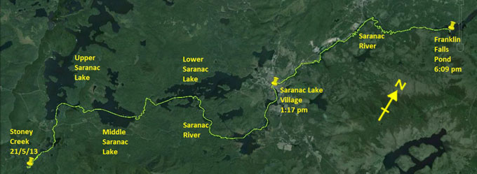
Day 3 route on Google Earth imagery
|
|
I went to bed last night under a clear sky with a beautiful half moon. Shortly after 3:00 am I was rudely awoken by an enormous clap of
thunder. Within a minute it was raining hard, and a squall blew through, releasing one end of my inadequately secured tarp. Water poured
into the head end of my hammock while I fumbled in the dark and wet to fix it. I'm clearly not yet in a groove regarding camping, having
been lackadaisical with tying the tarp and not having taken a headlamp into the hammock – more lessons learnt the hard way. Sleep is
impossible after that, so I'm up at 5:00 am, trying not to wake my neighbours.
The rain has soaked all the firewood I carefully prepared yesterday and did not feel the need to protect, and it proves impossible to
maintain a fire. Not wishing to consume unboiled river water, I dispense with breakfast, planning to make up for this in Saranac Lake.
By 6:45 am I'm on the water; my neighbours have not stirred.
|
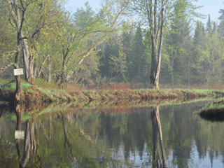
Entrance to Stoney Creek
|
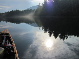
Stoney Creek
|
|
The route up Stoney Creek is not easy to follow, and I take one or two wrong turns, even though I've paddled this several times before.
At one point a huge – and yes, I mean huge – snapping turtle drifts past me, apparently unconcerned by my presence. Only when
I reach for the camera does it submerge.
About an hour's paddling brings me to Indian Carry to cross from the Raquette watershed to the Saranac drainage. It's a straightforward
carry, although my legs still complain at the uphill. By the time I reach Upper Saranac Lake, the sun is shining. Taping my heel is
proving problematical, devising a system which will allow for flexing while walking and not be rubbed off when wet. I skirt across the
south-east of Upper Saranac Lake; it seems a shame not to visit the rest of this jewel, but I've been there several times before. Even
though I'm on the lookout, there's no sign of the new NFCT campsite in Huckleberry Bay.
|
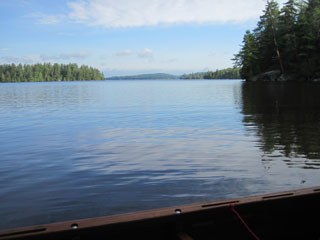
Upper Saranac Lake
|
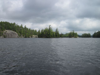
Lower Saranac Lake
|
|
The Bartlett Carry brings me to Middle Saranac Lake, where I once more experience a tailwind. The law of averages is looking ever less
good for the future. Soon I'm paddling down the Saranac River to the Upper Lock, where the lock-keeper advises me that there's someone
in a modified carbon fibre canoe a few days ahead of me. This must be Tom Holt, whose name has appeared in the various registers. Lower
Saranac Lake is another jewel, and even though I know it well, I'm confused by an island, and nearly turn into Pope Bay, having to
backtrack a little. It has now clouded over and, as I pass the Ranger Station by Route 3, the rain starts. It continues all the way to
the Lower Lock. Out of curiosity, I opt for the carry, never having tried it before. To my mind it takes an unnecessarily long route
and climbs too far for the distance it has to by-pass. Next time I'll go back to using the lock.
At this point I phone Mike Lynch of the Adirondack Daily Enterprise, who contacted me before departure with an interest in my story, and
who suggested meeting as I pass through. Rather rashly I predict arrival in an hour, and then realise that it's something more than 4
miles, so I set to some hard paddling and almost make the rendez-vous on time. He snaps pictures as I approach, and then, after I've
signed in, records a brief interview on video. Having carried around the dam, I paddle to St Regis Outfitters, where Dave and Dennis are
kind enough to let me leave my pack and canoe while Mike is so good as to drive me to a deli where I can have a belated breakfast.
Dennis and Dave show an interest in my canoe – it's great for the ego to paddle a conversation piece!
|
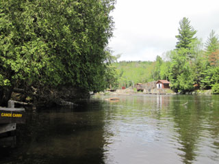
Lower Lock from below
|
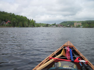
Lake Flower & Saranac Lake Village
|
|
Then it's time to push on down the Saranac River. I hope to reach maybe Union Falls Pond today. Traffic noise swells and fades as the
river approaches and leaves Route 3, and then finally swings east, offering more peace. After being advised not to run Permanent Rapids,
and having intended to carry around them, I find myself drawn into running them, not to save the carry, but to find out what I can
expect from a class II rapid. Sometime I have to find out, otherwise I'll end up trying to carry around all of them, which could become
tedious, and may not be possible.
|
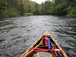
Approaching Permanent Rapids
|
As the take-out comes into sight, I don my life-jacket, stow my long paddle and pull out my shorter white-water paddle, lower the front
of my seat to adopt a kneeling position, and drop into the rapids. With some back-paddling to control speed, I'm pleased with my line,
and have a clean run in the upper section. Approaching the gorge section, I make one mistake – that's all it takes – and am shunted
sideways into a rock. The audible crack is deflating. I can't investigate yet, and must keep concentrating. I have a couple of other
very light skirmishes with rocks, but emerge at the bottom after what was almost a very good run, but that ominous crack is at the back
of my mind. I resolve to aim for an island camp-site in Franklin Falls Pond, not least because black clouds are gathering in the west.
|
|
Once camped, an inspection of the canoe reveals no significant damage on the exterior – the extra reinforcing fibreglass has done its
job – but a 10-inch longitudinal split in the interior fibreglass. The hull, however, is not soft, its strength is not severely compromised,
so I dry the interior and tape the split to keep further water out.
Having gathered stove-wood for dinner and breakfast, I cook an evening meal, and am just boiling water for more tea when an intense
thunderstorm strikes, accompanied by a violent squall. It blows all the embers from the wood-stove, a fire-risk in other circumstances,
but not with the volume of rain falling, and the intensity with which the rain hits the ground causes it to bounce up and soak the
underside of my hammock. Meanwhile I'm hunkered down beneath the tarp and hammock, trying to enjoy dinner. Although I took the
precaution of stowing wood for the morning under the tarp, it's now saturated. Breakfast is looking doubtful. As the storm passes, the
sky lightens in the west, an eerie yellow contrasting with the blackness overhead, but this doesn't photograph convincingly. The rain
has eased, but doesn't stop completely. There's little to do but retire to bed and write my journal by headlamp. I'm now one day ahead
of schedule. As my plans included no spare days for being wind-bound, gaining a day on water I know well has been an early goal, now
accomplished.
|
|

