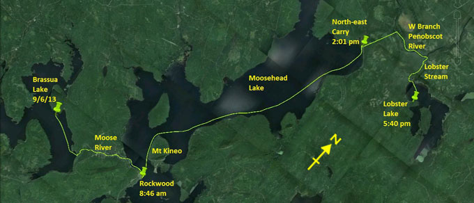
Day 22 route on Google Earth imagery
|
|
It was another cold night last night. I'm up soon after 5:00 am to a mix of low black cloud and low angle sun. Mountains are largely
obscured by cloud. I pack while breakfast water boils on the gas stove. It's then an easy pull for about 3 miles to the Brassua Dam and
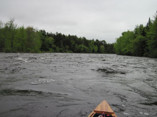
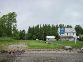
a straightforward carry around it. There follow some bouncy class I rapids with plenty of flow. I pull into the general store in the
Moose River community for a second breakfast. The rain starts just as I pull up, so I am glad to be indoors for a while.
|
Low cloud on Brassua Lake
|
More fun on the Moose River
|
|
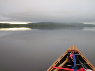
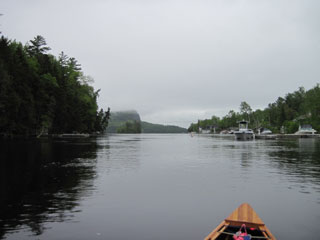
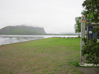
Although there's little wind, it's cold again today. I don the waterproof clothing and run the last part of the Moose River, emerging
into the enormous expanse of Moosehead Lake. Mt Kineo is bedecked with cloud. I go out of my way to visit Rockwood, only to register at
the NFCT sign-in box; I haven't missed any yet, and don't intend to start now. Now it's time for the 17.5 mile trek to the north end of
the lake.
|
Approaching Moosehead Lake
|
Rockwood & Mt Kineo
|
|
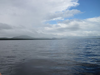
I skirt around Mt Kineo, pass Hardscrabble Point, and then take advantage of the still conditions to cut across the various bays. At
times dark clouds threaten, and a few drops sprinkle on me, but no storms blow up. Part way up the lake the sun comes out, and one half
of the sky is blue with sun while the other half is dark with clouds. A posse of no-seeums are my companions throughout.
Having stripped down to a T-shirt, a rarity, in celebration of the sun, the rain starts within an hour, and is still pouring as I
approach the North-East Carry. The signs are confusing: there is clearly a straight path leading away from the lake, but the signs
point left. I investigate where the signs point, but there is nothing. The signs must therefore mean to pass immediately to the left of
them. I wander around the settlement in the rain, looking for the general store, but find nothing and no-one, so embark on the carry.
Once again, the canoe shields me from the rain, but diverts the water up my sleeves.
|
Looking back down Moosehead Lake
|
North-east Carry
|
|
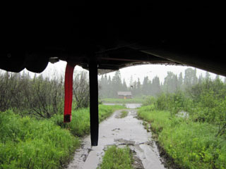
A short distance down the carry I find the store I was looking for, and pull in for a hot drink, some food and some temporary shelter.
After chatting with store owner Ed Raymond, comparing how we both gave up secure jobs to move to a more tenuous existence that neither
of us has regretted, I set off into the rain once more. Despite what the map says, the carry is not straight. Where it crosses a road,
it bends to the left and then back to the right. The later portion is muddy. My first view of the West Branch of the Penobscot is a
dismal river above a wet, muddy carry and under a heavy, grey sky.
|
We(s)t Branch of the Penobscot
|
|
I discern no noticeable flow as I head downstream, and am accompanied by a posse of mosquitoes now. At the Lobster Stream boat launch I
sign the register, and then continue upstream, the last in a parade of boats. Seemingly fishermen are happy to sit around in the rain. I
try to outrun the mosquitoes, but fail miserably.
|
Entering Lobster Lake
|
Beauty in adversity
|
|
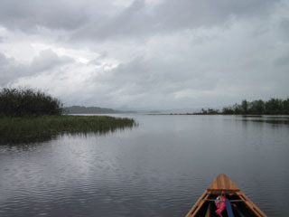
As I enter Lobster Lake, it's easy to find Ogden Point where, I'm assured, the best camping is to be had. As I approach Ogden Point,
the rain eases off, and holds off while I set up camp. There's no dry wood, so I use the gas stove to cook dinner. Not sure that the gas
will last, I ration myself to a single cup of tea – such a sacrifice!
I hang up clothes to air, but then the wind swings round to the north and black clouds are heading my way, so it's time to secure
everything under cover and to retire to the hammock.
|
|