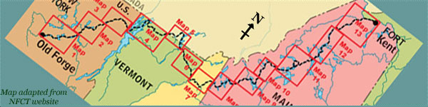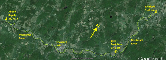
Day 8 route on Google Earth imagery
|
|
My hosts are early risers, which suits me fine. They feed me a good breakfast, and then Scott transports me back to the Abbey
Restaurant. I express my sincere gratitude once more, set a SPOT at 6:45 am, and resume the carry along the rail-trail. A night indoors
and some good food have worked wonders. The carrying is easy, and, even though the sky is hanging low as ever and intermittently throwing
rain at me, my mood is lighter than yesterday. Besides, I'm now wearing my fleece hat, as per Viveka's suggestion. I can't fathom why I
didn't think of this myself. Maybe I was saving it for a rainy day …? It makes a huge difference to my comfort level. I'm also wearing
thermal long-johns, rather than keeping them for evening and overnight warmth.
Where Route 120 crosses the Missisquoi, I assess that the best place to launch is from private property, the only place with an eddy. I
think about asking permission, but it's still early, so I simply launch and go. My goal is Richford, but that may be optimistic. The
river is fuller and faster than yesterday. Once warmed up I try sprinting upstream in the centre, and establish that the speed of
current is about 5-6 mph as I drift backwards despite maximum effort. I cannot ferry glide across this current without losing ground,
but sometimes that is necessary.
|
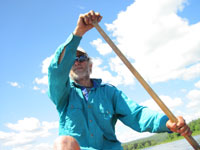
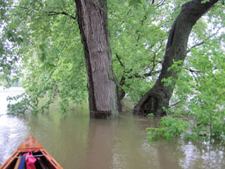
Finding eddies
|
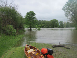
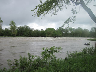
My view for the day
|
|
Today is another day of seeking eddies, paddling under trees, avoiding the temptation to paddle into flooded fields as there may be no
way out the other end, paddling behind trees whose knees are now well and truly awash. Three hours' steady paddling with occasional
strenuous effort bring me to the St Albans Road take-out in Enosburg Falls. I paddle up on to the grass, one of the easiest take-outs
yet. As I'm picking up the canoe, an elderly local, clearly out for a power walk, eyes me curiously. His path and mine coincide for the
length of St Albans Road. We walk together, chatting as we go. He's coming up on 96 years old, and much of the conversation involves
mutual admiration of each other's physical prowess, although I suspect he thinks I'm a little crazy. We part ways at the bridge, and I
drop canoe and pack at Lawyer's Landing in order to head into town unencumbered.
|
Enosburg Falls: St Albans Rd take-out
|
Enosburg Falls
|
|
The Flying Disc cafe, for which I have a coupon for a free hot drink, is closed, as is the outdoor equipment store where I hope to
replace my waterproof trousers. Only then do I realise that today is Sunday. In the world of travel, time has lost some of its meaning.
Sub-Way is open, however, so I take the opportunity for a sandwich, washed down with a hot chocolate from the neighbouring Cumberland
Farms.
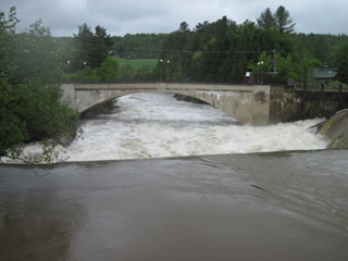
Then it's back to the game of patience, dodging tree branches, seeking out even the smallest of eddies. The rapids that should be below
Samsonville Dam seem to be washed out, but I have to carry early around Samsonville Dam itself. A farm track on my right provides easy
walking until I opt to remain close to the river rather than diverge away from it to places unknown. The path I now follow leads me
through a flooded region that I can't believe will get any deeper until it reaches thigh level. This was not my best decision.
Eventually it rejoins the other track.
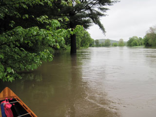
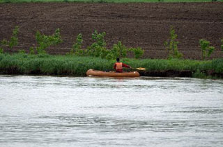
The farther upstream I go, the faster the current against me seems to be – the river is still rising. The rain is not continuous, but
close. I succeed in eddy-hopping up the rapids in East Berkshire. Twin Bridges requires an all-out effort to get over the hump of water
that has formed. Once more the bank frequently comes into play as I use it for propulsion. Magoon Ledge seems to be two ledges, one part
of which requires a carry as I'm making no headway at all.
|
Using the bank [photo: C Gill]
|
Samsonville Dam ruins
|
|
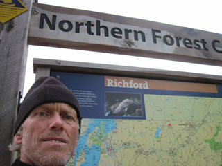
On the way into Richford, even though I am looking for the new NFCT campsite, my heart really is set on indoor accommodation. I see the
end of the cut where the site lies, but the outflow is even faster than what I'm paddling on. At 5:45 pm I pull into Davis Park,
Richford, my goal for the day. It's a quite emotional arrival. Other than maybe 30 minutes in Enosburg Falls, I've been slogging
upstream, exercising patience and immense concentration for well over ten hours. The weather has been less unkind than yesterday, but
it's still cold and very wet. To have travelled about 20 miles in these conditions is a real accomplishment, and I allow myself a
moment of pride as I sign the register.
|
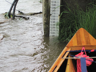
Water gauge near E Berkshire
|
Proud moment of arrival
|
|
But this kind of reflection cannot last. Even with all the extra clothing, I'm soaked and chilled. I can feel that my body is not
generating enough heat to compensate for the losses, so I carry across the road to Grey Gables Mansion, park the canoe and knock on the
door, to be welcomed by Debbie Green. This is such a warm welcome. She sizes up the situation immediately, confirms that she has a room,
worries not about my dripping wet pack and body and clothing, and ushers me to the front room where a log fire is burning. With
instructions to stay and warm up, she disappears, returning a little later with tea and muffins, together with an offer to run my
clothes through the dryer. Hospitality just doesn't get any better than this. After a while Tim Green shows me to my room, where I
spread out wet gear to dry, take a hot shower – this is becoming a habit – and begin to warm up once more.
Later, while I'm by the fire again, there's a knock at the door, two people asking if there's a canoeist called Peter Macfarlane staying
here. I put in an appearance to meet Russ and Sterling Ford. They, together with a bunch of other NFCT enthusiasts, have, unknown to me,
been following my progress on SPOT, and even snapping some pictures of me, and were going to offer a bed, should I have opted to camp in
Davis Park – yet more Trail generosity. We chat for some time, during which Russ offers the following information on river flow. Last
weekend, when there was a NFCT jamboree for trail maintainers here in Richford, they were unable to paddle as the water level was too
low, a mere 250 cfs (cubic feet per second). Today the flow has reached 11,000 cfs! I glean further figures from Channel 5
TV: apparently in the recent weather 34 inches of snow fell on Whiteface Mountain in the Adirondacks, 16.5 inches of snow fell on Mt Mansfield in
Vermont, and Burlington VT received over 7 inches of rain in 5 days. Roads have been washed away in Jericho VT, and generally it seems to have
been very wet and cold. My suspicions are confirmed by the figures.
|
|