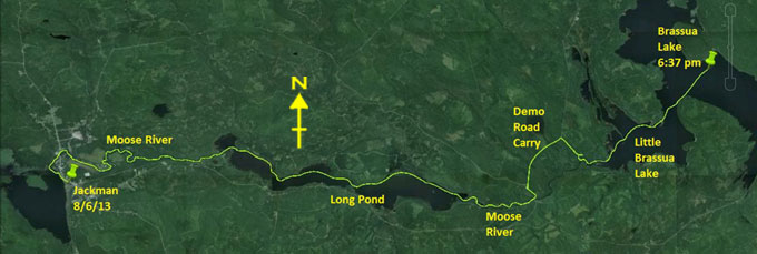
Day 21 route on Google Earth imagery
|
|
Any time I woke in the night, it was still raining, and it still is this morning. The weather forecast is now saying that the rain will
clear quickly today, but will return as showers tomorrow, and will get heavier through Monday, Tuesday and Wednesday, in other words wet
for most of the rest of the trip. I assess that I can probably reach Fort Kent by Friday, and, if there's no decent weather on the
horizon to wait for, there's no point in prolonging the trip. I use the microwave to brew tea and cook oatmeal while contemplating my
options.
|
|
I have no phone service here, but at the store down the road there is a payphone. Maybe, just maybe, I can get in touch with my support
crew. Maybe this is not quite such a black hole of telecommunications as was Groveton, NH. I gather up all my quarters and phone Viveka,
but there's no reply – she's not yet home after playing for a gig last night. I finagle some more quarters and phone Ray and Hildy,
briefly sum up the situation and ask about a Friday pick-up. They confirm what I feared: Viveka cannot make Friday. Pick-up will be
Saturday. Ray immediately suggests throwing an extra loop into the Trail, visiting Allagash Lake. As the 4 minutes of call expire, we
agree that I'll look at this and call back.
|
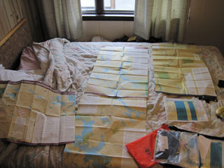
Route revision in Jackman
|
|
Back in the motel room I spread out the remaining maps and study the options, soon coming up with a revised itinerary: aim for Rockwood
today, Lobster Lake tomorrow, Chesuncook on Monday, Allagash Lake on Tuesday, Eagle Lake on Wednesday, Round Pond in the Allagash on
Thursday, Allagash Village on Friday and finish on Saturday. I haven't checked the mileages but, eye-balling the maps, this should be
feasible. I muster up more quarters and phone Ray once more to give him the itinerary. I also establish that they cannot guarantee to
be at Fort Kent before 3:00 pm on Saturday. As arriving to an empty landing would be an anti-climax, I agree to hold off my arrival
until 3:00 pm at the earliest.
|
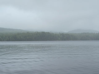
Low cloud on Long Pond
|
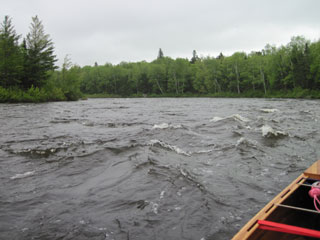
Bouncy ride on the Moose River
|
|
Rockwood is over 30 miles away, and it's now getting on for 10:00 am, so I return to pack my now dry gear and set off into the rain to
find Pomerleau Park, which I now know is not where I took out. The sky hangs low and grey, a familiar scene, as I put in, having got wet
feet merely by walking through grass. The current in the Moose River helps me along, as do some class I riffles, but this assistance is
offset by the brisk and cold north-east wind. The same wind makes Long Pond a bit of a battle, funnelling up the lake towards me. A few
more riffles after Long Pond lead me to the Demo Road bridge.
|
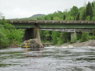
Demo Road bridge ...
|
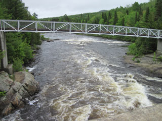
... and the rapids I decline to tackle
|
|
The water gauge painted on the rock immediately above the bridge reads 1.5, the top of the range for comfortable paddling, but, looking
at the rapids immediately below the bridge, I know that this is not for me. I take out, sign the register, and start to carry. Another
moose wanders away from me as I walk along Demo Road. Part way along the carry I'm confused by a blue and yellow blaze on a tree,
together with pink surveyors' tape. I put down the canoe to investigate, thrashing about in the woods looking for a trail, but to no
avail. It then becomes obvious that the surveyors' tape continues parallel to the road but set back into the forest. I re-load and
continue, keeping the tape in sight. Eventually, just where I expect it to be, there's a turning to the right. The blaze and the tape
proved to be less than helpful, more confusing.
At the logging clearing where I should branch to the right, there's a left branch or straight on. I choose straight on, but after about
a quarter of a mile the path disappears. I return to see my mistake: there's a small trail with a sign tucked back in the woods. With a
canoe on my head it's easy to miss this – I did. This trail leads down to the Moose River, just below the final rapids where it empties
into Little Brassua Lake, where I see another moose and a bald eagle.
|
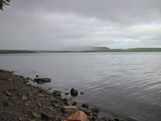
The rain is now intermittent, having fallen for much of the day, but the north-east wind is now fresh at 15-20 mph. It's a hard pull
across to Brassua Lake and an even harder pull across to the island where a campsite is indicated on the map. My left shoulder is
feeling the strain, and my right shoulder is now also beginning to complain. I don't find any convincing take-out or campsite, but see a
couple of trees with almost the right spacing behind a stony beach. Being on the south-west corner of the island, I'm now sheltered from
the wind. This has to be the place for me to camp. I'm glad to be in a hammock: there's no even remotely flat ground to be found.
|
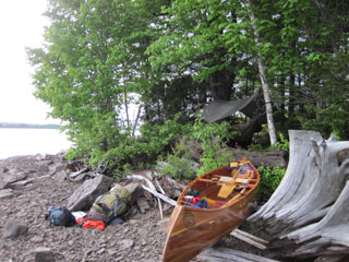
Hammock? Good. Tent? Good luck!
|
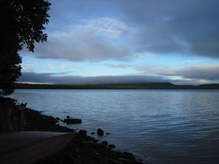
More rain sweeping in ...
|
... and then out
|
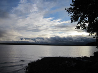
A rare fine evening
|
There's a loon swimming just off the island (every campsite should have one), and the sun comes out briefly in the evening. There being
no hint of dry wood anywhere, I use the gas stove to cook dinner, hoping that it will last. The mosquitoes and blackflies have now
joined forces with the no-seeums. With the late start today, reaching Rockwood was always a long shot, but this doesn't worry me. What
concerns me more is the pain in my shoulders. This I am not used to. It plays on my mind as I retire to the hammock and exterminate
insect invaders.
|