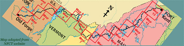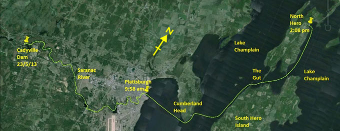
Day 5 route on Google Earth imagery
|
|
Two more thunderstorms nailed me during the night, and the rain was continuous for much of it. A headache doesn't improve my mood. It
may be lack of sleep (rain on the tarp and an alarm from the hydro plant saw to that), or dehydration (I don't feel like drinking cold
water when it's cold and raining), or maybe caffeine withdrawal (I had no tea yesterday, and this morning will be no better).
After packing, I set off to complete the carry past Kent Falls Dam, including re-launching to cross the river by the closed bridge. It
becomes obvious that I could have paddled from where I camped to the bridge, this being flat water, despite the warning sign talking of
class V.
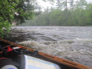
After putting in, my mood lightens, as does the sky. There's plenty of water, and the paddling is good. There are more or less
continuous class I-II rapids all the way to Treadwell Mills Dam, and the water level makes these a joy to paddle. Furthermore, it's not
yet raining. After a slightly confusing carry, there's more good paddling, albeit brief, to Indian Rapids Dam. The take-out here is
awkward, but the carry is short. The rapids and enjoyable paddling continue to Imperial Mills Dam, where the take-out is obvious, but
the carry is not clear. I end up taking a long route, only to get to where I could have reached very simply.
|
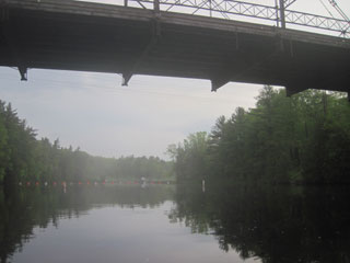
Kent Falls bridge
|
Rapids on the lower Saranac
|
|
At this point I phone Viveka, who was planning to meet me in Plattsburgh. As the wind is low, it's not raining at the moment, and I'm
making good time (it's not yet 9:00 am), today may be a good chance to cross Lake Champlain at least as far as North Hero. We leave it
that she will ask our neighbours about using their house in Alburgh for the night, and will meet me in North Hero.
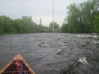
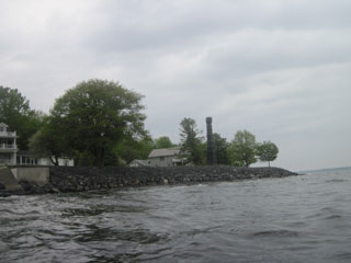
The rapids continue through the outskirts of Plattsburgh, and I'm annoyed to hit one rock, the first since Permanent Rapids. As the bow
rises through a wave, the stern drops on to a rock. And then, as I pass by at 5 or 6 mph, a sign on the right bank, half hidden in
vegetation, announces that the river is closed and that I should “Take Out Here”. The steepness of the bank and the lack of any
discernible path are not enticing, so I decide to find just how “closed” the river can be, passing over a boom as I do so.
A few hundred yards farther downstream, I encounter some obvious works in the river, so pull into an eddy to inspect them. It's some
sort of flood defence*, I suspect, and I have read of others having to carry around this. I take out on river left by the Police
Department for a better view, then re-launch to ferry glide to the opposite bank where the works are taking place to see if there's any
sign of a portage route there. Nothing. I return to the Police Department, and start to carry parallel to the river, but realise that I
have no idea of where I'm heading or where I may be able to put back in. This leads me to examine the river more closely, now scouting a
route. The flow is strong, and there are significant obstructions, but some confident paddling can bring me down the main tongue to
break out into the eddy on river left. I re-launch and execute this perfectly, a triumph of scouting, planning and confidence. I can
then paddle down the edge of the river, lift over another boom, and continue unimpeded, enjoying the remaining rapids. At the boat
launch, I'm disappointed to see that there's no obvious place to get something to eat, so sign the register and paddle out on to
Lake Champlain.
*In fact it was contamination remediation.
|
Outskirts of Plattsburgh
|
Mouth of the Saranac River
|
|
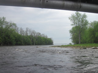
The transition from white-water paddling to open lake paddling is sudden and jarring, requiring a whole new mind-set. Cumberland Head
lies about 3 miles to the east-south-east. The wind is fresh, from the south-east, and the long fetch ensures that there is significant
swell, ranging from 18 to 30 inches. That's fine: swell is much more comfortable than chop, much easier to ride without shipping water. A
buoy part way across gives me a good marker to ensure a straight course as I take regular transits. I aim south of Cumberland Head to
allow for the effect of the wind.
|
The view to Cumberland Head
|
Cumberland Head
|
|
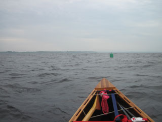
After rounding Cumberland Head without incident, I am pleased to see that the timing of the ferries is perfect. I do not have to break
stroke as one leaves well in front of me, another pulls in, allowing me to cross behind it, and the third is on the other side of the
lake. After clearing the ferry corridor, I aim for the South Hero shoreline, letting the wind blow me north as I cross. Thunderstorms
roll by to the south, but miraculously the sun comes out as I head for The Gut. The south-east wind continues to give a little help as
I head north to pull into North Hero.
|
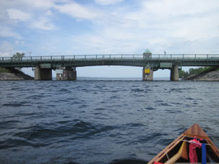
Route 2 bridge in The Gut
|
|
Hungry from lack of real dinner and breakfast, I head straight for Hero's Welcome, order two large sandwiches, some tea and some
confectionery, and then sit in the sun to absorb it all while waiting for Viveka. I've made better time than expected. This food is so
incredibly good. I've been amazed at how much work I can push my body into without properly compensating it, but that can't last
indefinitely. I order more tea. A brief interlude to sign the register is then followed by more tea, just as another intense
thunderstorm arrives, the same one probably that has delayed Viveka.
|
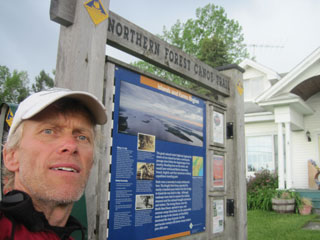
Signing in at North Hero
|
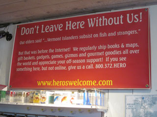
In Hero's Welcome
|
|
Eventually she arrives and we load the car to drive to Alburgh. Now is the chance to wash and dry clothes, to spread out any gear that's
damp to dry, and to have the first hot shower of the trip, as well as a cooked dinner. I also take the opportunity to offload the first
three maps, no longer needed, and some spare food, the meals that I have been unable to cook. This should lighten my load to where it
would have been had I been able to eat the food.
The weather forecast for tomorrow is a 15 mph north-west wind. That means a lot of exposure on the way to the Missisquoi delta. Options
are still running through my mind as, with thanks to Tod and Michele, I fall asleep in a real bed.
|
|