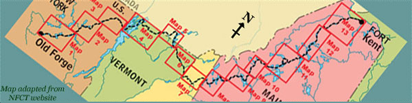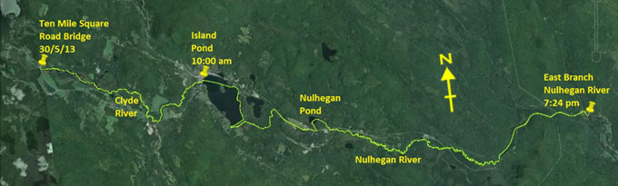
Day 12 route on Google Earth imagery
|
|
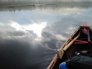
Despite the sky clearing yesterday evening, there was heavy rain frequently through the night. As I wake, the sky is totally overcast;
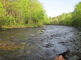
everything is grey. A little trail-mix serves as a stop-gap breakfast, and I'm on the water before 7:00 am. The Upper Clyde here is
wide, and the channel is difficult to follow. Despite having researched this section on Google Earth, it now looks radically different
because of the high water level. I succeed in finding the blind ending pond that my notes forewarn against. At least that means I now
know where I am. I take one other wrong turning that I know of, and end up in a very narrow channel, just like yesterday, which
eventually rejoins the main channel.
|
Clyde River above Ten Mile Square Road
|
A glimpse of the sun
|
|
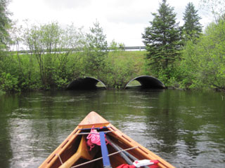
Farther on the river becomes better defined with wooded banks. I carry around the rapids that are mentioned on the map, but soon come to
another set which require a 150 yard bushwhack. As the trees thin out, I eventually catch a glimpse of Island Pond. The sun is coming
out, glinting off the church spire.
|
Decision time at Five Mile Square Road
|
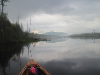
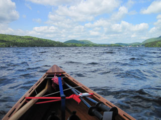
Early glimpse of Island Pond
|
|
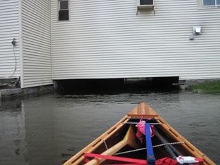
Some time later I am pushing under the Clyde Hotel which spans the river as it exits Island Pond. Control under here is not easy with a
considerable current, and my first attempt results in being swung around and swept back downstream. The second attempt is far more
successful, and I paddle out into Island Pond, the high point in Vermont on the Trail.
|
Limited headroom under the Clyde Hotel
|
On top of the world - for the VT section
|
|
I take out at the beach at 10:00 am and sign the register, before phoning Viveka to announce that I'm on the top of the world! Although
the sun is out, the strong north-west wind is keeping a chill in the air. I wash the canoe, and then head for the Yellow Deli for
breakfast. In fact it turns out to be a double breakfast. The couple who run this place are part of the “Twelve Tribes” commune in
Island Pond. They are keen for me to take some literature, but I decline with the excuse that I have enough stuff to try to keep dry.
|
Looking back at Island Pond
|
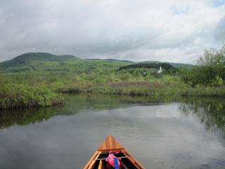
After a long break in Island Pond, I set out once more to find the new carry which incorporates Spectacle Pond. I search the relevant
part of the shoreline rigorously, but to no avail: there are no signs. I'm now stuck in the south-east corner of the pond and must reach
the boat launch in the south-west corner. The 20 mph north-west wind makes this a tough, time-consuming haul. I eventually take out
under the watchful gaze of a couple of surveyors planning some construction work there. Having changed shoes for the long carry to the
Nulhegan, I soon come to a muddy spot, so change back into water shoes. There's no point in getting both pairs of shoes wet. Once on the
road, I change back again.
|
|
Near Nulhegan Pond, a car pulls up, heading east, and the driver winds down the window and starts taking photos while exchanging some
pleasantries. She then pulls away and turns round, parks and waits for me. Apparently she had already passed me, found me to be an
interesting photographic subject, and turned round to investigate. I now stop and unload to talk to Jennifer for a while. She's a
professional photographer. I give her my card, hoping to receive copies of some of the photos. She wants to help by giving me a ride to
the pond, but I decline. She does, however, have a good supply of water, and replenishes my dwindling supply.
At last I put into the Nulhegan and paddle out to the pond where I am met by a blast of north-west wind once more. This fades as I now
enter the sinuous Nulhegan River. It's a delightful river, but the tight turns make it difficult to maintain momentum. My progress is
slow, slower than is good for making a campsite this evening. I shoot over at least six beaver dams before losing count, and have to
haul over a downed tree. South America Pond Road bridge proves to have too little clearance, so I carry around it.
|
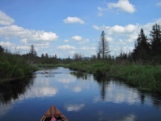
Nulhegan River
|
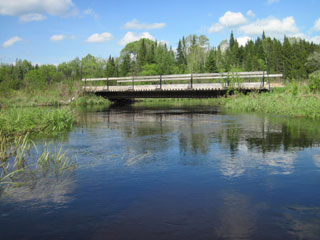
Limited headroom on the Nulhegan
|
|
At the first set of rapids after Wenlock Crossing, it becomes clear that the Nulhegan is not running as high as the other rivers I have
been on recently. The rapids are bony, so I decide against risking the canoe on them. I take out on to the railway as soon as it is
close enough and begin another long carry, but not before removing the first tick of the trip which is crawling up my leg. There was a
time that a three mile carry was a daunting prospect. I now just pick up the canoe and go, regardless of the distance. At the railway
bridge I contemplate getting back in, but the put-in looks steep, and I'm not confident about negotiating past the rapids below it.
Instead I continue to carry along the railway, eventually transferring to the road.
|
East Branch Nulhegan shallows
|
This takes me past Stone Dam, where I would have taken out anyway, and on to the East Branch of the Nulhegan where I put in.
The East Branch is shallow, and I spend more time wading than paddling. I'm aiming for the NFCT campsite, but am not sure how to
recognise it. On passing an area with nicely spaced trees and fairly short grass, I decide that this is as good a place as any, and so
pull out and set up camp. It's about 7:30 pm and the blackflies are swarming me. Even the head net does not keep them at bay; they
merely crawl up inside it. I pump some water and eat a hasty dinner of trail-mix - there's no supply of wood here to cook a dinner -
then soon retreat to the sanity of the hammock. I have not put up the tarp, it being a fine evening. Will I regret this?
|
|