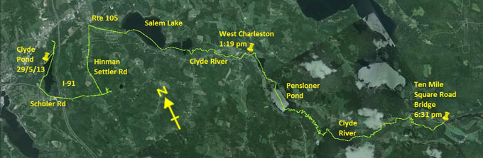
Day 11 route on Google Earth imagery
|
|
Soon after midnight last night the wind came up and was sometimes strong. Light rain started about 4:00 am, but an hour later I am up
with a beautiful sunrise. I succeed in cooking a double portion of oatmeal for breakfast, glad to have gathered and protected the fuel.
Shortly before 7:00 am I'm underway.
|
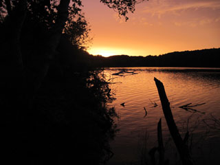
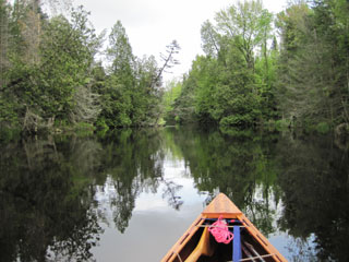
Sunrise on Clyde Pond
|
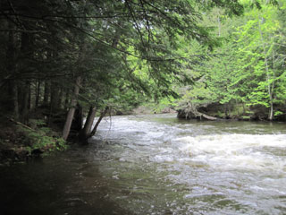
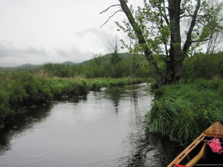
Clyde River
|
|
Initially I try to tackle the Clyde River; I feel that, despite the warning that this is a tough section, I should at least give it a
try. I paddle to the river entrance and start to eddy-hop upstream. After a while progress proves impossible, so I wade with the canoe.
The rocks are slippery, and this is not good for my feet, especially after the Grand Portage yesterday. I try to carry and reach the
first major bend, but it then becomes obvious that this is going to be a strenuous bushwhack or a painful wade, or both. Sadly I decide
to opt for a carry around this section. At least, however, having slogged this far upstream, I'll run the rapids back down, so I
re-launch and enjoy the volume of water in these class II rapids. Back at the dam, I take out and begin to carry.
|

Not the recommended portage
|
More scenic than the road
|
|
My perusal of the map suggests that I can go south of Clyde Pond, follow Schuler Road to Cross Road and this will lead to the junction of
Salem Lake with Little Salem Pond. I head south and turn left on Schuler Road. It seems strange to carry a canoe past a junction with an
Interstate (I-91). At the junction with Hinman Settler Road I go straight to find Cross Road. This road splits. I try the right fork,
but after a while this ends up at a private gate, closed. I backtrack and try the left fork. This splits, but each path ends up at a
private residence. No-one is at home to ask for directions. Defeated, I return to Hinman Settler Road and turn north for the long haul
to Route 105.
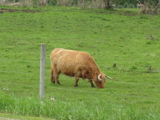
Throughout this carry it rains intermittently, more on than off. A highland cow is the highlight of this part of the carry. On reaching
Route 105, the rapids are still too strong to be worth putting in, so I carry along Route 105 to Salem Lake. If yesterday was the Grand
Portage, this is a “Grander Portage”, probably about 7 miles in all. The decision to take the southerly route was not one of my finer
ones.
As Salem Lake comes into sight it is now raining steadily and the sky is the familiar low and grey that I have come to know so well.
It's also cold again.
|
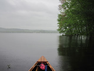
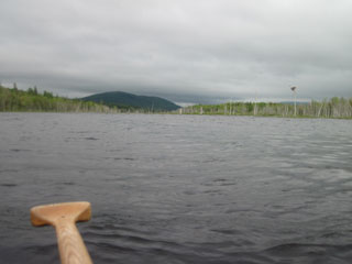
Salem Lake in heavy rain
|
There's an obvious field that leads to Salem Lake, and it appears to belong to the end house, so I knock at the door to ask permission.
The resident is only too happy to allow me to use the land to access the lake, but in return he wishes to be allowed to fulfil his
vocation to evangelise me. Clearly he is serious about his calling as he seems not to care that it is raining, nor that he is walking
through long, wet grass with no rain protection. We have a frank exchange of views as he accompanies me to the water's edge. I suspect
he realises early that I am not one to be converted, but I give him full marks for trying. Apparently a couple of young women on the
Trail received much the same attention when they asked the same permission a couple of weeks ago.
|
|
A headwind, of course, greets me on Salem Lake and Little Salem Pond, but above there the paddling is more sheltered. There's still a
considerable current to contend with, but progress is possible until about a half a mile below the Fontaine Road Bridge in West
Charleston where I had been planning to take out. I take out on my right and cross a field to Route 105 in order to carry through West
Charleston, past the dam.
Part of my plan can still be executed – a stop at Scamp's Deli. By this time I'm cold and need to put on more clothing. The staff in the
deli are good enough to allow me to use their bathroom as a changing facility. Then it's time for a hot chocolate and a large sandwich.
As I'm leaving, Chris from Clyde River Recreation pulls in and has a chat, including suggesting that I launch from his place. It's a
little farther to walk, but the put-in is easy. He also has encouraging words about the river conditions upstream. This is good to hear.
|
Approaching Great Falls carry
|
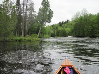
Clyde River - easier going
|
|
I complete the carry, paddle across Charleston Pond, and puff my way up the steep carry past the Great Falls, then take up Chris's offer
of a launching site into Pensioner Pond. The headwind makes its presence felt again in the open expanse of the Pond, but at the far end
I enter an interesting stretch of the Clyde River. It's basically flooded swamp forest, and route finding is a challenge. There are many
routes with water flow towards me. Even the blind endings have enough water soaking through them to generate flow in the channels. I
take a blind ending, and have lost track of exactly where the decision point was that led me here. I'm almost at the point of finding
the easiest access to the road to carry this section when I stumble across a narrow channel with a strong current. Progress is slow, but
eventually this joins a much wider channel, clearly the main channel that I diverged from some time ago.
I follow this channel to Ten Mile Square Road bridge. Chris advised me that camping was to be found on the left above this bridge. I
paddle along this stretch but there's no indication of any good take-out, let alone a place to camp. After about half a mile, I return
to Ten Mile Square Road bridge to scout for a campsite. In the corner of a field there are a couple of trees which are spaced just
right. There is some under-brush, but I tie most of it out of the way.
|
Clyde River
|
Clyde River above Ten Mile Square Road bridge
|
|
Despite the rain for much of the day, I find enough dry wood to cook dinner and brew tea. This feels good after what has been a tough
day, especially the long, and not altogether necessary, carry. It has now stopped raining and the sky is clearing, which means that the
blackflies and mosquitoes are making their presence felt. It's time to retire to the hammock after a quick wash in the river. I shall
aim for an early start tomorrow, with breakfast in Island Pond.
|
|