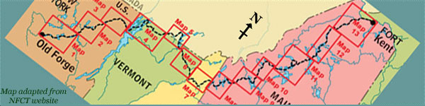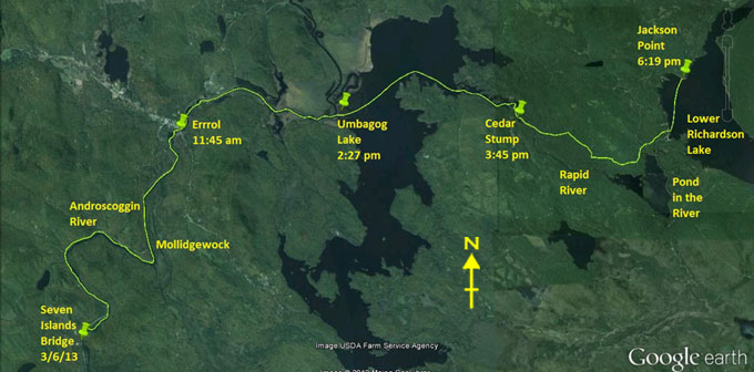
Day 16 route on Google Earth imagery
|
|
We're up at first light for breakfast. Today should be the last I see of my support crew, Ray and Hildy, until the end at Fort Kent,
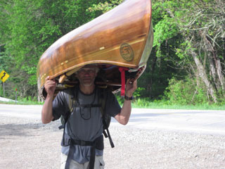
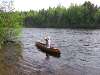
nearly two weeks away. Ray drops me back at Seven Islands Bridge, exactly where he picked me up, as I insist on carrying around it. I'm
not going to cheat on a single yard of the Trail. Well before 8:00 am I'm paddling again, fuelled by a good breakfast and refreshed by
a shower and comfortable bed.
|
Carry starts the day [photo: R&H Danforth]
|
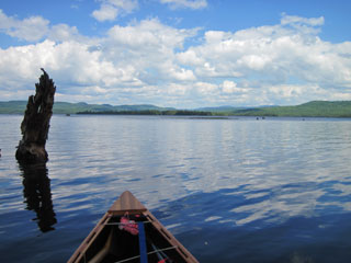
Up the Androscoggin [photo: R&H Danforth]
|
|
As I progress upstream, taking it a little easier than yesterday – there's no deadline to meet – Ray keeps appearing with a camera and
often a bon mot. It will be good to have some photos which are not just from my perspective. Eventually he takes his leave to head back
south, while I continue the long journey north. Whilst I could conceivably call in the cavalry, the plan is that I should now be totally
on my own from here, nearly two weeks unaided, and probably with no phone contact – I have no signal in Maine. We have arranged timing
at the end according to when I reach the infamous Mud Pond carry.
Just past Wayside Park the rapids get heavier. I choose to carry past them, maybe as far as Mollidgewock, but after about a mile
paddling looks easier so I put back in. A combination of paddling and poling and minimal wading takes me up the remainder of the rapids,
more satisfaction at a job well done. Then deep water allows me to make good progress up the eddies all the way to Errol by 11:30 am. My
compass, attached to the centre thwart, has ceased to be functional: an air bubble has been growing, to the point where the needle is
now adhering to the top rather than swinging freely. I walk to LL Cote to replace it, grabbing a sandwich as I do so.
|
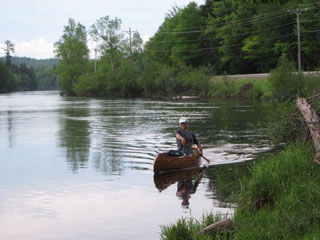
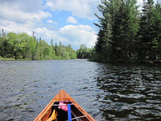
Cruising upstream [photo: R&H Danforth]
|
Harder work
|
|
Trying to phone Viveka, I confirm that I have no signal. A few more attempts and I'll give up on this. I then complete the carry past
the Errol Rapids and put in briefly before taking out below the dam. The put-in above the dam is unclear. I opt for the obvious grassy
bank, but soon find that I'm downstream of the boom, not one that I can paddle over, but which requires me to balance on it, a bit like
log-rolling, while hauling the canoe over. From above I'm interested to see conflicting signs regarding the portage, a small one pointing
right, over the boom where I have just come from, and a much larger one pointing left, maybe to where I should have come.
The rest of the Androscoggin is easy paddling, still against a current, but less marked above the dam, and soon I'm being propelled by a
brisk westerly wind out of the river into Umbagog Lake. This is familiar territory – Viveka and I paddled this section from Rangeley to
Mollidgewock last summer with Ray and Hildy. I recognise Pine Point and aim for it. As I cross Umbagog Lake to the east the waves
increase in size according to the fetch.
|
If I lower my head, I'm invisible
|
Umbagog Lake - the calmer side
|
|
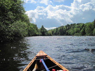
Soon after rounding Pine Point I begin to notice the current of the Rapid River. This takes me by surprise, not because I don't know
that I'm heading up the Rapid River but that the current is noticeable this far out into the lake. It's enough to form standing waves as
it meets the west wind. More eddy work brings me to the Cedar Stump campsite where we stayed last year, and a chance to use the privy.
It's now 4:00 pm, and I have a notion of reaching Lower Richardson Lake.
After crossing to the north bank, I begin the Rapid River carry. It's initially muddy, and I'm glad to be wearing my water shoes still.
After climbing over various downed trees, no doubt brought about by the recent storms, I reach the Carry Road and, with intermittent
checking for the Alligator sign, proceed to retrace my steps of last summer, a time when a 3-mile carry was a big ordeal.
|
Approaching the Rapid River
|
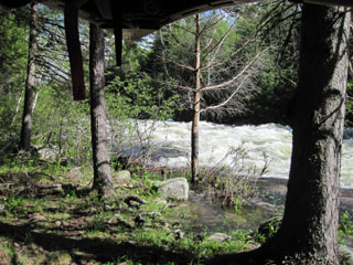
Rapid River from the carry
|
|
The Rapid River is flowing well, and would be great for white-water kayaking today. At the Forest Lodge, former home of author Louise
Dickinson Rich, some fishermen estimate the distance to Pond in the River, but I'm wary of other people's estimates of distance. I see
the Lower Dam which I scouted last year, but decide that the flow is too great to put in there. The carry continues, and somehow I
totally miss the Alligator sign, and therefore miss Pond in the River. The carry continues uninterrupted all the way to Middle Dam, not
what I was planning, but at least I've seen the Alligator before, the remnants of an old steam tug from logging days.
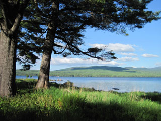
|
Lower Richardson Lake from Jackson Point
|
It's nearly 6:00 pm as I put in and head directly for Jackson Point on Lower Richardson Lake. Pete, a friend of Ray's, has a camp there
and is happy for me to use it. We camped there last summer. I cross to Jackson Point under sun and a few dark clouds. It has been sunny
with clouds most of the day, and this is the first paddling day with no rain. The sky clears as I arrive. I opt not to hang the hammock
but to sleep in the shack, above which someone has carved “BED & BREAKEAST” – every sculptor's nightmare (look again!)
Although I get the wood-stove lit, most of the fuel is damp and I cannot maintain a fire, so resort to the small gas stove which I'm now
carrying. I have only one cylinder which must last the next couple of weeks, so I conserve it as much as possible.
|
|
Once again Viveka's suggestion has proved immensely practical and valuable. I cannot afford to go under-nourished as I head off into the
wilds of Maine where indoor accommodation and opportunities for hot meals are much more scarce.
I'm treated to a beautiful sunset, only the second of the trip, the first since Highwater in Quebec, and then settle to a comfortable
night, albeit a cold one. Tomorrow I'll aim for Rangeley.
|
|