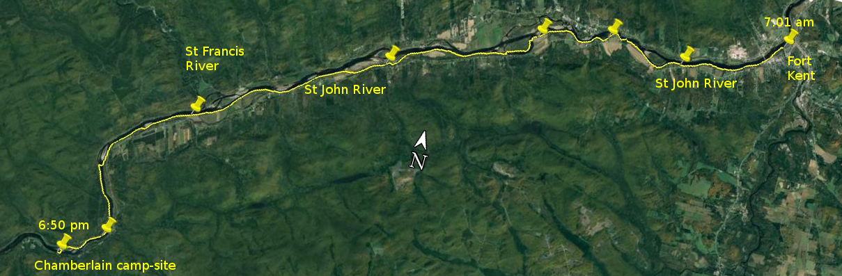
Day 1 route on Google Earth imagery
|
|
My quest for sleep last night was not entirely successful. There was undoubtedly too much going through my mind, and yet I can identify
none of it. I used to teach sciences at high school level, and assured my students, when they claimed just before an exam that they
couldn't remember anything, that that was because they had nothing telling them what to focus on; the exam questions would provide that
focus. I suspect my brain was similarly unfocussed, wanting to think about everything and not knowing where to start.
It was light by about 4:30 am and I was awake to see it. Soon after 5:00 am we were all up, drinking tea and snacking on various breakfast
goodies, after which we packed the car and headed for the Riverside Park. As we crossed the Fish River, we could see it flowing strongly
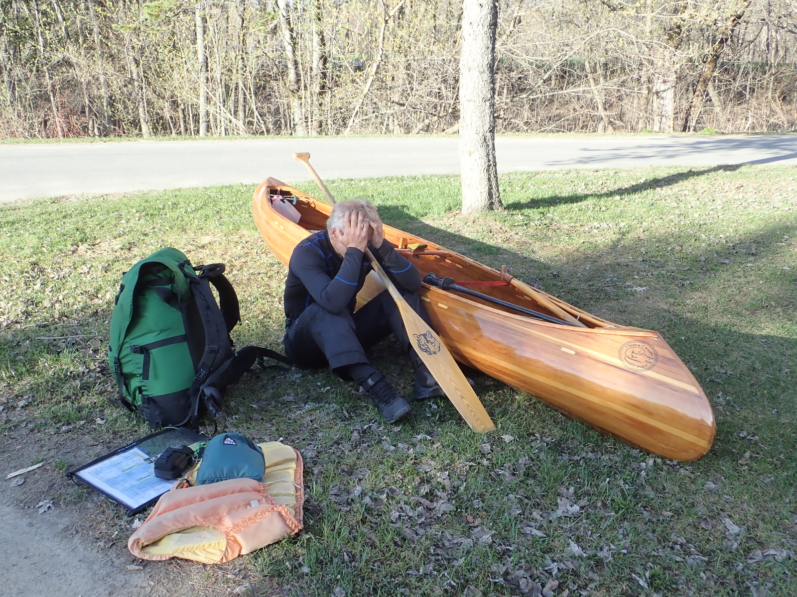
still, and I was glad not to be ascending it. At the NFCT kiosk, the Eastern Terminus of the Trail, we took the obligatory posed photos.
These included re-staging a shot from my trip five years ago, sitting beside canoe, cradling paddle, head in hands. At that time I was
going through a moment of intense personal reflection. This time it might better be interpreted as, “What have I let myself in
for?”
|
What have I done?
|
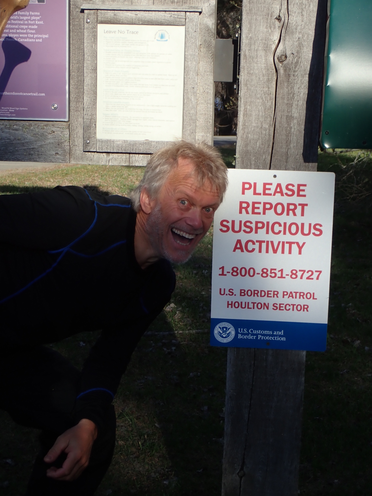
Suspicious? Moi?
|
|
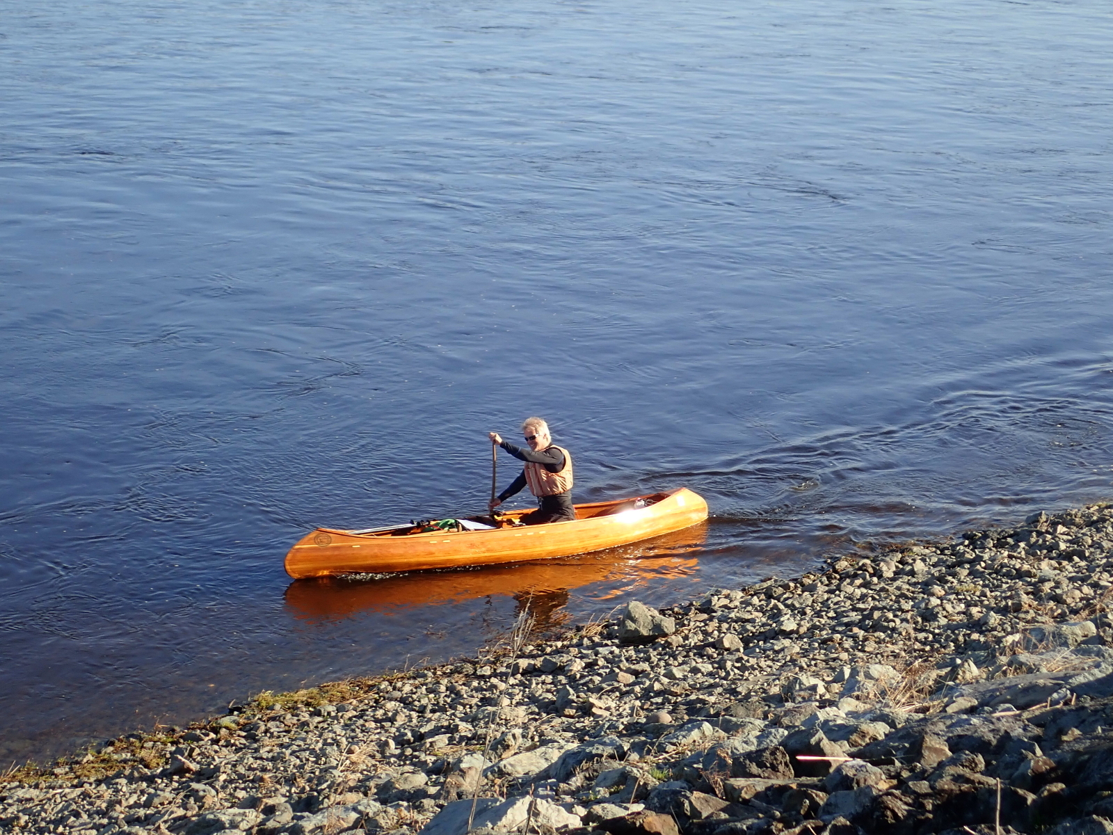
At about 7:00 am I sent the first waypoint from my SPOT GPS Messenger to announce my arrival on the Trail, and climbed into the canoe,
completely forgetting to hug Ray and Hildy. The unfocussed brain had clearly already become so focussed on the task at hand. They were
going to watch me start and then move to near the bridge to take more photos. With that I set off on this intrepid, maybe foolhardy,
adventure, pulling away smoothly from the boat launch. The first challenge was crossing the Fish River outflow. I worked up the eddy as
far as possible before nosing into the current for a ferry glide across. The speed of flow was such that it swept me farther out into the
St John than I had hoped, but persistence brought me to a small channel of slack water between the flows of the two rivers, allowing me at
last to make headway, aiming for the slack water by the south bank. Sometimes this water was slack enough for me to make about 3 mph; other
times it reduced my progress to a crawl.
|
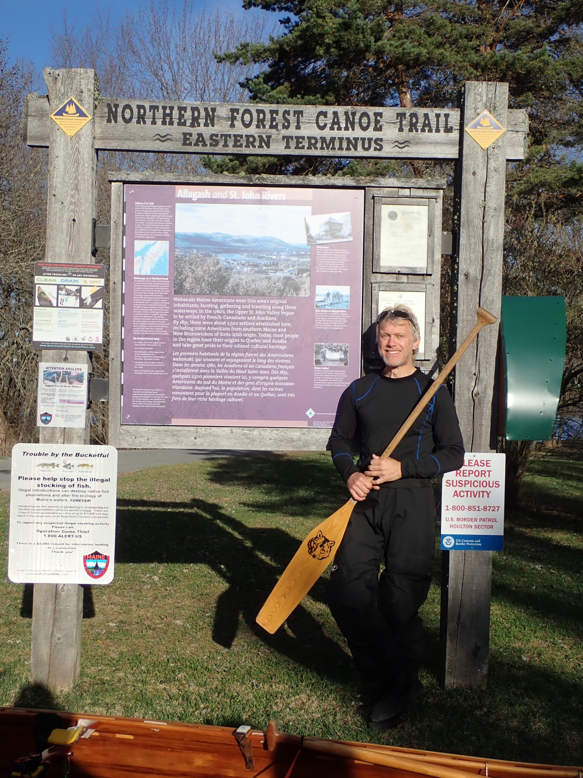
The inevitable posed shot
|

Here goes!
|
|
It was evident from early on that this river would have few good eddies. The sloping, smooth banks made it rather like a flume, with the
current continuing almost all the way to the bank. Karrie Thomas, Executive Director of the NFCT, had warned me a few days previously that
the St John lacked eddies, but I had assured her, clearly more out of hope than of knowledge, that there was always slack water to be
found. On today's menu was a large slice of humble pie! One question, to which the answer constantly changed, was whether to put the canoe
in the slackest water and the paddle in the current, where the relative paddle speed is lower, making the stroke less efficient, or to have
the paddle in the more efficient position in the slack water driving the canoe which was more in the current. Sometimes the answer was
dictated by the depth of water by the bank: a few inches can float a canoe but not accommodate a full paddle immersion. The other thing
that became evident was that upstream was to be a game of infinite patience; I would need to paddle strongly to make progress, but still
needed to be able to last all day.
As I passed under the St Clair bridge, Ray and Hildy were there, taking more photos, and that was the last I saw of them until day 13. I
later learned that they had gone upstream in search of me, but had missed me by only a few minutes, judging by the timing of my SPOT
waypoint.
|
Seeking slack water
|
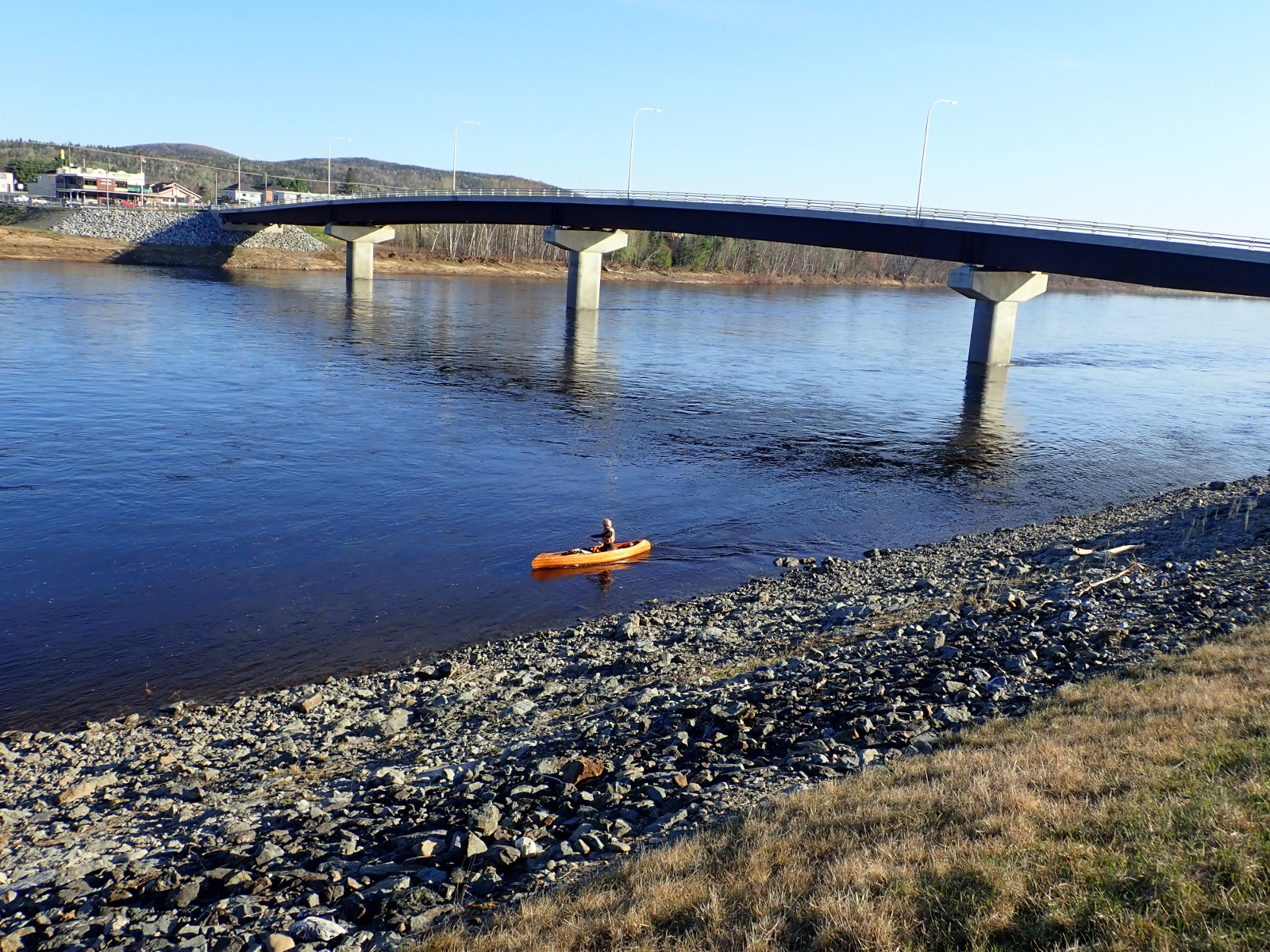
Half a mile gone
|
|
I am very much a rhythm paddler: I like to settle into a groove, a smooth action that repeats seamlessly. Chopping and changing I find
frustrating. The boils, upwellings of water which then spill out in unpredictable directions, played havoc with my course, requiring
regular correction, upsetting the rhythm, necessitating extra expenditure of energy, eating away at my supply of patience. And then the
wind built, even before I had been going for an hour. It rose to about 15 mph from the west, funnelling down the valley into my face and
frequently pushing me into the bank.
I sent frequent SPOT waypoints early on so that Ray and Hildy would know about my progress. If I were to bail out, it would be best to do
this before they made the journey home. I, of course, entertained no such notion, yet progress was becoming harder. My poles came into
action, a pair of ski poles used in double-poling fashion. All in all, I probably poled up about 4 miles of the St John today. The wind
continued to push me backwards. At one point, patience already having lost the battle to frustration, I took out on to the bank and tried to
carry in order to make more progress, but with gusts well over 20 mph, controlling the bow of the canoe was even more of a wrestling
match, making progress even slower, so I took to the water once more.
Eventually, tiring of poling and paddling into both current and wind, I took to wading in the shallows, dragging my canoe. The change of
action was refreshing, and the increase in progress improved my mood. I was pleased to find that the combination of dry-pants and NRS
boots, both bought specifically for this eventuality, restricted water ingress, and made wading in fairly frigid water not unpleasant at
all. There followed a mix of paddling, poling and wading, the transitions between the different means of propulsion becoming well honed,
a slick operation.
In this manner I passed the mouth of the St Francis River and Pelletier's camp-site, where we had stayed a couple of years previously.
Just past the Rankin Rapids I took advantage of the north-south orientation of the river to switch to the other bank (river left) to
shelter under the west bank. This was the first time I had switched sides of the river. Although my advice is to stay on the insides of
bends where the current is typically slowest, crossing a river as wide and as fast as the St John involves losing significant ground, so
was to be done only when it was likely to yield substantial benefits. Rounding a right hand bend I could see, beyond the Golden Rapids,
my destination: the Chamberlain camp-site with a bunch of birch trees and others. Having negotiated the rapids, I crossed the river once
more and pulled in to the camp-site at 6:50 pm, an almost 12-hour day to start. Hammock up, I boiled water to make hot chocolate and a
meal of tagine. A few mosquitoes pestered me in the evening, but probably only single digits. Peepers started up across the river.
Today was a bit of a baptism with fire, but I've learned that tracking, or at least wading and pulling the canoe, is sometimes a more
effective way to make progress than paddling or poling, and is not overly unpleasant. The sky today was blue and the sun shone. I saw a
couple of beaver and some juvenile eagles. It was close to perfect, except for the frustrations and hard work caused by the headwind.
Tomorrow I reach the Allagash and turn south.
|
|