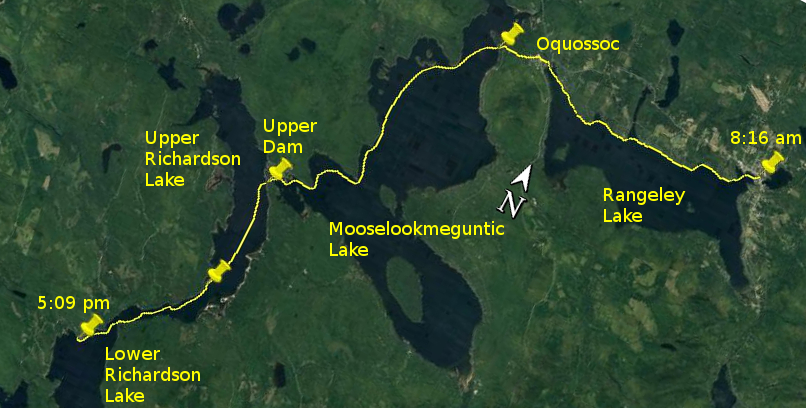
Day 12 route on Google Earth imagery
|
|
Today proved that even what should have been a relaxed day can become arduous. I woke at about 4:15 am, as has become habit, and did some finger
exercises. After long hours of over-gripping in strong wind they stiffen up, especially overnight. I repeated this at about 5:15. The next I knew,
sirens along Main St woke me with a start at 6:25. I jumped out of bed, as well as yesterday's carrying would allow, and quickly packed to vacate my
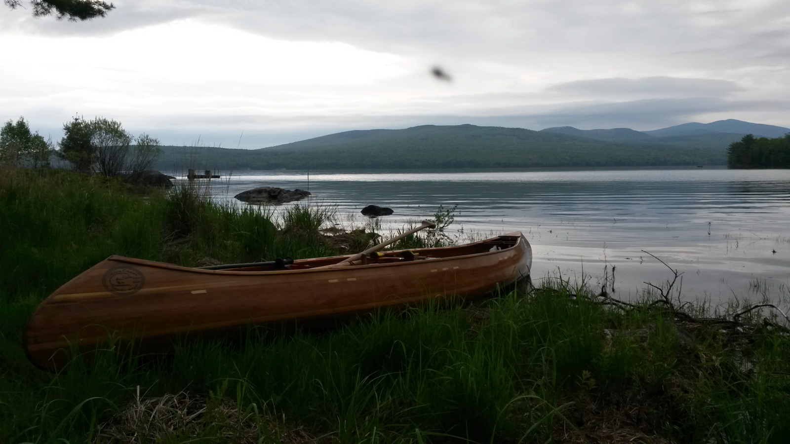
room and to have a prompt departure after breakfast. A relaxed cooked breakfast, chatting with Sue, ensued. Finally I headed out across to the park
and launched at about 8:15 am.
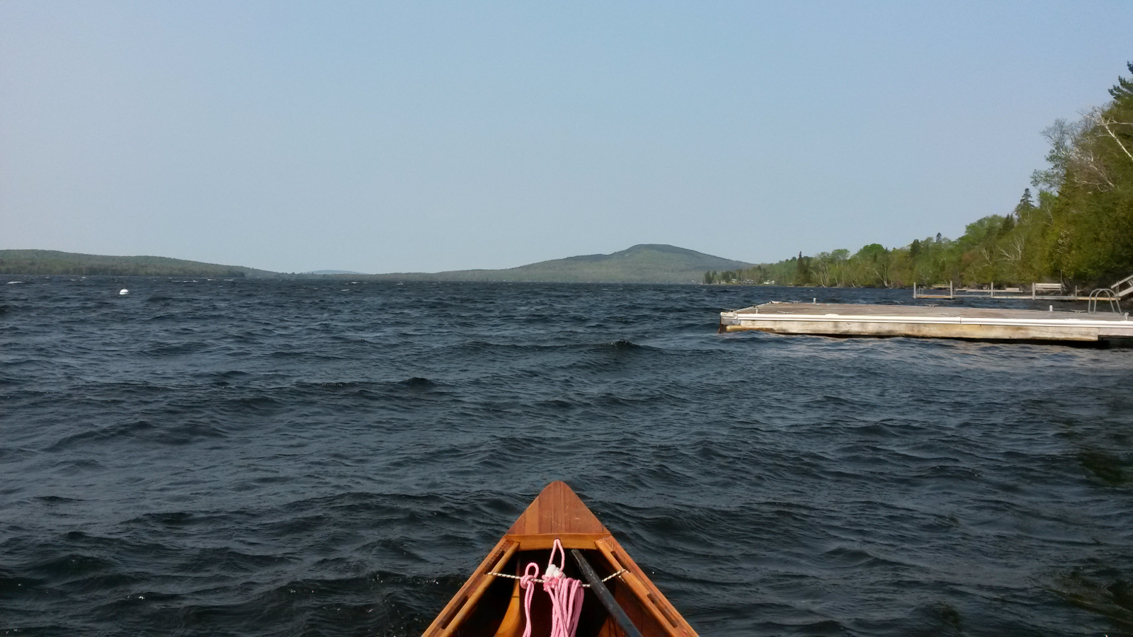
My misgivings about the late start were soon confirmed: a fisherman told me that 30 mph winds were forecast. Already the trees were stirring as I
headed out of the cove. Ahead of me I could see wave trains running to my left (east), driven by a lively (that's an understatement) westerly wind.
I turned the corner into a furious west wind, and made slow progress by finding what little shelter existed against the northern shore of Rangeley
Lake.
|
Rangeley Lake …
|
… in the wind
|
|
Crossing coves, I took advantage of any lulls to make headway towards the next headland, but opted to ferry-glide farther into the cove when the
wind blew at full force, sacrificing some distance as an investment in future shelter as I neared the far side of the cove and, in doing so, not
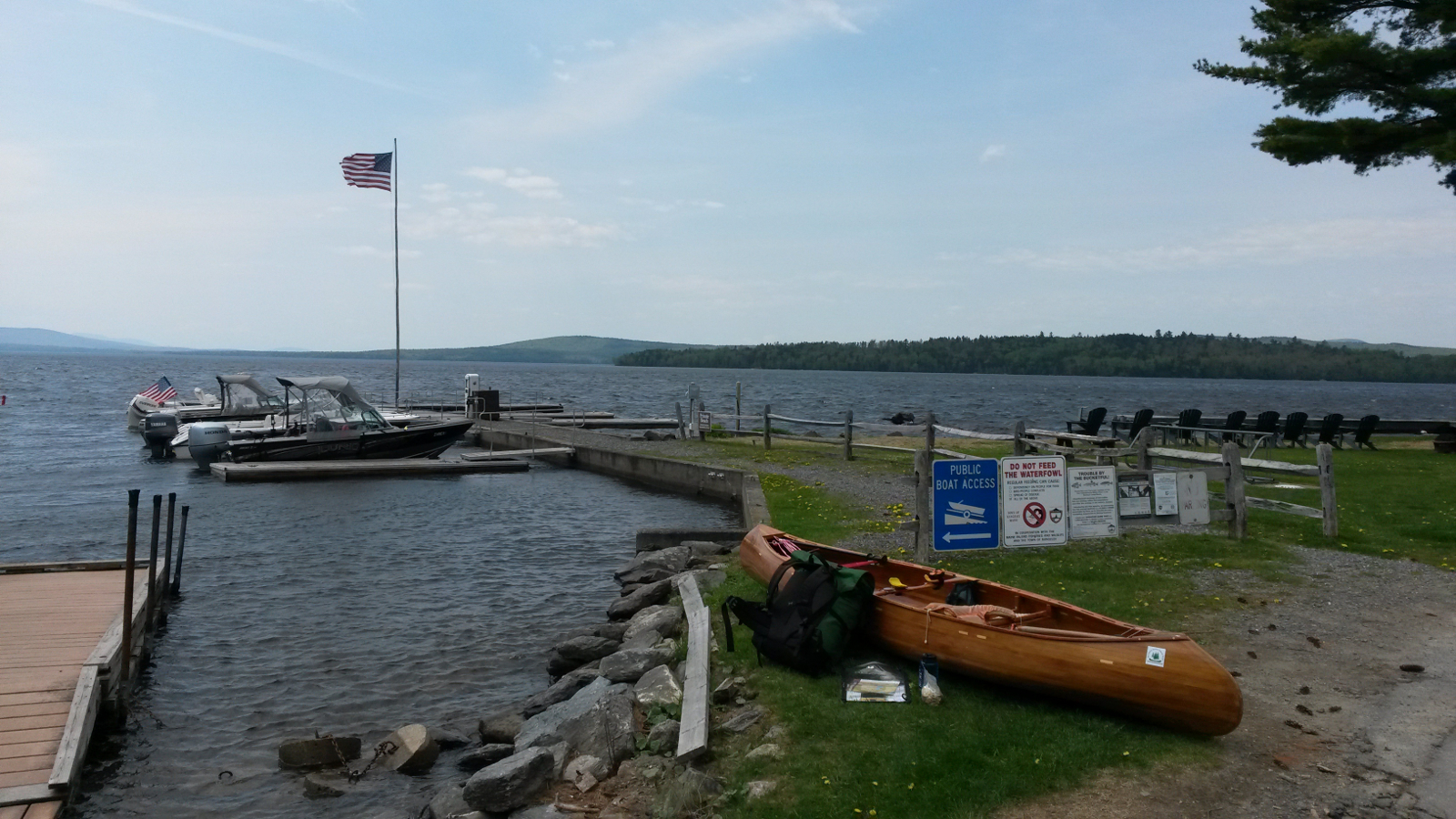
battling directly headlong into the strongest wind. It worked: 2.5 hours later I was in Oquossoc.
Sadly my promise to visit 4-Seasons Cafe could not be fulfilled. The place has changed hands and looks run-down, no longer the neat little cafe, and
it was closed. With a heavy heart I continued the carry to Haines Landing. Half way along this short carry I was offered a ride in a truck, the
first such offer of this trip, and it was easy to decline.
|
Mooselookmeguntic Lake …
|
… in the wind
|
|
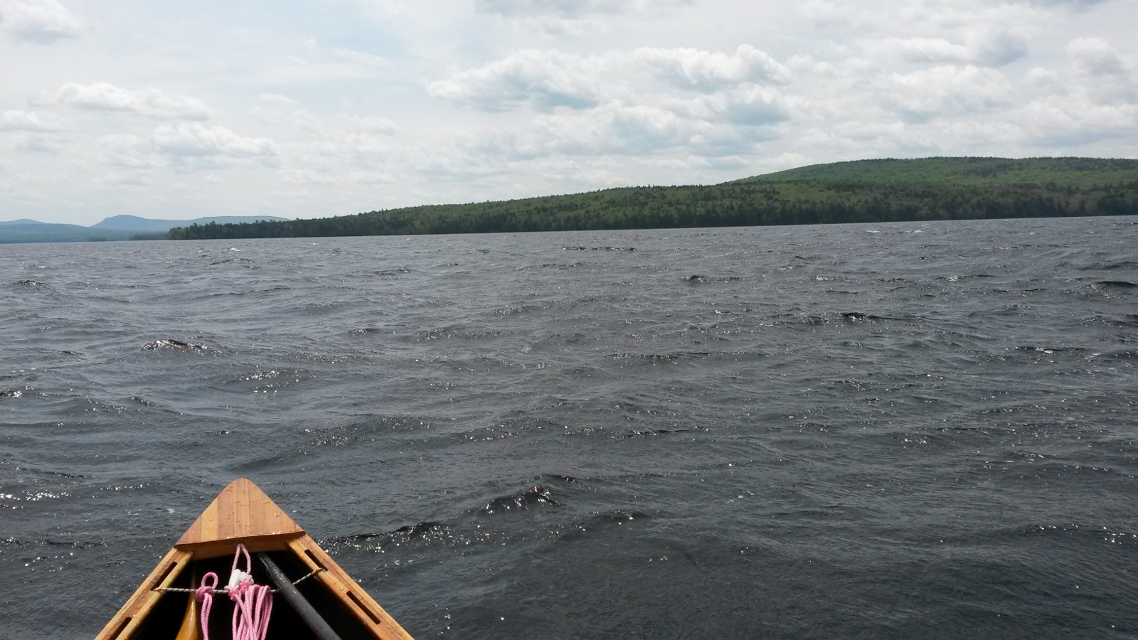
Mooselookmeguntic Lake was as expected: waves piling out of the northwest from Cupsuptic Lake. I immediately set off into the wind for the crossing
to Stoney Batter Point, arriving there just behind a school adventure group who, despite a certain amount of variability, were making headway into
the wind. As they headed into the bay towards the islands I caught them up and chatted briefly. One lad asked how it was that I was going faster
than they were even though there was only one of me in the boat. It was the kind of question that I could have spent a few hours answering, but
summed it up in one word: technique. After offering a few words of well-intentioned advice, I cut away to the south to begin a 3-mile ferry-glide
crossing of Wildwood Cove. The wind was relentless, so I paddled continuously on my left side, maintaining my angle and achieving a very pleasing
line across the cove, checked by taking regular transits.
When the wind blows hard across a flag, it makes a kind of ripping sound as the flag flutters at high frequency. At one point something similar
happened with my ears, a most disconcerting experience. Birch Point arrived and departed, followed by Brandy Point In the final cove to cross to
reach Upper Dam there was no shelter to be had. It was a tough slog to reach the take-out, even close to the dam – the wind merely blasted
over the top of it.
The carry to Upper Richardson Lake, being quite sheltered, was a relief, easy and short and downhill. At Upper Richardson I sat for a while, taking
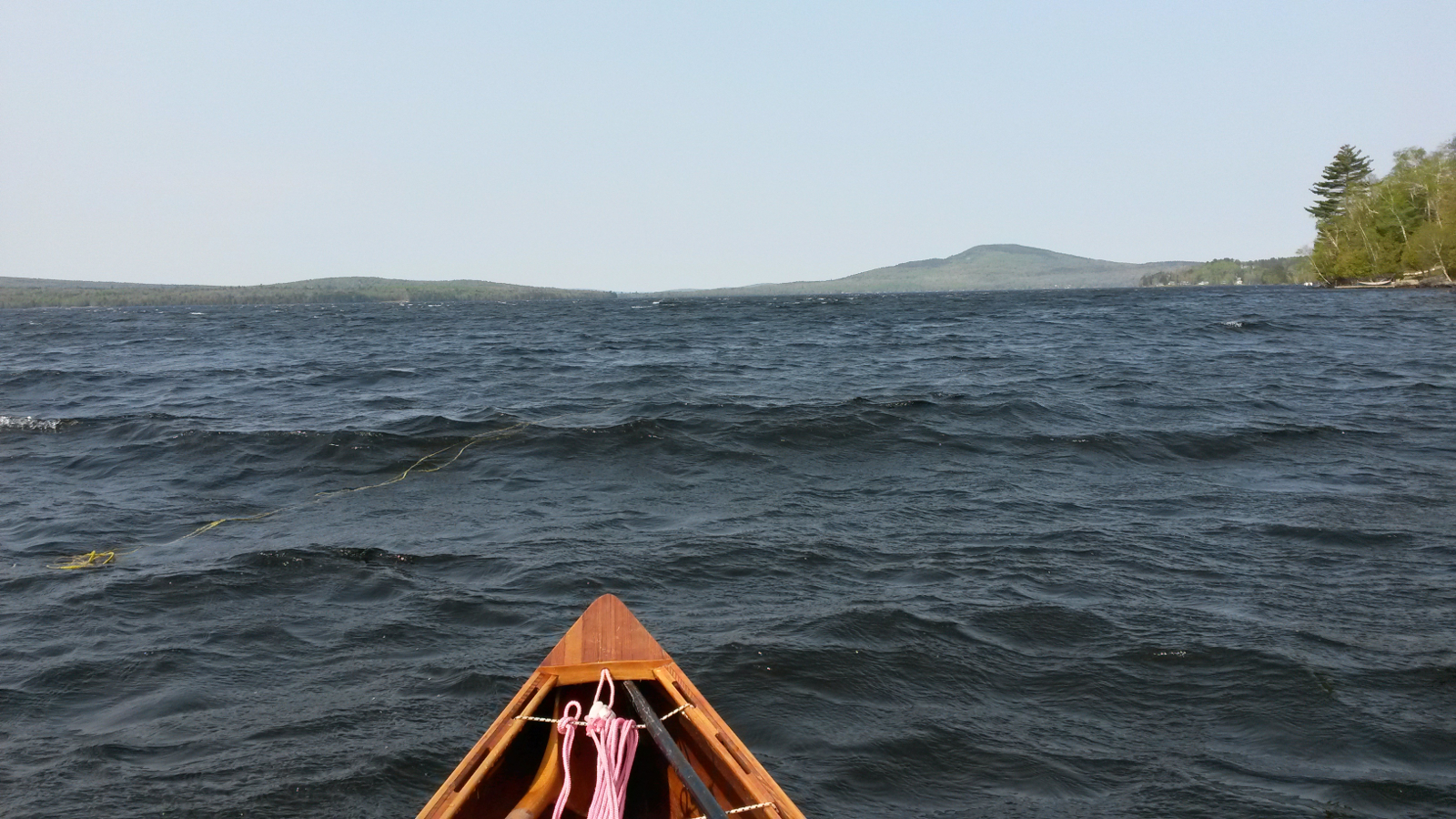
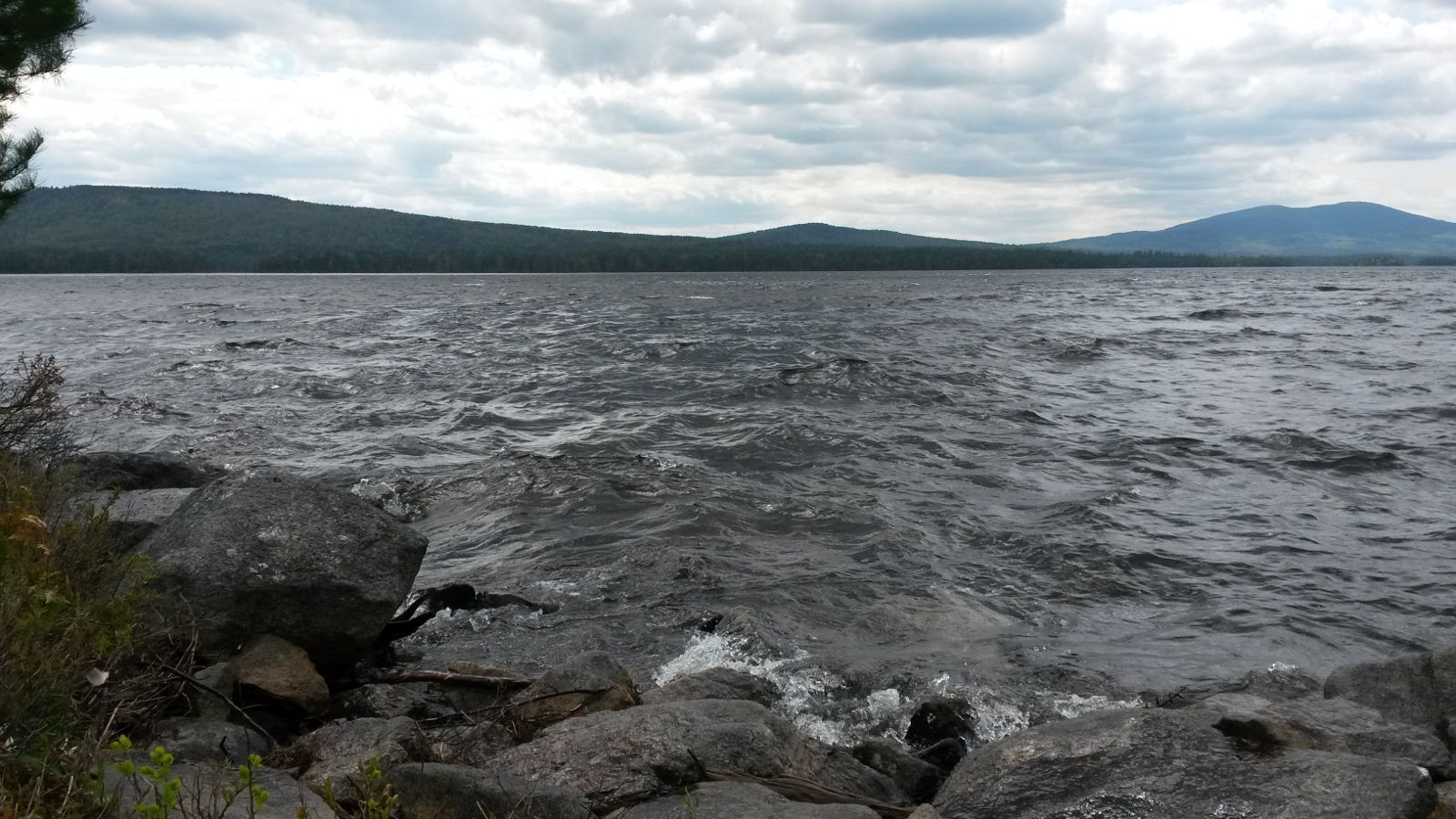
on board fuel for what was promising to be another hard crossing. The scene was partly familiar: rollers were coming down the lake from the northwest.
In addition, though, the strong westerly wind was creating a second set of waves running from west to east, directly towards me. These two set of
waves were interacting to create confused conditions and some very tall waves. It was into this melee that I set out, my sole intention being to
reach the other side where I would be sheltered.
Although it was possible to surf the waves, their direction inevitably brought me back to the eastern shore, the opposite of my intention, so I had to
battle into them, always being alert for those which were curling over, promising to slap water into the canoe. After an hour of extremely hard
work, involving far too much gripping on the paddle, I reached the lee of the far shore, and by that time had ferry-glided a long way south on the
lake. It had been a very long, exposed crossing. When conditions had allowed, I had glanced over my right shoulder to see the put-in receding into
the distance.
|
Upper Richardson – confused waters
|
Evening calm
|
|
For a short while paddling was easy. Then, as the lake curled to the southwest towards the narrows, I could see waves piling to my left again,
promising a return to a headwind very soon. It seemed that the southern end of Upper Richardson Lake should be filling up since waves were piling up
there from both north and south. Maybe I was paddling uphill. I hugged the shore, a time-honoured tradition by now, switching sides in the narrows
as necessary.
The final push to Jackson Point was largely assisted by shelter under the western shore, but blasts of headwind still hit me at intervals. I finally
rounded the point and pulled into the same camp, owned by a friend of Ray's, that I had used five years ago. Since the hidden key had not changed
location, I was able to let myself into a little shack with a bed; stringing my hammock was not necessary. That would allow me a quick exit in the
morning, as I wished to complete the Rapid River carry and cross Umbagog Lake before the wind got up, as it was sure to do.
|
|