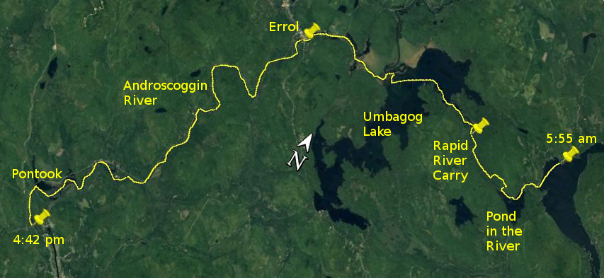
Day 13 route on Google Earth imagery
|
|
Last night was too humid. I soon found on the bed in the shack that my sleeping bag was too much. Although, as it became light outside, it was
tempting to sleep in to try to recoup the deficit, I was mindful of the possibility of wind on Umbagog Lake, so was up by 5:00 am. Breakfast and
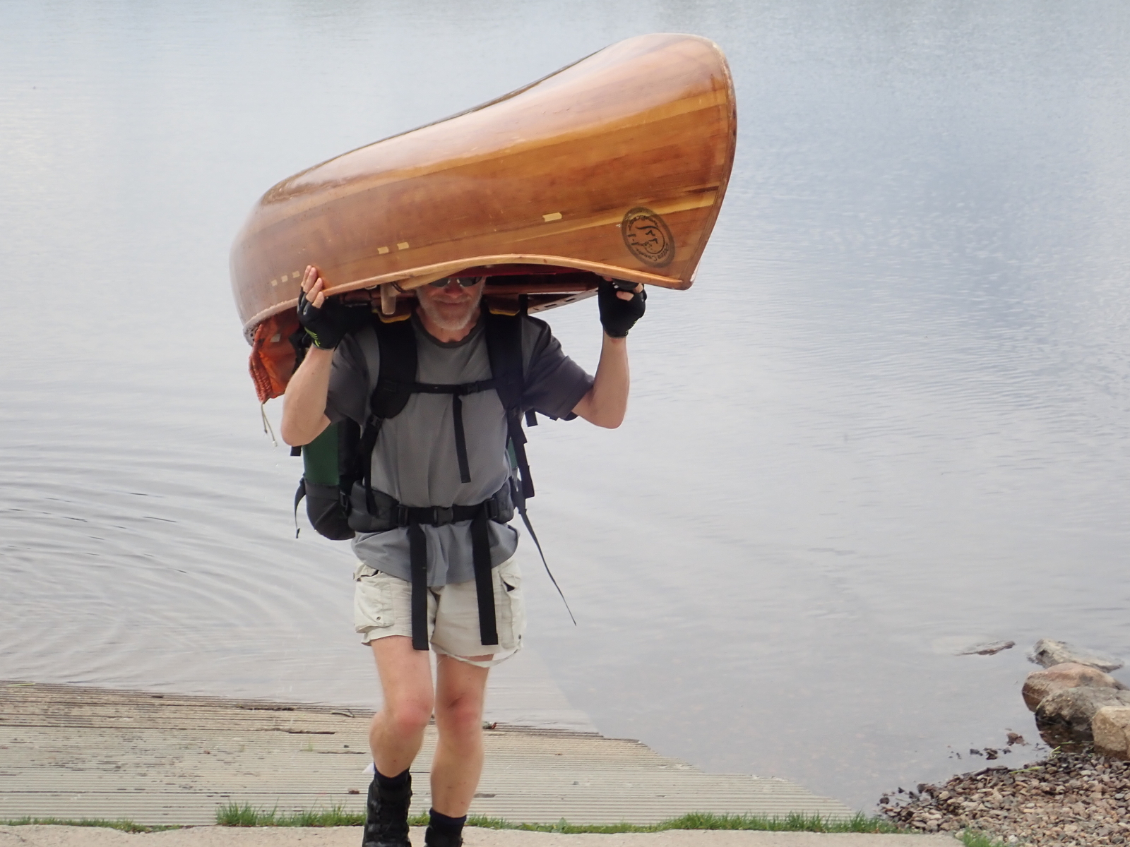
packing were quick, and I set off in almost calm conditions to Middle Dam, found the carry trail and started walking.
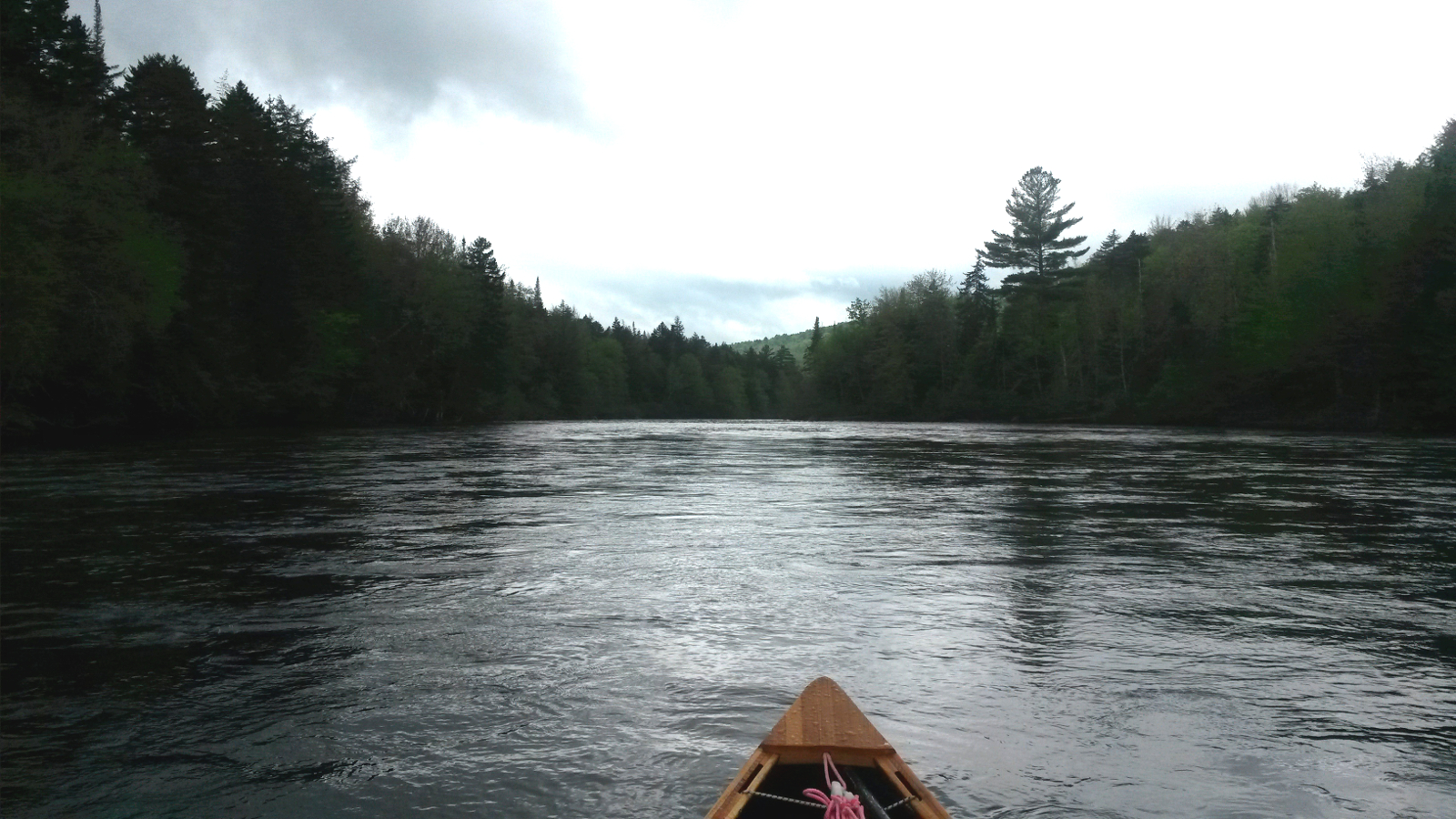
This time I found Pond-in-the-River, so broke up the carry by paddling a short mile. The trail from Pond-in-the-River was in need of some
maintenance, there being several trees blown down across it, but, once back on the Carry Road, all was plain sailing. Not wishing to miss the
turning to Cedar Stump, I scouted an earlier turn which led to the river. At that level it looked paddlable, and I was sorely tempted, but knew that
there would likely be larger rapids farther downstream that would change my mind, so continued with the carry.
Soon after putting in at Cedar Stump a strong westerly wind arose. Then a squall blew through, with rain and strong headwind, making me disinclined
to venture out on to Umbagog Lake, but the squall passed and the wind died. It was just teasing me. As I passed Pine Point to cross the lake to the
Androscoggin River, I espied a canoe coming in my direction. The very presence of a canoe on that trajectory suggested NFCT paddlers, and sure
enough Andrew and Kristen, in a metal canoe with dragon teeth painted on it, were on day 20 of their trip and having a good time. We chatted for a
while and continued on our respective ways, diverging as we had converged, and soon they were nothing more than a distant speck near Pine Point and
a memory of a pleasant encounter.
|
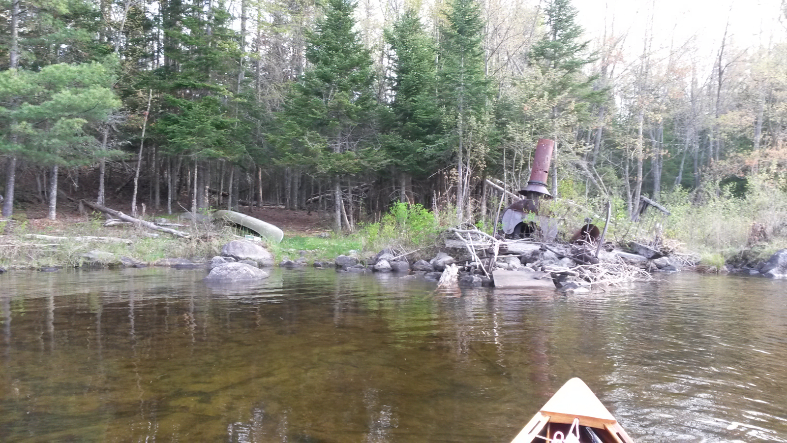
The "Alligator", Pond-in-the-River
|
Androscoggin River
|
|
My initial aim for the entrance to the Androscoggin was perfect, but, on nearing the eastern shore, I began to doubt this and headed a little north,
rounding some islands before ending up exactly where I was aiming for anyway. The early part of the river was into the wind, not strong but enough
to counter the benefit of the sluggish current. It was difficult, extremely difficult, to persuade myself to stay in the middle of the river and not
to hug the bank. I realised just how strongly thigmotactic I had become during the many, many miles of upstream so far covered, clinging to edges, a
tendency reinforced on lakes with a headwind.
Another thought crossed my mind: after all of that upstream, is this the best that downstream can offer? My assessment of the Androscoggin. though,
was a little hasty – it was to improve. I carried past the Errol Dam, having to displace some fishermen from the steps to put in, and then
carried past the Errol Rapids. I had entertained ideas of running these, but had not scouted them, and was on a mission to be picked up by Ray and
Hildy for a night of comfort, so had little inclination to spend time scouting now. After crossing the road, I walked down a boat ramp to look at
the last section of the rapids to see if I might put in there. Someone, very concerned that I might be thinking of taking a wooden canoe down such
rapids, ran over to me to let me know that the end of the trail was farther down (which I knew).
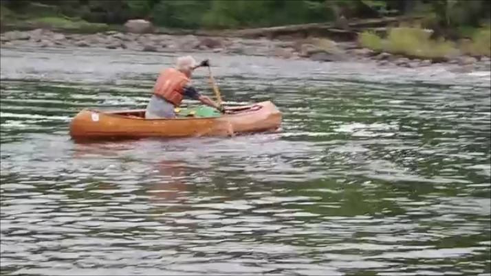
There followed some exquisite paddling, deep water, downstream flow and minimal wind. It rained on and off, but nothing heavy. I was able to make
good headway using good technique, all in rhythm, no fighting, little effort. This was the bliss of downstream that I had worked long and hard for.
The rapids below Mollidgewock had plenty of water and were easy to navigate, and all remaining rapids were similar, with enough space to run along
the edges of the wave-trains and thereby avoid the biggest of the waves.
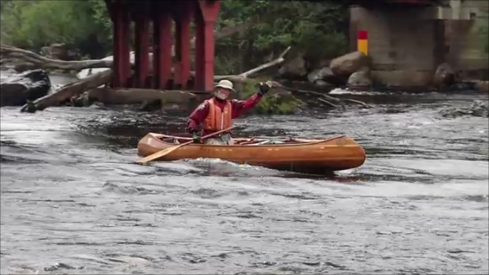
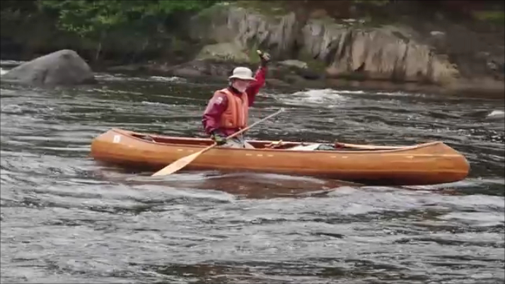
Just as I was lining up to run through Seven Islands Bridge, I spotted two familiar figures on the bank, one with camera in hand and one making a
“T” sign. I passed under the bridge with a wave, pulled into an eddy, and climbed out to greet Ray and Hildy. They had driven farther
upstream in order to find me and to provide me with a hot cup of tea and some Grasmere gingerbread, one of the staples that Hildy makes to bring on
our joint trips. They then returned to Pontook to paddle upstream to meet me as I continued the downstream fun, finding more rapids as easy to
navigate as those above.
|
Acknowledging friends
Photo: R&H Danforth
|
Acknowledging "Tea-time"
Photo: R&H Danforth
|
|
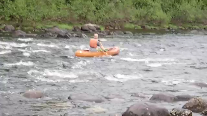
We met about 2-3 miles above Pontook Dam where the current was diminishing, and had a leisurely paddle back to the dam. A quick look at the rapids
below the dam suggested they were runnable, and I accepted the challenge. While Hildy wielded the camera I pulled into the flow and began a fairly
technical decent. Careful route selection was imperative. As with Permanent Rapids five years ago, I achieved an almost perfect run, hitting only
one rock, but that rock was hard enough to cause a sound that I've heard before – an ominous crack. Later inspection revealed a 10-inch split
in the internal fibreglass, which I taped for the remainder of the trip to keep out further water.
|
Approaching Pontook Dam
Photo: R&H Danforth
|
Pontook Dam Carry
Photo: R&H Danforth
|
Entering Pontook Rapids
Photo: R&H Danforth
|
Pontook Rapids
Photo: R&H Danforth
|
|
The final steep drop of the rapids looked too risky, so common sense prevailed and I pulled out to carry along a riverside trail. Eventually it
looked safe to put back in, although carrying my full load over, and balancing on, slippery rocks was an exercise in patience and balance. Every
footing was tried before committing full weight to it. It's one thing to balance on rocks, but quite another when top-heavy. I successfully paddled
the remaining few hundred yards to the take-out behind an island, and carried the remaining distance to the junction of Route 16 with Route 110A.
This is where I would begin my journey tomorrow – with a carry of about 4 miles over to the Upper Ammonoosuc River at West Milan.
Ray and Hildy took me home via an ice cream parlour – all canoe trips must involve such visits – and a pizza place, which provided
dinner. The evening passed with debriefing, uploading photos to Dropbox, something that I was doing at every wi-fi opportunity in case of a phone
disaster, doing laundry, repacking my pack with a food re-supply while offloading some unneeded items, and eating and drinking, not to mention
having my third shower of the trip. Tomorrow they were planning to meet me at the Normandeau camp site near the bottom of the Upper Ammonoosuc,
bringing with them dinner. That was one fewer dinners I had to carry, and it would be good to have another meal that was not dried. By the end of
tomorrow, two of the four major downstream rivers would be complete.
|
|