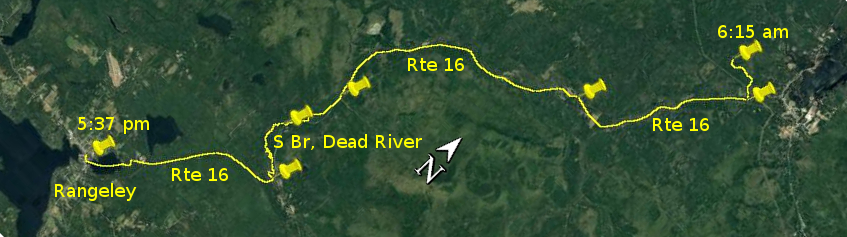
Day 11 route on Google Earth imagery
|
|
Up at 4:45 am with first light, I finally made the decision: today would be a portage day. The prospect of wading on slippery rocks for mile after
mile just didn't make any sense. If I was going to walk, I may as well make some good progress with less chance of injury.
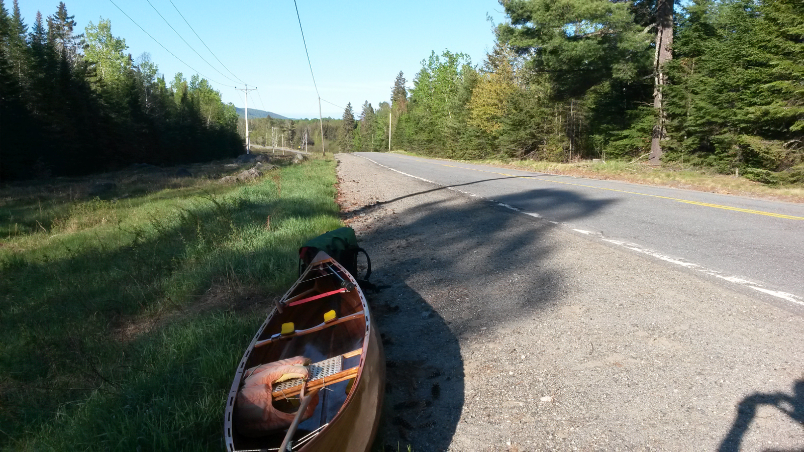
At 6:15 am I started out along the road to the east from the Brochu Memorial Bridge towards Route 16. Sure enough, after 1.25 miles, there was the
main road that would be my companion for most of the day. It started cool, but soon developed into a hot day. Once more I would walk wearing a
14-foot wooden parasol. I was glad to be wearing “civilian clothes”, not dry-pants (although the latter had to be carried). I walked facing the
traffic, shifting on to the soft shoulder when vehicles approached. With very few exceptions, traffic, including all logging trucks, respectfully
pulled over to give me a wide berth. Having heard stories of logging trucks giving way to no-one and offering no quarter, I was most impressed with
the courtesy that they showed me.
|
Route 16 … is long
|
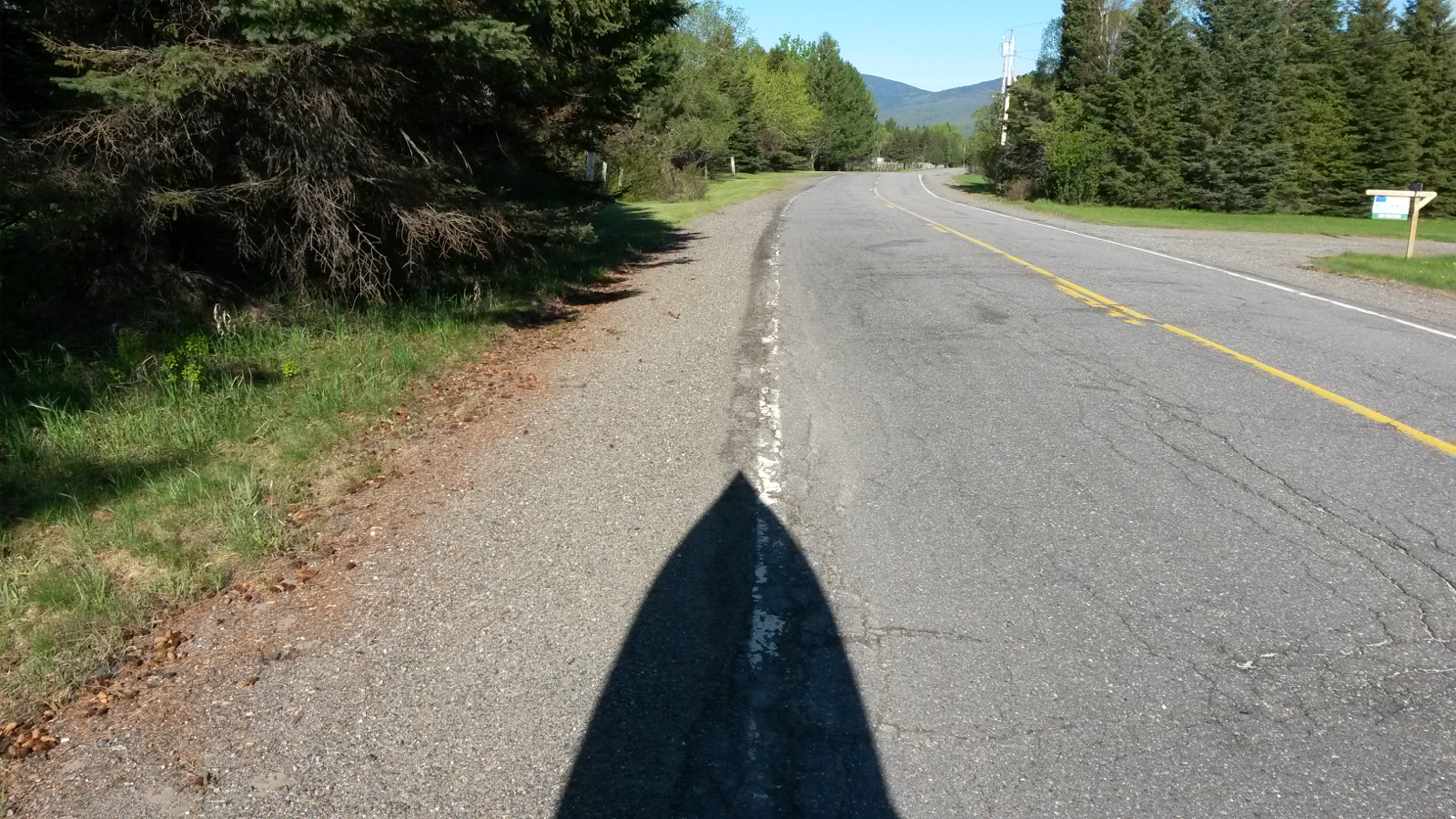
In the shade of the parasol
|
|
I followed my usual discipline of carrying for 20 minutes, followed by a break for a minute or two, sometimes to have a drink. The main reason for
the rest is to allow my shoulders to reset their discomfort clock to somewhere near zero. Each 20-minute bout is usually one mile, although it turned
out that I was travelling faster on the tarmac surface. My boots, lined with 5mm neoprene, whilst great in cold water, were a little on the warm
side for this amount of carrying, but, other than the temperature, they were comfortable.
The end of Kennebago Road appeared, and I resisted the temptation to follow it back to the river. Walking on the left camber, my right hip began to
complain a little, essentially because my right foot was landing higher then my left one (or it may have been due to a displaced sacroiliac joint
which I should have had re-set long ago). At one point the river was close beside the road, but it looked too rocky to be worth getting back in, so
I continued to carry. When the river was next accessible from the road, the discomfort of carrying finally persuaded me that a change of action
would be good, so I once more put back in, thinking that I was at Langtown Mills and that I would stay in the river until the Fansanger Falls
portage. I paddled a short distance, waded a short distance, slipped and fell over a few times, and realised that this was a poor choice. Even though
I had just carried 11.7 miles (measured later), carrying was still the better option.
I took out once more and started to carry, and immediately was surprised to see Quill Lane and a NFCT marker indicating the put-in at the end of the
Fansanger Falls carry. I had clearly made much better progress than I had realised, reaching this point when I thought I was at Langtown Mills, and
it was fortuitous that I chose to carry once more. Otherwise I would have been trying to wade up Fansanger Falls. Another 1.5 miles of carrying took
me to the put-in above Fansanger Falls, and I re-entered the river, fully expecting it to be nice deep paddling up to the Dallas bridge, the top of
the Dead River on the Trail. I was sure that it had been so when I paddled down here 5 years ago, but was in for a rude awakening.
|
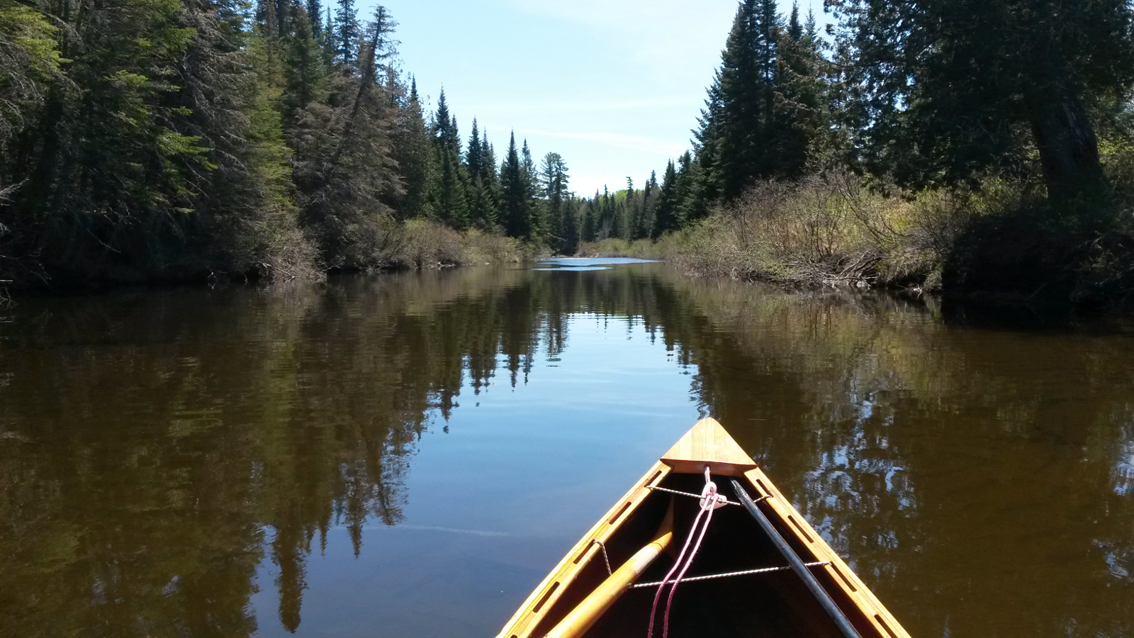
Dead River – deceptively deep
|
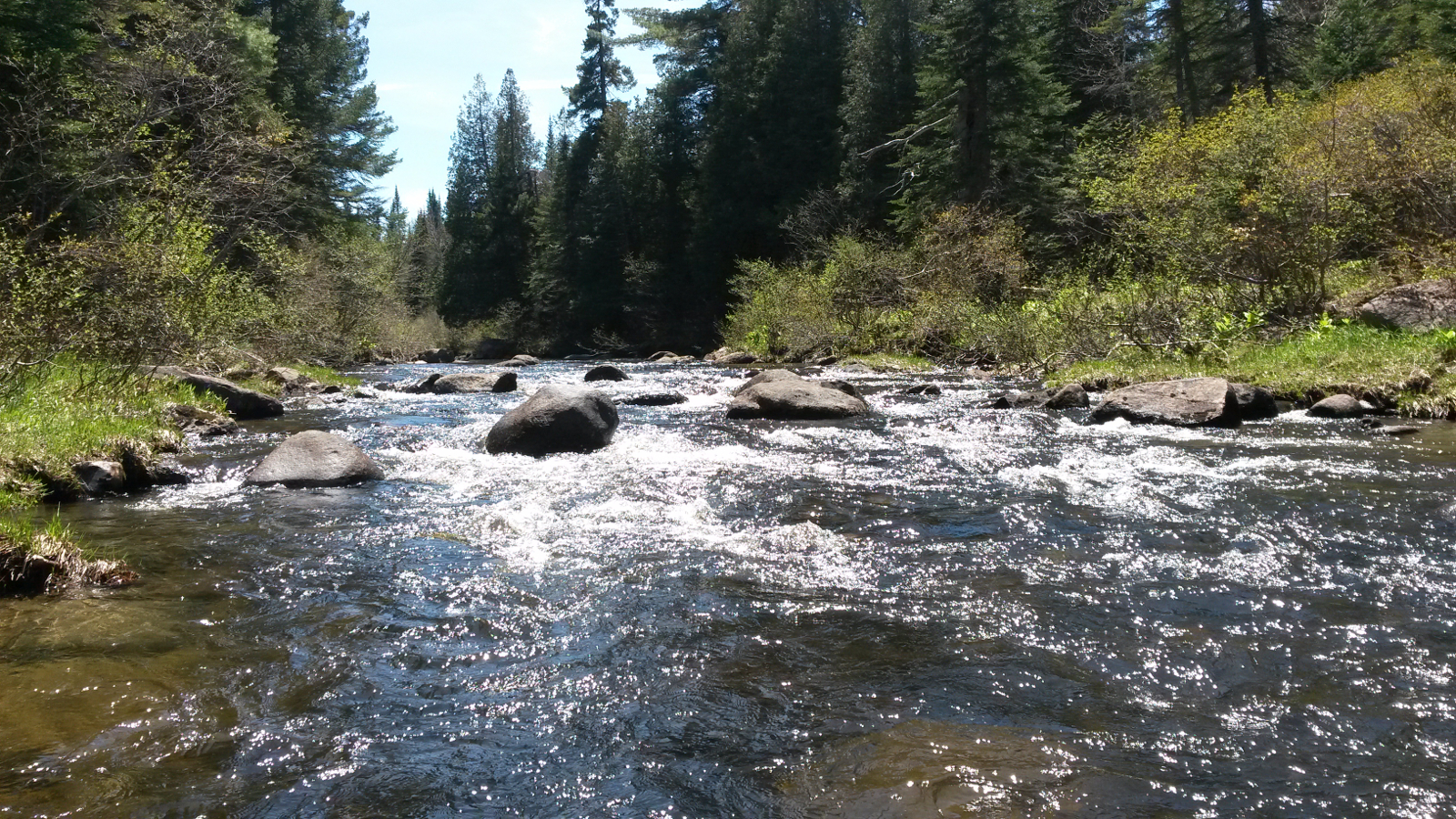
What it really had in store
|
|
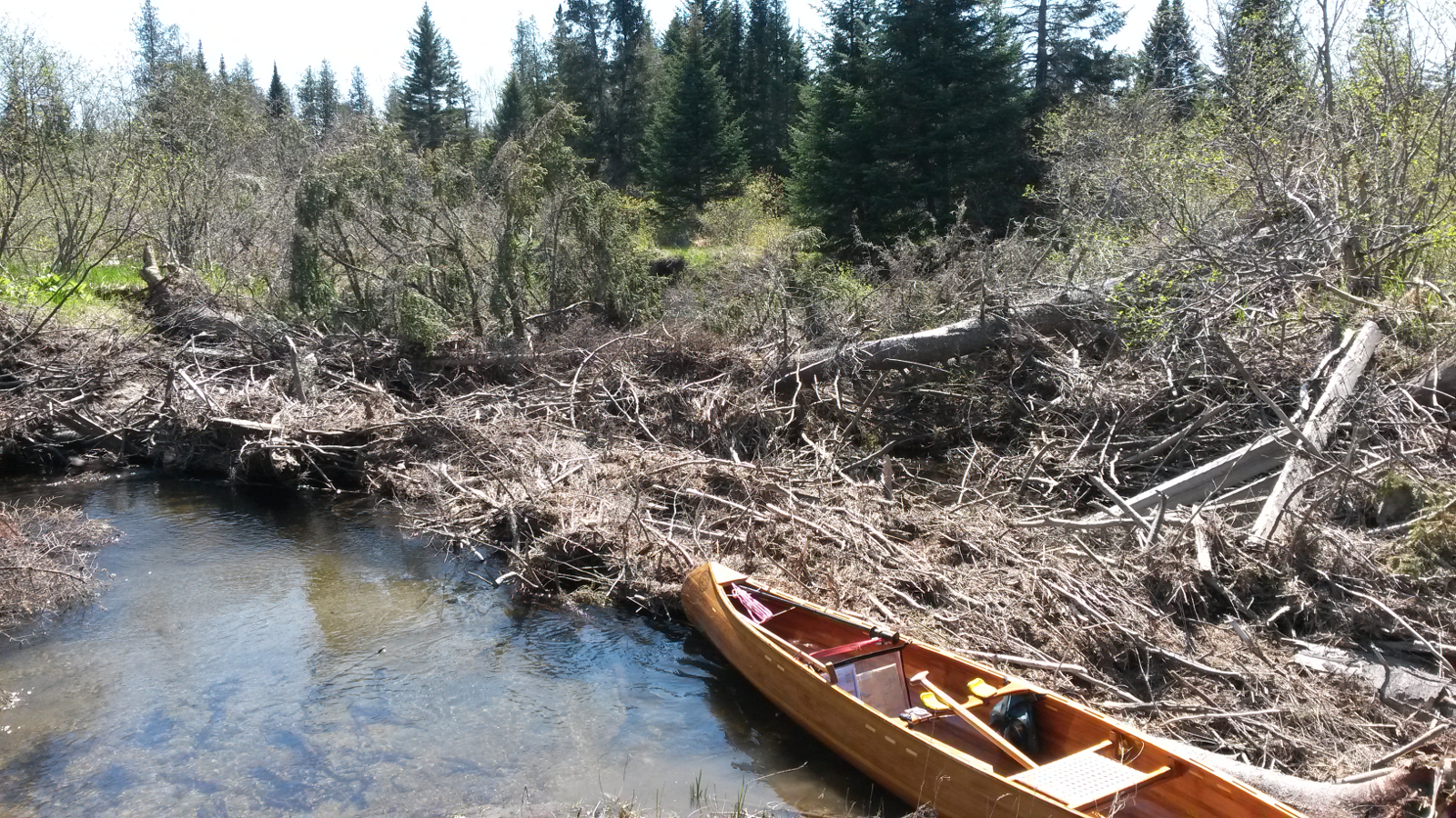
There were several riffles and rock gardens requiring negotiation on foot with more attendant slipping on algal-covered rocks. And then a large
blow-down blocked my path. The portage options were not pretty. I tried to my left, but decided that right was a better choice. Effectively I broke
a way through bits of downed tree, and then returned for my load. Before long another blow-down required a carry around. And then, where my notes
advised me to turn right to avoid an oxbow, turning right was completely out of the question because of a huge snag of fallen trees. My route was
through the oxbow, sinking into soft silt and finally dragging out on to the bank to put in above the blockage. One more blow-down I managed to
negotiate by breaking off a few branches and climbing over it. At least that would create a possible path for anyone else encountering it.
|
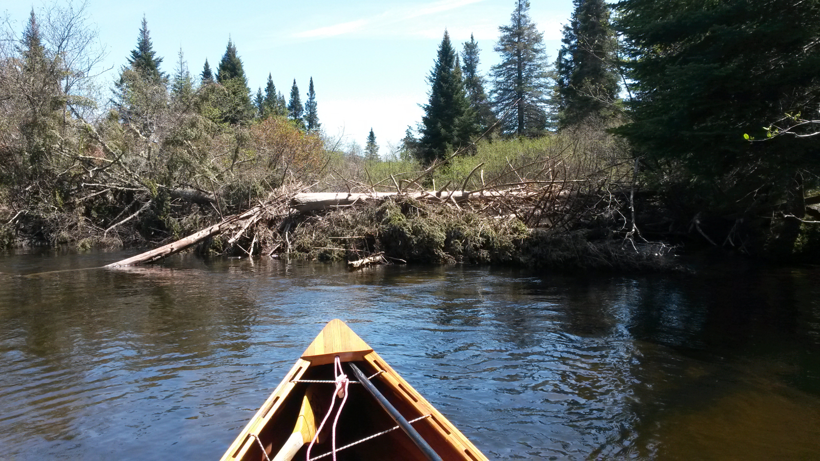
Turn right to avoid oxbow – yeah, right!
|
Where there's a will …
|
|
Some more paddling and some intermittent wading brought me to the Dallas bridge, Route 16 once more, and brought to an end my fifth upstream river.
I washed canoe and boots and face and more, and then sat in the shade, snacking and rehydrating. This was one possible place to stop, but it was too
early yet, and Rangeley was just a few miles away. The lure of some comfort brought me to my feet for another 3.7 miles of carry along Route 16,
taking me through the Maine Forestry Museum and down the Gull Stream trail. I thought to look at the new NFCT lean-to, but after following the path
for a while it seemed that it was a long way and the mosquito population was healthy in the utmost, also apparently starving. I returned and put
into Haley Pond, crossed it quickly to Ecopelagicon, and asked there for advice on accommodation. I was offered a ride to a couple of B&Bs, so,
leaving my pack and canoe, accepted this, secured a room at the North Country B&B, and then returned to collect my pack and canoe for the final
carry of the day, another 0.2 mile (bringing today's total carrying to 17.1 miles, measured later).
Sue at the North Country was very welcoming, and I was glad to have a shower after the stickiness of so many miles on the road. I respectfully left
my (somewhat smelly) boots out on the porch to air. Then it was time to find a meal. To my knowledge there exists no video of me walking a couple of
hundred yards along Main St. What it would have shown is someone who was essentially sigmoid in shape, shoulders stooped, knees bent. The
effects of many miles of loaded walking that day took a while to undo. Even though I covered only about 20 miles today, it was 20 tough miles.
Carries tomorrow would be minimal: a mile in Oquossoc, and maybe 250 yards at Upper Dam. The paddling would all be on lakes, so I was hopeful of a
relaxing day, which was good because the earliest I could have breakfast was 7:00 am, so I would be starting later than usual.
|
|