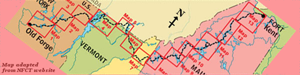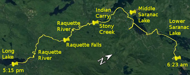
Day 26 route on Google Earth imagery
|
|
I was in bed by 8:00 pm last night, the only refuge from the mosquitoes. Although I woke only a few times through the night, once because of a brief
shower of rain with very sharply defined edges, it was nearly 5:00 am before I was done with sleeping. Maybe the dark of the lean-to – I had
hung my hammock inside it – or the dense tree cover were responsible for delaying the light stimulus that had typically woken me.
Breakfast and packing were quick, and I was pulling away upstream by about 6:15 am, having beaten most, but not all, of the mosquitoes. I loosened
up on Second and First Ponds, and then turned west on an almost windless Lower Saranac Lake. As I warmed up, I experienced the consummate and
exquisite bliss of the paddle stroke coming together. My body rotated in rhythm; the paddle feathered forwards, then almost silently entered the
water for a smooth catch; the pull was joyfully easy as the canoe was gliding, momentum uninterrupted. Too often on this trip either adverse current
or adverse wind (or indeed both) had ensured that this rhythm had eluded me. Now I revelled in the ease, the glide, the perfection of paddling at
its most serene.
|
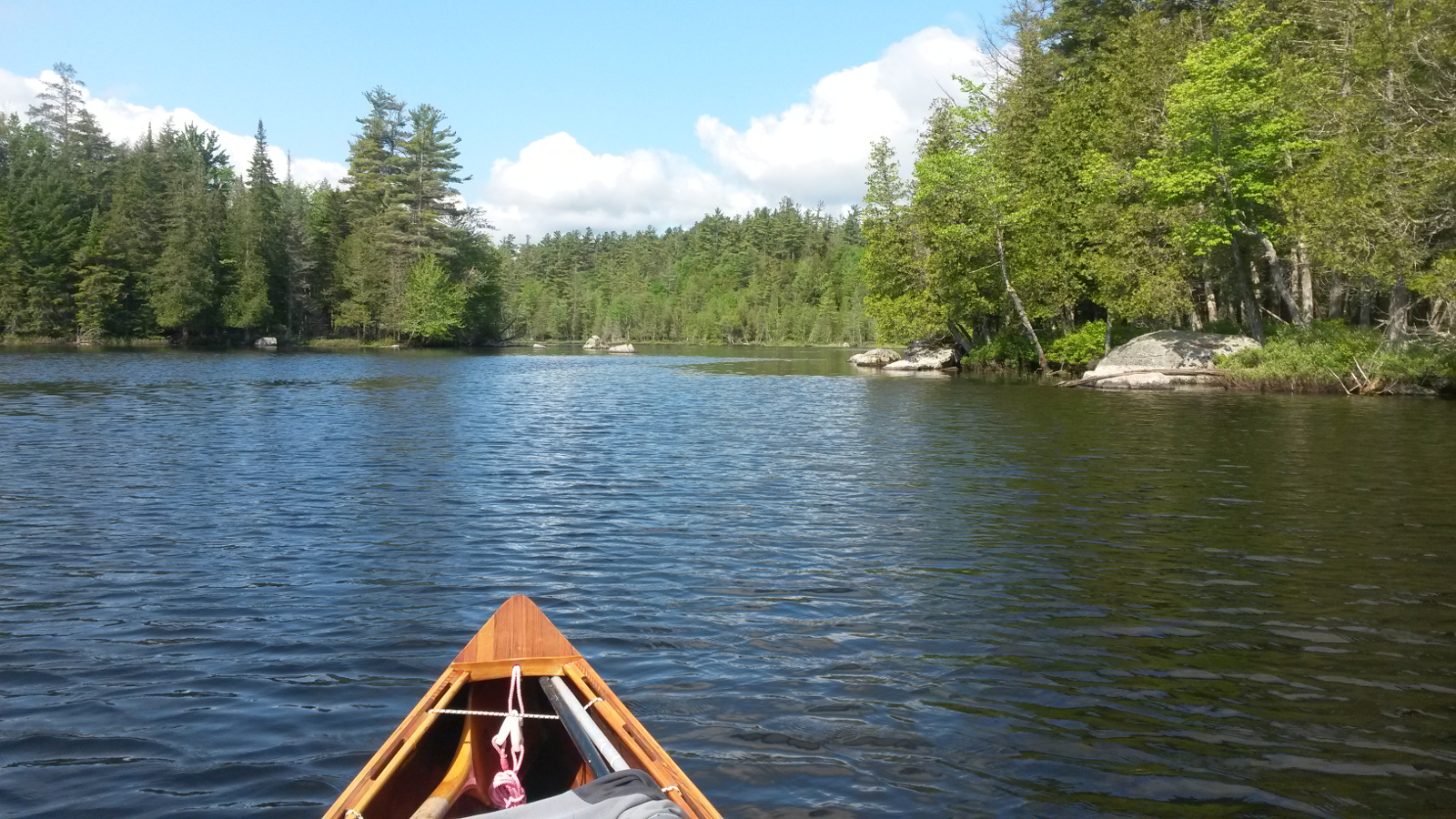
Saranac River
|
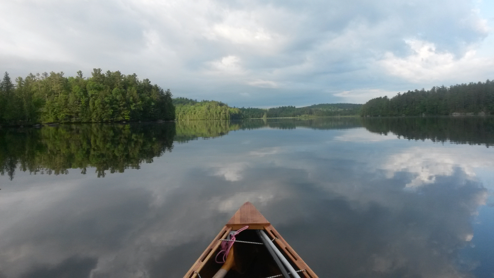
“paddling at its most serene”
|
|
I made a beeline for the inlet of the Saranac River, and was soon at the Upper Lock. No-one was in attendance, so I paddled into the lock – it
was empty and the lower gate was open – moored the canoe, and climbed out to operate the lock. From the recent paddling, my brain was filled
with ideas of efficiency, and it was a simple and satisfying pleasure to work out how to achieve passage through this lock with as few manoeuvres as
possible.
|
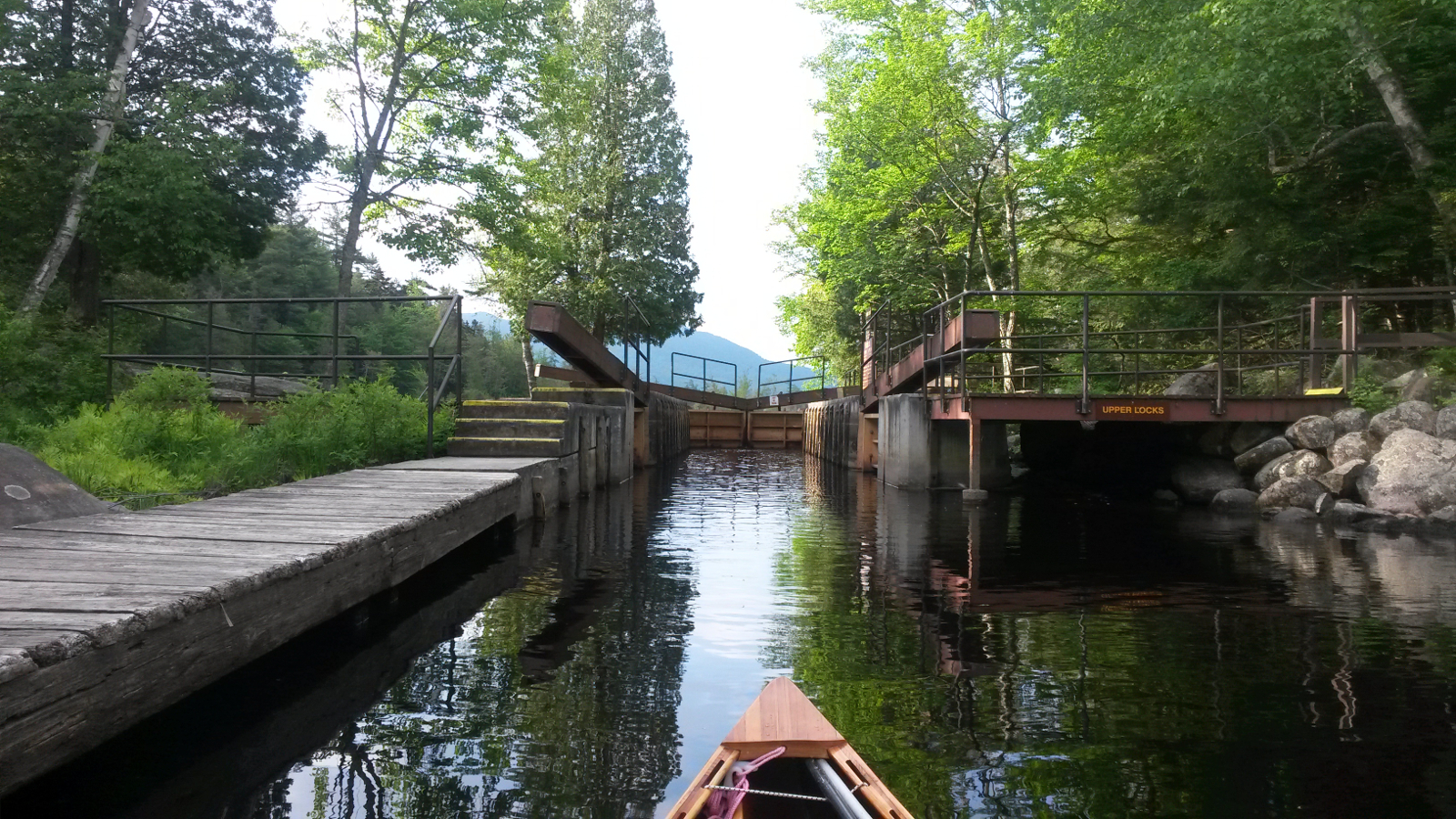
Upper Lock – arrival
|
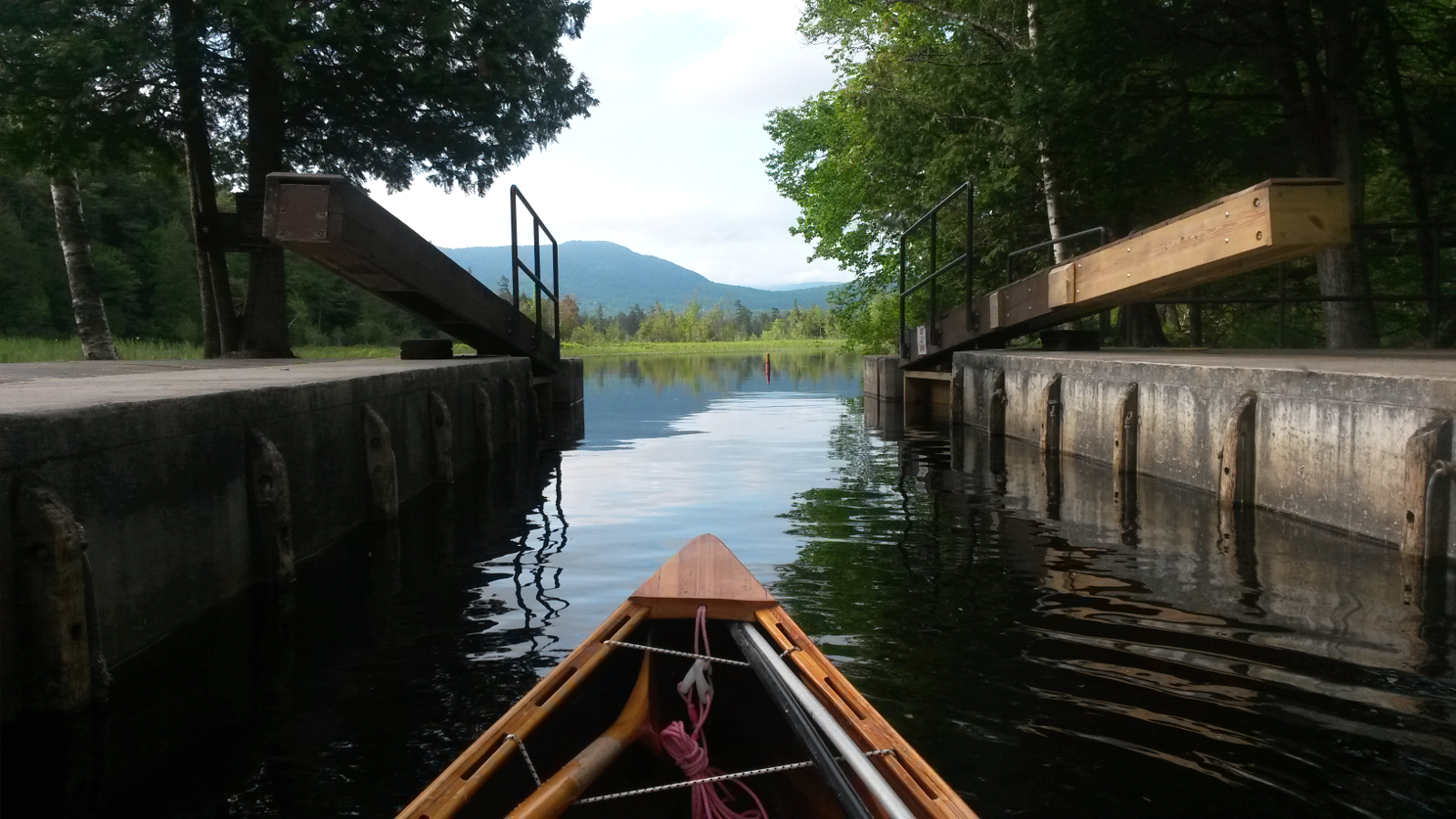
Upper Lock – departure
|
|
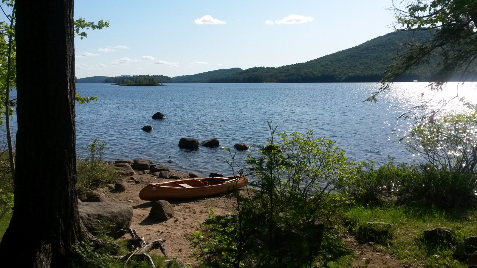
After snaking farther upstream, I emerged into Middle Saranac Lake, and immediately headed for a favourite swimming rock on Second Island. There,
for the first time on this trip, I achieved full immersion. It was a little bracing, but very welcome. It was not until emerging from the water that
I realised I had stripped off in full view of a fishing boat. I also took the opportunity to rinse my T-shirt (which was beginning to smell so much
that even I noticed it) and my underwear (which was probably much the same, but my nose was going nowhere near it!)
With wet clothing donned once more to dry, I headed across Middle Saranac Lake on an almost perfect course – almost. Nearing the other end of
the lake it was hard to know which way to turn to find the river entrance, just like the mouth of the Saranac at Plattsburgh. I chose wrong, turning
left and finding the South Inlet. It didn't feel right, especially when the beginning of the Bartlett Carry did not appear, but I followed it to
just past the Route 3 bridge, only to be certain of where I was, before heading out and along the shoreline to find my intended route, very close to
where I had arrived after crossing the lake. Had I been in a hurry, this would have irritated me, but the paddling was so enjoyable that the extra
half hour just slid by without effort.
|
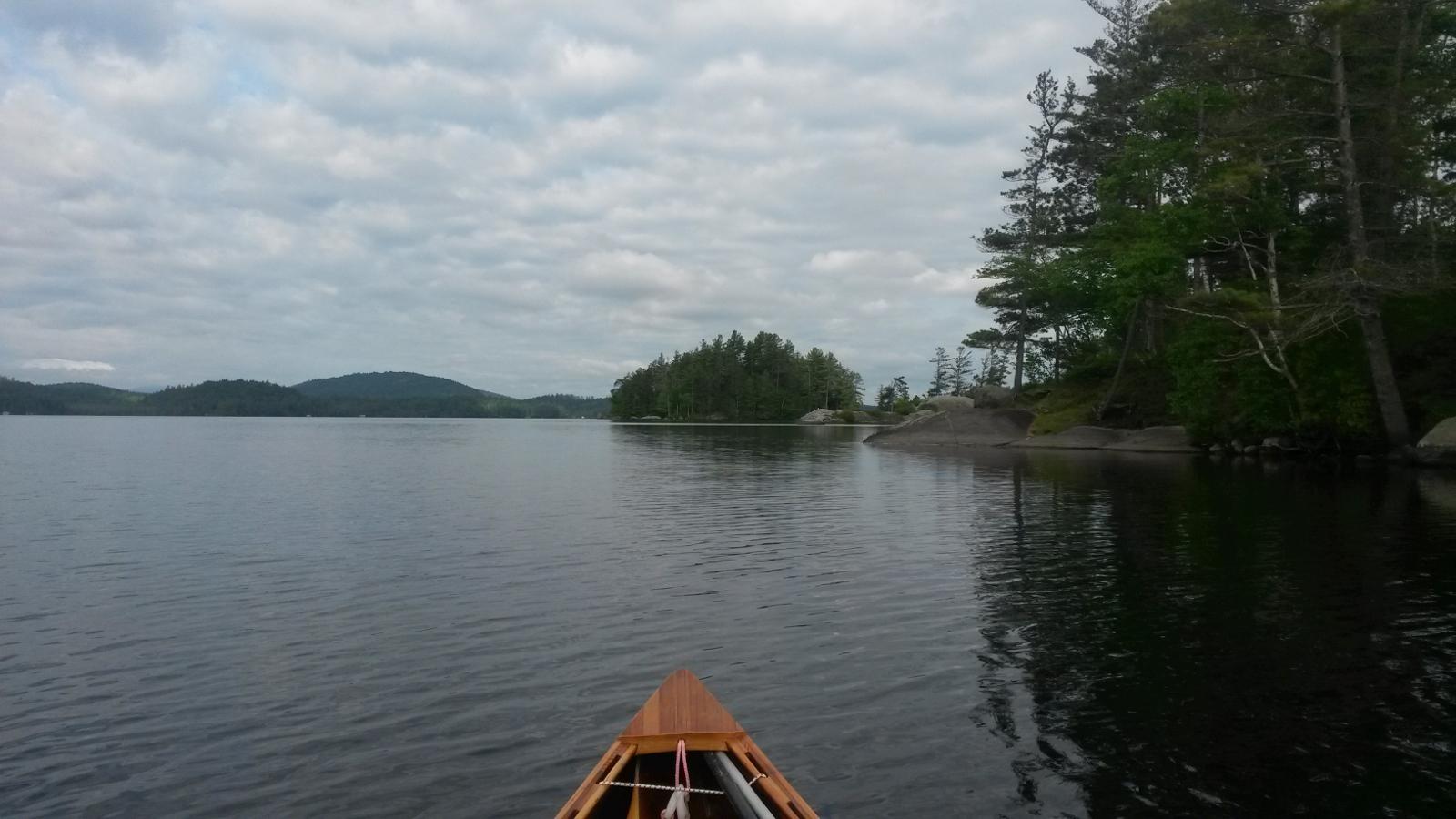
Middle Saranac Lake
|
Approaching Bartlett Carry
|
|
After a couple of bends the Bartlett Carry to Upper Saranac Lake came into view. As I took out, a family of geese came waddling down the carry
trail. As they were reluctant to pass by me, I started carrying, effectively herding them back up the trail until they finally decided to wander off
into the woods. Upper Saranac Lake was brief, although my exit from Huckleberry Bay was hindered by a developing west wind. The Indian Carry from
the south end of Upper Saranac Lake has been altered, eliminating the need to carry along Route 3, and shortening it a little to 1.1 mile. My pack
was now getting lighter as the food supply diminished, and this carry went by with ease. I had adopted the habit of having just one hand on the
canoe to guide direction and maintain balance while the other hung and swung freely in rhythm with my walking. Every couple of minutes I would
change hands. This was something that the perfect balance of the canoe (with paddles, poles and life-jacket) made possible, and it added a
nonchalant air to my carrying (as witnessed later on some video).
Stony Creek Ponds were familiar, and bright blue in the unremitting sunshine, and it was a pleasure to run Stony Creek in the downstream direction,
assisted by a noticeable current. Navigation was easy once more – just follow the current. All too soon my final downstream was over, and I
met my last major upstream: the Raquette River.
|
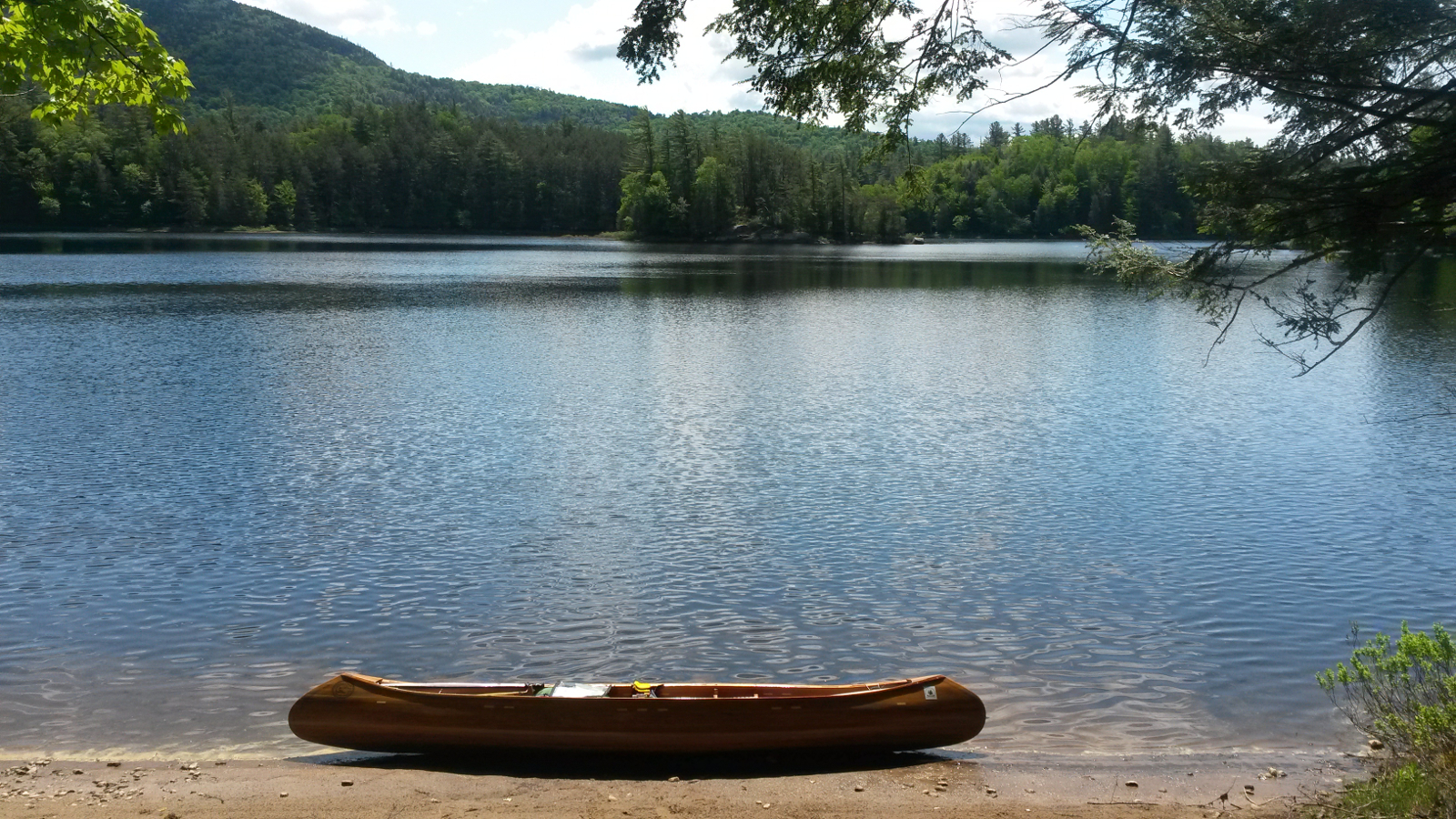
Stony Creek Pond
|
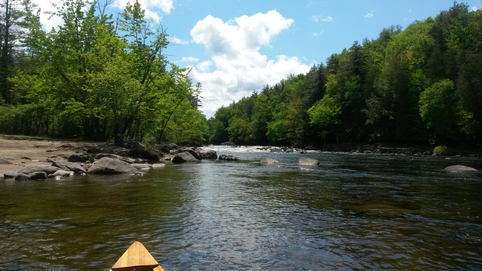
Raquette Falls
|
|
As upstream rivers go, this proved to be delightful: not too much current, reasonable slack water along the edge, and mostly enough depth to plant a
paddle blade. Without trying too hard, but merely by sustaining a focussed effort to optimise my route, I covered the 5.7 miles to Raquette Falls in
1 hour 45 minutes. At the base of the falls I took a break, filtered some water and had a snack. The carry, of course, involved considerably more
uphill than down, as has been a feature on this trip.
Above the falls the deep, slack water lulled me into false optimism, and I was making almost 4 mph upstream. But it didn't last – the current
strengthened and the river became shallower, so progress slowed. At one junction I became confused. Current was pouring out of both branches, yet
this couldn't be the Cold River confluence – that's marked by a huge glacial erratic which was nowhere in sight (and was most unlikely to have
been washed away in floods!) I tried the left branch for a way, but it didn't feel right, and the compass bearing suggested that I was going to head
too far to the east, so I back-tracked and tried the right fork. Within a couple of hundred yards, there was the erratic marking the entrance to the
Cold River. I had not realised that the Cold River forks a little above the confluence with the Raquette, the lower fork usually just passing by
unnoticed while heading downstream on the Raquette.
The remaining 1.5 miles to Long Lake went smoothly and quickly. At Camp Riverdale on the northwest of the lake there were two party pontoon boats
pulled up. That was likely to be too much company for me, and not the peace and quiet that I prefer. The eastern shore was preferable anyway,
allowing the westerly wind to keep down the blackflies, which had plagued me for much of the day. At 5:15 pm I pulled into Plumley's Landing
camp-site, sun shining, blue and almost cloudless sky, and a gentle westerly breeze.
|
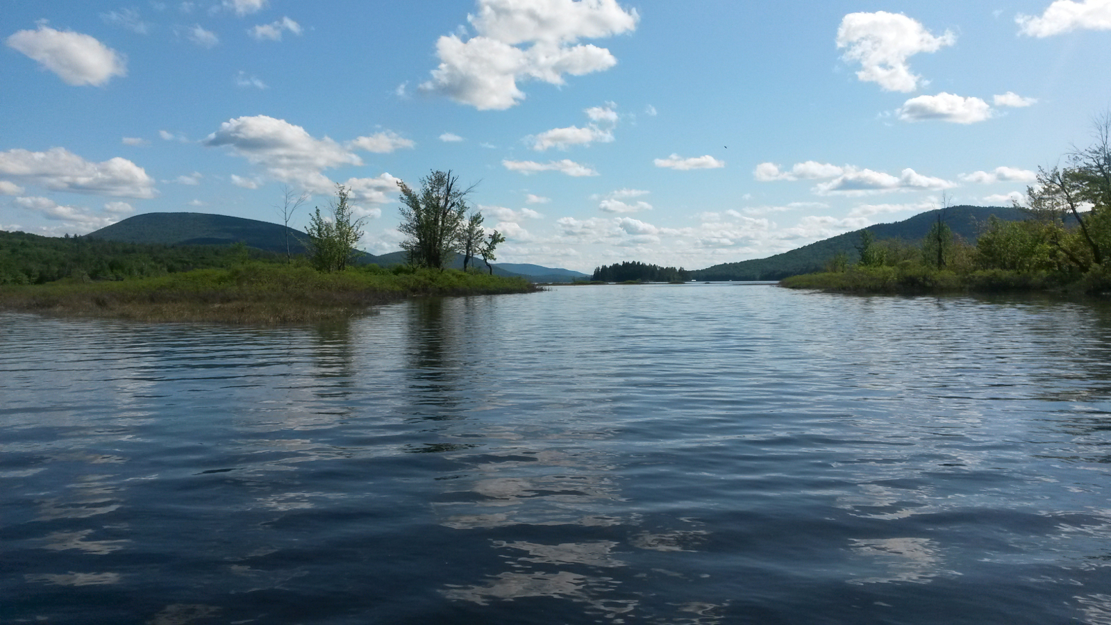
Approaching Long Lake
|
Plumley's Landing
|
|
The lean-to was vacant, and I cooked dinner on the wood-stove on a sandy beach as the sun sank over the mountains to the west. Perfection in
paddling had started the day and perfection in camping was wrapping it up (if the blackflies could be ignored … which is extremely difficult!)
|
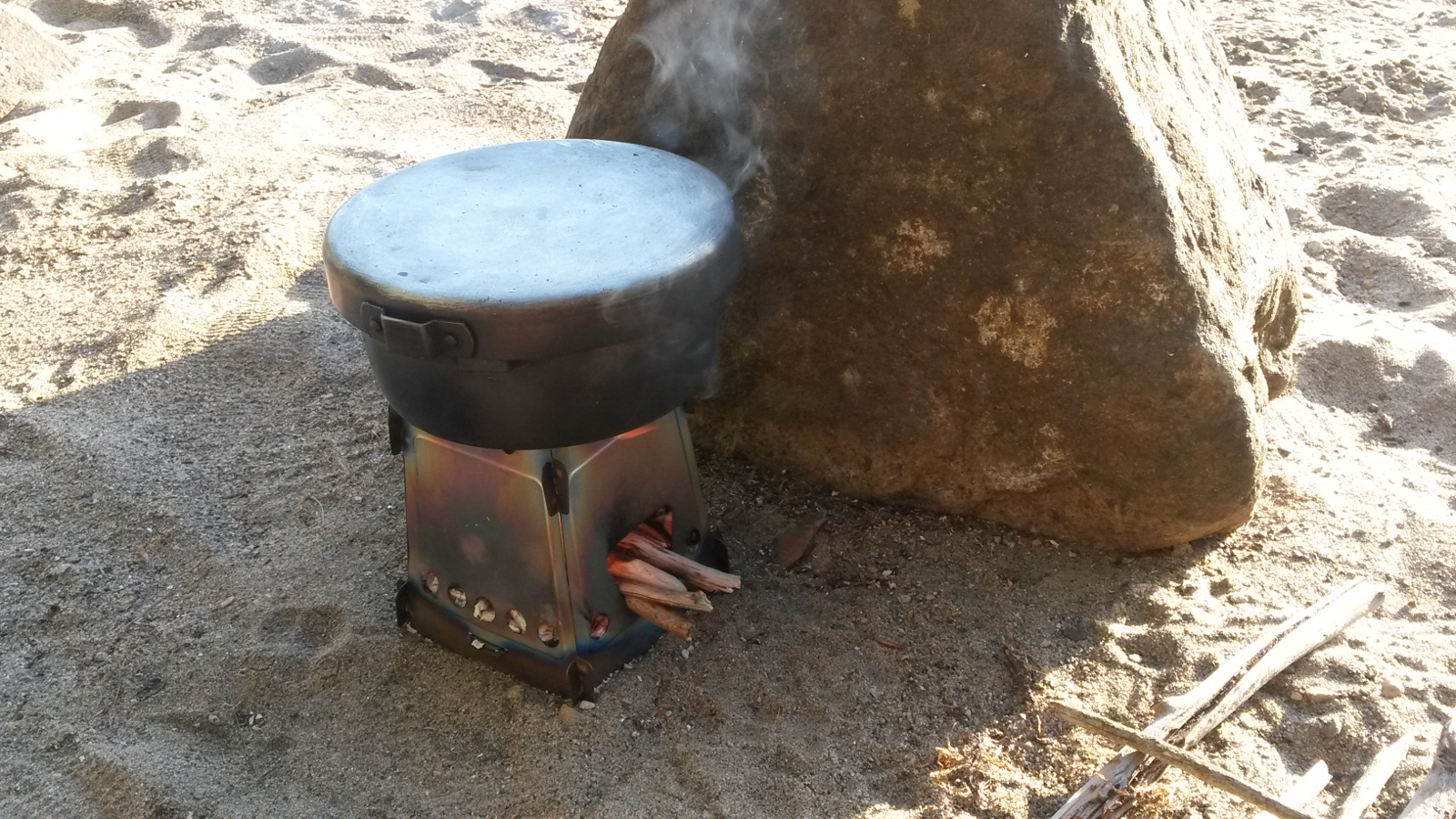
Cooking dinner
|
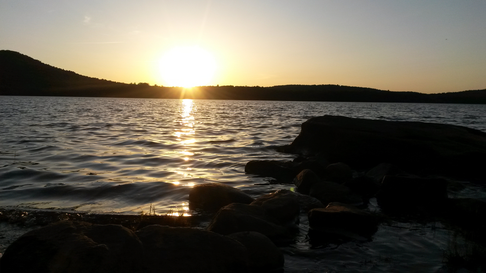
A perfect end
|
|